Manchester Village Historic District (Manchester, Massachusetts)
|
Manchester Village Historic District | |
|
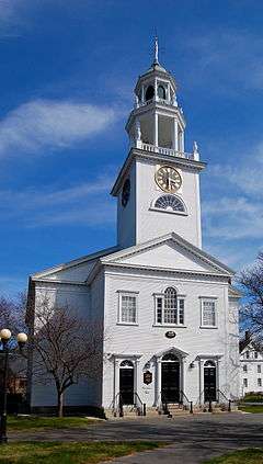
Manchester First Parish Church | |
  | |
| Location | Manchester, Massachusetts |
|---|---|
| Coordinates | 42°34′28″N 70°46′21″W / 42.57444°N 70.77250°WCoordinates: 42°34′28″N 70°46′21″W / 42.57444°N 70.77250°W |
| Area | 39 acres (16 ha) |
| Architect | Multiple |
| Architectural style | Late Victorian, Georgian, Federal |
| NRHP Reference # | [1] |
| Added to NRHP | January 8, 1990 |
The Manchester Village Historic District encompasses the village center of the seaside town of Manchester, Massachusetts. It is stretched along Massachusetts Route 127, which runs in an arc around the northern part of Manchester Harbor, extending north on School and North Streets at the very center of the village. It is bounded on the western end roughly by Bennett Street and Ashland Avenue, and on the east by Beach Street. The village had its beginnings in the 17th century as a fishing and agrarian center, and its major roads were laid out by the late 18th century. The village was at its height in the first half of the 19th century as a fishing center, and it is from that time that most of its buildings date. Growth in the later 19th century was slower, as sea-related economic activity declined and cabinetmaking grew as a local industry.[2]
The district was added to the National Register of Historic Places in 1990.[1]
See also
References
- 1 2 National Park Service (2008-04-15). "National Register Information System". National Register of Historic Places. National Park Service.
- ↑ "NRHP nomination for Manchester Village Historic District". Commonwealth of Massachusetts. Retrieved 2015-07-20.
| Topics |  | ||||||||||||||||||||||||||||||
|---|---|---|---|---|---|---|---|---|---|---|---|---|---|---|---|---|---|---|---|---|---|---|---|---|---|---|---|---|---|---|---|
| Lists by county | |||||||||||||||||||||||||||||||
| Lists by city |
| ||||||||||||||||||||||||||||||
| Other lists | |||||||||||||||||||||||||||||||
| |||||||||||||||||||||||||||||||