Magnolia, Iowa
| Magnolia, Iowa | |
|---|---|
| City | |
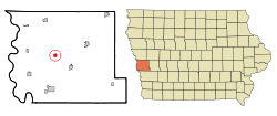 Location of Magnolia, Iowa | |
| Coordinates: 41°41′40″N 95°52′25″W / 41.69444°N 95.87361°WCoordinates: 41°41′40″N 95°52′25″W / 41.69444°N 95.87361°W | |
| Country |
|
| State |
|
| County | Harrison |
| Area[1] | |
| • Total | 0.57 sq mi (1.48 km2) |
| • Land | 0.57 sq mi (1.48 km2) |
| • Water | 0 sq mi (0 km2) |
| Elevation | 1,339 ft (408 m) |
| Population (2010)[2] | |
| • Total | 183 |
| • Estimate (2012[3]) | 178 |
| • Density | 321.1/sq mi (124.0/km2) |
| Time zone | Central (CST) (UTC-6) |
| • Summer (DST) | CDT (UTC-5) |
| ZIP code | 51550 |
| Area code(s) | 712 |
| FIPS code | 19-48495 |
| GNIS feature ID | 0458733 |
Magnolia is a city in Harrison County, Iowa in the United States of America. The population was 183 at the 2010 census.
History
Harrison County was established in 1851 and organized on March 7, 1853.[4] Abram Fletcher, Charles Wolcott and A. D. Jones were appointed by the Iowa General Assembly as Commissioners to organize the county and establish a county seat. They chose the location for Magnolia and gave it its name. The third building that was erected in the town for the county courthouse in 1873 still stands in the town, and is listed on the National Register of Historic Places.[5]
The county seat was transferred to Logan from Magnolia in 1875.[6]
Geography
Magnolia is located at 41°41′40″N 95°52′25″W / 41.69444°N 95.87361°W (41.694404, -95.873516).[7]
According to the United States Census Bureau, the city has a total area of 0.57 square miles (1.48 km2), all of it land.[1]
Demographics
| Historical populations | ||
|---|---|---|
| Year | Pop. | ±% |
| 1910 | 311 | — |
| 1920 | 299 | −3.9% |
| 1930 | 271 | −9.4% |
| 1940 | 242 | −10.7% |
| 1950 | 207 | −14.5% |
| 1960 | 215 | +3.9% |
| 1970 | 206 | −4.2% |
| 1980 | 207 | +0.5% |
| 1990 | 204 | −1.4% |
| 2000 | 200 | −2.0% |
| 2010 | 183 | −8.5% |
| 1880 | 194 | +6.0% |
| 2014 | 175 | −9.8% |
| 2015 | 174 | −0.6% |
| Source:"American FactFinder". United States Census Bureau. and Iowa Data Center Source: | ||
2010 census
As of the census[2] of 2010, there were 183 people, 79 households, and 50 families residing in the city. The population density was 321.1 inhabitants per square mile (124.0/km2). There were 87 housing units at an average density of 152.6 per square mile (58.9/km2). The racial makeup of the city was 100.0% White.
There were 79 households of which 22.8% had children under the age of 18 living with them, 51.9% were married couples living together, 7.6% had a female householder with no husband present, 3.8% had a male householder with no wife present, and 36.7% were non-families. 29.1% of all households were made up of individuals and 15.2% had someone living alone who was 65 years of age or older. The average household size was 2.32 and the average family size was 2.86.
The median age in the city was 47.7 years. 15.3% of residents were under the age of 18; 7.1% were between the ages of 18 and 24; 22.5% were from 25 to 44; 39.8% were from 45 to 64; and 15.3% were 65 years of age or older. The gender makeup of the city was 55.7% male and 44.3% female.
2000 census
As of the census[9] of 2000, there were 200 people, 85 households, and 57 families residing in the city. The population density was 343.2 people per square mile (133.1/km²). There were 96 housing units at an average density of 164.8 per square mile (63.9/km²). The racial makeup of the city was 97.50% White, 0.50% Native American, 0.50% from other races, and 1.50% from two or more races. Hispanic or Latino of any race were 0.50% of the population.
There were 85 households out of which 25.9% had children under the age of 18 living with them, 61.2% were married couples living together, 5.9% had a female householder with no husband present, and 31.8% were non-families. 30.6% of all households were made up of individuals and 16.5% had someone living alone who was 65 years of age or older. The average household size was 2.35 and the average family size was 2.93.
In the city the population was spread out with 24.5% under the age of 18, 6.0% from 18 to 24, 24.5% from 25 to 44, 27.5% from 45 to 64, and 17.5% who were 65 years of age or older. The median age was 42 years. For every 100 females there were 122.2 males. For every 100 females age 18 and over, there were 109.7 males.
The median income for a household in the city was $30,625, and the median income for a family was $40,000. Males had a median income of $31,250 versus $30,833 for females. The per capita income for the city was $16,533. About 8.9% of families and 11.0% of the population were below the poverty line, including 26.8% of those under the age of eighteen and none of those sixty five or over.
References
- 1 2 "US Gazetteer files 2010". United States Census Bureau. Retrieved 2012-05-11.
- 1 2 "American FactFinder". United States Census Bureau. Retrieved 2012-05-11.
- ↑ "Population Estimates". United States Census Bureau. Retrieved 2013-05-23.
- ↑ "County History". Harrison County, Iowa. Retrieved 2011-03-04.
- ↑ National Park Service (2009-03-13). "National Register Information System". National Register of Historic Places. National Park Service.
- ↑ History of Western Iowa, Its Settlement and Growth. Western Publishing Company. 1882. p. 321.
- ↑ "US Gazetteer files: 2010, 2000, and 1990". United States Census Bureau. 2011-02-12. Retrieved 2011-04-23.
- ↑ "Census of Population and Housing". Census.gov. Retrieved June 4, 2015.
- ↑ "American FactFinder". United States Census Bureau. Retrieved 2008-01-31.
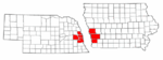
Metropolitan area of Omaha–Council Bluffs | ||||||||
|---|---|---|---|---|---|---|---|---|
| Primary Cities |
|  | ||||||
| Cities over 10,000 (per 2010 Census) |
| |||||||
| Cities of 5,000 to 10,000 (per 2010 Census) |
| |||||||
| Cities of 1,000 to 5,000 (per 2010 Census) |
| |||||||
| Census-designated places |
| |||||||
| Cities and villages of fewer than 1,000 (per 2010 Census) |
| |||||||
| Counties |
| |||||||
Municipalities and communities of Harrison County, Iowa, United States | ||
|---|---|---|
| Cities | ||
| Townships |
| |
| CDPs | ||
| Other unincorporated communities | ||
| Footnotes | ‡This populated place also has portions in an adjacent county or counties | |