Lower Manair Dam
| Lower Manair Dam | |
|---|---|
 Lower Manair Reservoir | |
  Location of Lower Manair Dam in India Telangana#India | |
| Official name |
లోయర్ మనేర్ డ్యామ్ Lower Manair Dam |
| Location | Karimnagar district, Telangana, India |
| Coordinates | 18°23′59″N 79°7′52″E / 18.39972°N 79.13111°ECoordinates: 18°23′59″N 79°7′52″E / 18.39972°N 79.13111°E |
| Opening date | 1985 |
| Owner(s) | Government of Telangana |
| Dam and spillways | |
| Impounds | Manair River |
| Height | 41 metres (135 ft) from river level |
| Length | 10,741 metres (35,240 ft) |
| Reservoir | |
| Creates | Lower Manair Reservoir |
| Total capacity | 680,137,000 m3 (551,396 acre·ft) |
| Active capacity | 380,877,000 m3 (308,782 acre·ft)[1] |
| Catchment area | 6,648 square kilometres (2,567 sq mi) |
| Surface area | 81 km2 (31 sq mi) |
|
cyclone in 2016 In July 30 2016 tornado placed in lower manair dam . It is placed about above half an hour . As per the meterology tornado is a violently rotated column of the air that rotates while in contact with the both earth surface and a cumulonimbus cloud or , in rare cases, the base of the cumulus cloud. They are often referred to as twisters or some times cyclones.. | |
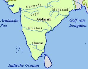
The Lower Manair Dam also known as LMD[2] was constructed across the Manair River, at Alugunur village, Thimmapur mandal, Karimnagar District, in the Indian state of Telangana during 1974 to 1985. It provides irrigation to a gross command area of 163,000 hectares (400,000 acres),[3] and drinking water supply benefits and reservoir fisheries.[4]
Location
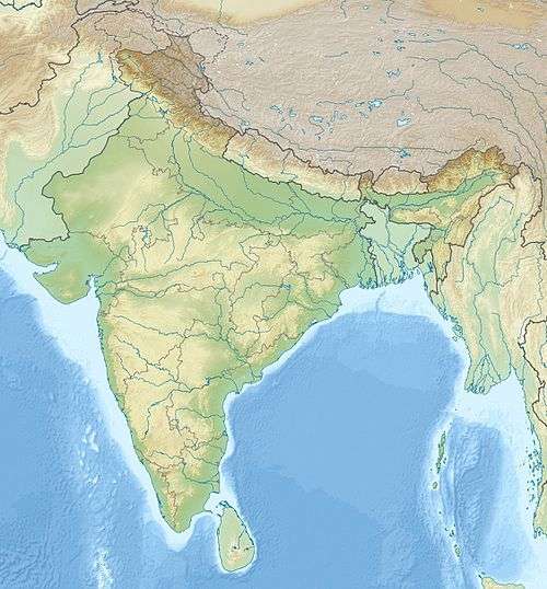
The Lower Manair Dam is located on the Manair River at 18°24' N latitude and 79° 20' E longitude in Karimnagar District at Km.146 of Kakatiya Canal. The Manair River is a tributary of the Godavari River and the dam is built across the river at the confluence with Mohedamada River. The dam drains a catchment area of 6,464 square kilometres (2,496 sq mi) which includes 1,797.46 square kilometres (694.00 sq mi) of free catchment and the balance is intercepted catchment.[5][6] Karimanagar town is 6 kilometres (3.7 mi) away from the dam.[7]
In the vicinity of the LMD which is the only place of recreation for the people of Karimnagar, in the light of recent drowning incidents and the insecurity created by hooligans, security measures have been stepped up.[8]
Features
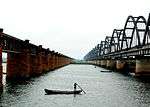
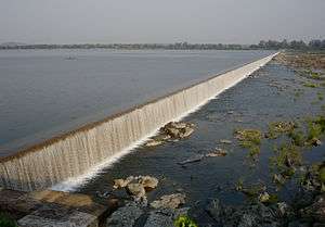
Lower Manair Dam's construction was started in 1974 and commissioned in 1985. It is an Earth cum Masonry dam. The dam height above the deepest foundation is 41 metres (135 ft); the maximum height of the earth dam is 88 feet (27 m). The dam length is 10,471 metres (34,354 ft), top width is 24 feet (7.3 m). It has a volume content of 5.41 million cum with a reservoir water spread area of 81 square kilometres (31 sq mi) at FRL of 920.00 ft. The gross storage capacity of the reservoir is 680 million cubic meter and the live storage capacity is 380.977 million cum. The spillway is designed for discharge of capacity 14,170 cubic metres (500,000 cu ft)/ second (and is controlled by 20 gates[7] of 15.24 by 7.31 metres (50.0 ft × 24.0 ft) size,[6] while the maximum observed flood discharge is reported to be 9,910 cubic metres (350,000 cu ft)/second.[5][9]
The storage behind the dam serves as a balancing reservoir for the Kakatiya Canal and regulates flow for irrigation.[10] The command area for irrigation is 163,000 hectares (400,000 acres). The storage of the dam is also utilized as drinking water source for Karimnagar and Warangal towns and for reservoir fisheries (Pisciculture}.[4]
The water quality status of the Lower Manair Reservoir was studied from September 2009 to August 2010 for the physico- chemical parameters such as water temperature, pH, turbidity, transparency, total dissolved solids, total hardness, chlorides, phosphate, nitrates, dissolved oxygen (DO) and biological oxygen demand (BOD). The results indicated that all parameters of water quality were within permissible limits and it was concluded that the water in the reservoir was fit for use for irrigation, drinking water supply and pisciculture.[11]
Plankton studies
Based on plankton studies of the reservoir from September 2010 to August 2011, the rich biodiversity of the zooplankton is an indication that the storage water is unpolluted and suitable for uses such as irrigation, fisheries and drinking water supply. The field studies of the reservoir identified 34 species of zooplankton of which 16 are rotifera, 8 of cladocera, 6 of copepoda, 2 species of ostrocoda and 2 protozoa.[4]
Aquatic plant studies
Investigations were carried out during 2013–2014 on the aquatic macrophyte diversity in the reservoir. The studies have reported macrophytes of "04 classes, 20 orders and 26 families, including five free floating macrophytes, ten submerged, and thirty three emergent species of weeds." Eichhornia crassipes species has been recorded all through the year. The submerged species of Vallisneria spiralis, Ceratophyllum demursum, Hydrilla verticillata, and also the rooted floating species of Ipomoea aquatica are reported throughout the year.[12]
Reservoir fisheries
Studies were conducted in the LMD reservoir from June, 2013 to May, 2014 to identify the larvivorous activity of fishes. On the basis of morphometric and meristematic characters, the 58 fish species are identified in the reservoir. Also reported were 53 ornamental fish species comprising eight orders; of these 23 species belong to cypriniformes order. Awaous grammepomus, also called Scribbled goby was also identified.[2]
See also
References
- ↑ "India: National Register of Large Dams 2012" (PDF). Central Water Commission. Retrieved 26 August 2014.
- 1 2 "Rare fish species found at Lower Manair Dam in Karimnagar (reported from Deccan Chronicle". Seafood Solutions. 20 November 2011.
- ↑ Howard White (2008). An Impact Evaluation of India's Second and Third Andhra Pradesh Irrigation Projects: A Case of Poverty Reduction with Low Economic Returns. World Bank Publications. pp. 13–. ISBN 978-0-8213-7543-3.
- 1 2 3 "Diversity of zooplankton in Lower Manair reservoir,Karimnagar, AP, India" (pdf). International Research Journal of Biological Sciences. 2012. p. 1, 6.
- 1 2 "Lower Manair Dam". National Informatics Center.
- 1 2 "Major Water Resources Development Projects in the Godavari Basin Lower Manair Reservoir". Hydrology and Water Resources Information System for India.
- 1 2 "Lower Manair Dam". Department of Tourism, Government of Telangana.
- ↑ "Authorities step up vigil at Lower Manair Dam". The Hindu. 27 May 2015.
- ↑ "National Register of Large Dams" (pdf). Andhra Pradesh Sr. no. 121. Central Water Commission.
- ↑ "Sriramsagar Project Stage 1". Official web site of Government of Andhra Pradesh.
- ↑ Medudhula, Thirupathaiah; Ch., Samatha; Chintha, Sammaiah (2012). "Analysis of water quality using physico-chemical parameters in lower manair reservoir of Karimnagar district, Andhra Pradesh". International Journal of Environmental Sciences.
- ↑ "Checklist of The Aquatic Macrophyte Flora Abundence [sic] In Lower Manair Dam At Karimnagar Dt. Andhra Pradesh, India" (pdf). IOSR Journal of Environmental Science, Toxicology and Food Technology. May 2014.