Louise, Texas
| Louise, Texas | |
|---|---|
| CDP | |
| Nickname(s): LTX | |
| Motto: Straight Outta LTX! | |
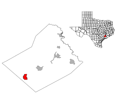
 Location of Louise, Texas | |
 | |
| Coordinates: 29°6′42″N 96°24′37″W / 29.11167°N 96.41028°WCoordinates: 29°6′42″N 96°24′37″W / 29.11167°N 96.41028°W | |
| Country | United States |
| State | Texas |
| County | Wharton |
| Area | |
| • Total | 6.6 sq mi (17.2 km2) |
| • Land | 6.6 sq mi (17.2 km2) |
| • Water | 0.0 sq mi (0.0 km2) |
| Elevation | 85 ft (26 m) |
| Population (2000) | |
| • Total | 977 |
| • Density | 147.1/sq mi (56.8/km2) |
| Time zone | Central (CST) (UTC-6) |
| • Summer (DST) | CDT (UTC-5) |
| ZIP code | 77455 |
| Area code(s) | 979 |
| FIPS code | 48-44212[1] |
| GNIS feature ID | 1361870[2] |
Louise is a census-designated place (CDP) in Wharton County, Texas, United States. The population was 977 as of the 2000 census.
Geography
Louise is located at 29°6′42″N 96°24′37″W / 29.11167°N 96.41028°W (29.111539, -96.410223).[3]
According to the United States Census Bureau, the CDP has a total area of 6.6 square miles (17.2 km²), all land.
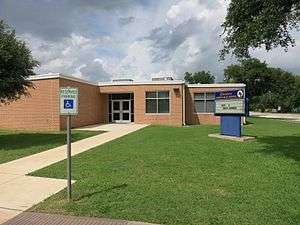 Louise Junior High School
 US Post Office in Louise
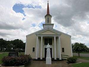 St. Procopius Catholic Church in Louise
Education
Louise is served by the Louise Independent School District.
References
- ↑ "American FactFinder". United States Census Bureau. Retrieved 2008-01-31.
- ↑ "US Board on Geographic Names". United States Geological Survey. 2007-10-25. Retrieved 2008-01-31.
- ↑ "US Gazetteer files: 2010, 2000, and 1990". United States Census Bureau. 2011-02-12. Retrieved 2011-04-23.
Municipalities and communities of Wharton County, Texas, United States | ||
|---|---|---|
| Cities | 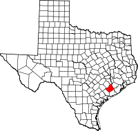 | |
| CDPs | ||
| Other unincorporated communities |
| |
| Ghost towns |
| |
This article is issued from Wikipedia - version of the 1/13/2016. The text is available under the Creative Commons Attribution/Share Alike but additional terms may apply for the media files.