List of lighthouses and lightvessels in Chile: NGA1155.8–NGA1312
This is a list of lighthouses in Chile from Huasco to San Antonio.
Huasco
| It. | NGA/Int number |
Location | Coordinates | Light characteristic |
Height (ft/m) Range (nmi) |
Structure description |
Height (ft) | Remarks |
|---|---|---|---|---|---|---|---|---|
| 89 | 1155.8 | Punta Lobos. | 28°18.0′S 71°11.6′W / 28.3000°S 71.1933°W | Fl.W. period 5s fl. 1s, ec. 4s | 39 12 8 | White fiberglass tower, red band, rectangular daymark; | 11. | Visible 023°-180°. |
| 90 | 1156 G 1921 |
Islote Cayo. | 28°27.4′S 71°13.7′W / 28.4567°S 71.2283°W | Fl.(4)G. period 12s fl. 0.3s, ec. 1.7s fl. 0.3s, ec. 1.7s fl. 0.3s, ec. 1.7s fl. 0.3s, ec. 5.7s | 30 9 5 | Green fiberglass tower; | 11. | |
| 91 | 1161 G 1918.2 |
Marine Terminal No. 1, Range, front. | 28°27.8′S 71°15.3′W / 28.4633°S 71.2550°W | F.R. | Mast, white square daymark, black ball; | 16. | Occasional. | |
| 92 | 1161.25 G 1918.21 |
Middle, 35 meters 275° from front. | 28°27.8′S 71°15.3′W / 28.4633°S 71.2550°W | F.G. | Mast, white square daymark, black ball; | 16. | Occasional. | |
| 93 | 1161.5 G 1918.22 |
Rear, 50 meters 275° from front. | 28°27.8′S 71°15.3′W / 28.4633°S 71.2550°W | F.G. | Mast, white square daymark, black ball; | 16. | ||
| 94 | 1162 G 1918.4 |
No. 1 Range, front. | 28°28.2′S 71°15.8′W / 28.4700°S 71.2633°W | 3 F.R. | Metal tower, white rectangular daymark, black ball; | 33. | ||
| 95 | 1162.5 G 1918.39 |
Rear, Anchorage No. 2, 98 meters 203° 54′ from front. | 28°28.2′S 71°15.1′W / 28.4700°S 71.2517°W | F.G. | Mast, white rectangular daymark, green ball; | 16. | ||
| 96 | 1162.8 G 1918.5 |
Rear, 100 meters, 223° 53′ from front. | 28°28.2′S 71°15.1′W / 28.4700°S 71.2517°W | F.G. | Metal tower, white rectangular daymark, black ball; | 33. | ||
| 97 | 1162.81 G 1918.6 |
A-1, range, common front. | 28°28.3′S 71°14.8′W / 28.4717°S 71.2467°W | F.G. | ||||
| 98 | 1162.82 G 1918.59 |
A-2, rear, 150 meters 225° from common front. | 28°28.3′S 71°14.9′W / 28.4717°S 71.2483°W | F.G. | ||||
| 99 | 1162.83 G 1918.61 |
A-3, rear, 139 meters 208° from common front. | 28°28.3′S 71°14.9′W / 28.4717°S 71.2483°W | F.G. | ||||
| 100 | 1162.9 G 1918.8 |
Pt. Loros Range, front. | 28°28.3′S 71°14.6′W / 28.4717°S 71.2433°W | F.R. | Metal tower, white rectangular daymark, black ball; | 33. | ||
| 101 | 1162.95 G 1918.81 |
Rear, 60 meters 143° 46′ from front. | 28°28.3′S 71°14.6′W / 28.4717°S 71.2433°W | F.G. | Metal tower, white rectangular daymark, black ball; | 26. | ||
| 102 | 1163 G 1919.1 |
Santa Bárbara Terminal Range, common front. | 28°28.4′S 71°14.1′W / 28.4733°S 71.2350°W | F.G. | Mast, white rectangular daymark, black ball; | 33. | ||
| 103 | 1163.5 G 1919.11 |
Rear, 340 meters 131° 04′ from common front. | 28°28.5′S 71°13.9′W / 28.4750°S 71.2317°W | F.G. | Mast, white rectangular daymark, black ball; | 26. | ||
| 104 | 1163.6 G 1919 |
Rear, 95 meters 143° from common front. | 28°28.4′S 71°14.1′W / 28.4733°S 71.2350°W | F.G. | ||||
| 105 | 1163.7 | Cordón del Espinazo AVIATION LIGHT. | 28°28.7′S 71°15.6′W / 28.4783°S 71.2600°W | F.R. | 15 | Radio mast. | ||
| 106 | 1163.8 G 1916.5 |
Punta Huasco Sur. | 28°30.0′S 71°16.4′W / 28.5000°S 71.2733°W | Fl.W. period 5s fl. 0.4s, ec. 4.6s | 115 35 8 | White fiberglass tower, red band; | 11. | Visible 000°-216°. |
| 107 | 1164 G 1916 |
Isla Chañaral, W. side. | 29°01.9′S 71°35.0′W / 29.0317°S 71.5833°W | Fl.W. period 10s fl. 0.2s, ec. 9.8s | 190 58 14 | White round tower, red bands; | 30. | Visible 010°-214°. |
| 108 | 1165 G 1915 |
Punta Rancagua. | 29°04.7′S 71°30.0′W / 29.0783°S 71.5000°W | Fl.W. period 5s fl. 1s, ec. 4s | 66 20 8 | White fiberglass tower, red band; | 11. | Visible 022°-290°. |
| 109 | 1166 G 1906 |
Damas Island. | 29°13.6′S 71°31.9′W / 29.2267°S 71.5317°W | Fl.(3)W. period 9s fl. 0.3s, ec. 1.7s fl. 0.3s, ec. 1.7s fl. 0.3s, ec. 4.7s | 161 49 7 | White fiberglass tower, red band; | 11. | |
| 110 | 1168 G 1908 |
Punta Mostacilla. | 29°27.0′S 71°18.4′W / 29.4500°S 71.3067°W | Fl.W. period 5s | 125 38 6 | White fiberglass tower, red band; | 26. | |
| 111 | 1172 G 1904 |
Islotes Pájaros, southernmost islet. | 29°35.2′S 71°31.7′W / 29.5867°S 71.5283°W | Fl.(2)W. period 10s fl. 0.5s, ec. 2.4s fl. 0.5s, ec. 6.6s | 131 40 10 | ISOLATED DANGER BRB, tower; | 13. | Obscured by N. islet 158°- 162°. |
Coquimbo


Punta Tablas lighthouse
Coquimbo lighthouse
| It. | NGA/Int number |
Location | Coordinates | Light characteristic |
Height (ft/m) Range (nmi) |
Structure description |
Height (ft) | Remarks |
|---|---|---|---|---|---|---|---|---|
| 112 | 1176 G 1900.5 |
Lighthouse of la Serena | 29°54.3′S 71°16.5′W / 29.9050°S 71.2750°W | Fl.W. period 5s fl. 0.7s, ec. 4.3s | 92 28 20 | Cream-colored concrete square tower, red dome; | 82. | |
| 113 | 1177 G 1901.5 |
Caleta Coquimbo. | 29°57.3′S 71°20.1′W / 29.9550°S 71.3350°W | Fl.W. period 10s fl. 1s, ec. 9s | 23 7 9 | White fiberglass tower, red band; | 11. | Visible 350°-182°. |
| 114 | 1180 G 1901 |
Landing pier, head. | 29°57.0′S 71°20.1′W / 29.9500°S 71.3350°W | Fl.W. period 5s fl. 0.4s, ec. 4.6s | 30 9 8 | White metal post, red band; | 23. | Second light Fl.W.5s2M, visible 180°-270°. F.R. and F.G. in line 194° about 0.25 mile S. |
| 115 | 1184 G 1900 |
Punta Tortuga. -RACON |
29°55.9′S 71°21.6′W / 29.9317°S 71.3600°W | Fl.W. period 13s fl. 0.2s, ec. 12.8s T(-) |
79 24 27 | White round metal tower, red band; | 13. | Visible 042°-255°. 3 F.R. on radio mast 1.97 miles SSE. F.R. on radio mast 0.73 mile S. Siren: 1 bl. ev. 30s (bl. 3s, si. 27s). |
| 116 | 1188 G 1896.7 |
Islote Mewes. | 29°57.8′S 71°22.9′W / 29.9633°S 71.3817°W | Fl.(3)G. period 9s fl. 0.3s, ec. 1.7s fl. 0.3s, ec. 1.7s fl. 0.3s, ec. 4.7s | 29 9 5 | Green fiberglass tower; | 10. | Visible 309°-175°. |
| 117 | 1192 G 1897 |
Herradura Approach Range A, front. | 29°58.9′S 71°21.1′W / 29.9817°S 71.3517°W | F.R. | 69 21 3 | Red and white diagonally striped diamond on white square daymark; | 66. | |
| 118 | 1192.5 G 1897.1 |
Rear, 165 meters 140° 30′ from front. | 29°59.0′S 71°21.0′W / 29.9833°S 71.3500°W | F.R. | 98 30 3 | Red and white diagonally striped diamond on white square daymark; | 74. | |
| 119 | 1193 G 1898 |
Mining Pier Range B, front, No. 1. | 29°58.5′S 71°21.9′W / 29.9750°S 71.3650°W | F.R. | 39 12 3 | Red and white diagonally striped diamond on white square daymark; | 30. | |
| 120 | 1193.5 G 1898.1 |
Rear, No. 2, about 48 meters 112.5° from front. | 29°58.5′S 71°20.8′W / 29.9750°S 71.3467°W | F.G. | 49 15 3 | Red and white diagonally striped diamond on white square daymark; | 30. | |
| 121 | 1194 G 1898.3 |
Anchorage Range C, front. | 29°58.2′S 71°21.2′W / 29.9700°S 71.3533°W | F.G. | 46 14 3 | Post, red and white striped rectangular daymark; | 33. | |
| 122 | 1194.5 G 1898.31 |
Rear, about 672 meters 112° from front. | 29°58.4′S 71°20.8′W / 29.9733°S 71.3467°W | F.G. | 56 17 3 | Post, red and white striped rectangular daymark; | 43. | |
| 123 | 1195 G 1898.5 |
Anchorage Range D, front, No. 1. | 29°57.9′S 71°22.3′W / 29.9650°S 71.3717°W | F.R. | 43 13 3 | Red and white diagonally striped diamond on white square daymark; | 30. | |
| 124 | 1195.5 G 1898.49 |
Rear, No. 2, about 120 meters 036° from front. | 29°57.9′S 71°21.2′W / 29.9650°S 71.3533°W | F.G. | 66 20 3 | Red and white diagonally striped diamond on white square daymark; | 30. | |
| 125 | 1195.7 G 1898.51 |
Rear, No. 3, about 120 meters 029° from front. | 29°57.9′S 71°21.2′W / 29.9650°S 71.3533°W | F.G. | 66 20 3 | Red and white diagonally striped diamond on white square daymark; | 30. | |
| 126 | 1196 G 1898.7 |
Oil Berth Range E, front, No. 1. | 29°57.9′S 71°22.6′W / 29.9650°S 71.3767°W | F.R. | 108 33 3 | Post, red and white diagonally striped diamond daymark; | 16. | |
| 127 | 1196.5 G 1898.71 |
Rear, No. 2, about 158 meters 031° from front. | 29°57.9′S 71°21.5′W / 29.9650°S 71.3583°W | F.G. | 246 75 3 | Post, red and white diagonally striped diamond daymark; | 16. | |
| 128 | 1204 G 1896.6 |
Punta Herradura. | 29°58.2′S 71°23.3′W / 29.9700°S 71.3883°W | Fl.W. period 5s fl. 0.4s, ec. 4.6s | 65 20 10 | White fiberglass tower, red bands; | 11. | Visible 101°-103° and 111°- 298°. |
| 129 | 1205 G 1896.5 |
Puerto Velero. | 30°13.8′S 71°28.7′W / 30.2300°S 71.4783°W | W Fl.R. period 3s fl. 1s, ec. 2s | 7 2 7 | STARBOARD (B) R, pillar; | 7. | Visible 325°-184°. |
| 130 | 1208 G 1896 |
Punta Lengua de Vaca. | 30°14.8′S 71°37.9′W / 30.2467°S 71.6317°W | Fl.W. period 15s fl. 0.5s, ec. 14.5s | 133 41 16 | White fiberglass tower red bands; | 13. | Visible 039°-265°. F.R. lights mark masts SSE. Aero Radiobeacon 8 miles E. |
| 131 | 1208.5 G 1896.2 |
Puerto Aldea, Caleta Hornilla. | 30°17.6′S 71°36.5′W / 30.2933°S 71.6083°W | Fl.R. period 5s fl. 0.4s, ec. 4.6s | 56 17 5 | Red fiberglass tower; | 16. | Visible 175°-340°. |
| 132 | 1209 G 1896.3 |
Puerto Aldea. | 30°18.0′S 71°36.0′W / 30.3000°S 71.6000°W | Fl.(3)W. period 9s fl. 0.3s, ec. 1.7s fl. 0.3s, ec. 1.7s fl. 0.3s, ec. 4.7s | 23 7 7 | White fiberglass tower, red band; | 15. | Visible 106°-261°. |
| 133 | 1209.5 | Río Limarí. | 30°44.1′S 71°42.0′W / 30.7350°S 71.7000°W | Fl.(3)W. period 9s fl. 0.5s, ec. 1.5s fl. 0.5s, ec. 1.5s fl. 0.5s, ec. 4.5s | 26 8 7 | White fiberglass tower, red band, rectangular daymarks; | 11. | Visible 010°-170°. |
| 134 | 1210 G 1894 |
Punta Sierra. | 31°08.7′S 71°40.5′W / 31.1450°S 71.6750°W | Fl.W. period 5s fl. 1s, ec. 4s | 154 47 6 | White fiberglass tower, red band; | 11. | Visible 013°-174°. |
| 135 | 1211 G 1893.5 |
Caleta Chigualoco. | 31°45.3′S 71°31.1′W / 31.7550°S 71.5183°W | Fl.W. period 10s fl. 1s, ec. 9s | 33 10 2 | White fiberglass pillar, red band; | 20. | Visible 316°-104°. |
| 136 | 1212 G 1892 |
Cabo Tablas. | 31°51.0′S 71°34.0′W / 31.8500°S 71.5667°W | Fl.W. period 10s fl. 0.4s, ec. 9.6s | 236 72 10 | White fiberglass tower, red band; | 16. | Visible 284°-170°. |
| 137 | 1213 G 1891.3 |
Islas Blancas. | 31°52.7′S 71°31.7′W / 31.8783°S 71.5283°W | Q.(6)+L.Fl.W. period 15s | 82 25 7 | S. CARDINAL YB, tower; | 30. | |
| 138 | 1214 G 1891 |
Muelle de Pasajeros. | 31°54.7′S 71°31.4′W / 31.9117°S 71.5233°W | Fl.R. period 5s fl. 1s, ec. 4s | 29 9 8 | White fiberglass tower, red band; | 11. | Visible 059°-271°. |
| 139 | 1215 G 1891.5 |
Islote Penitente. | 31°52.4′S 71°34.5′W / 31.8733°S 71.5750°W | Fl.(2)W. period 10s fl. 1s, ec. 1.5s fl. 1s, ec. 6.5s | 44 14 2 | ISOLATED DANGER BRB, tower; | 11. | |
| 140 | 1216 G 1890 |
Isla Huevos, N. side of island. | 31°54.3′S 71°31.6′W / 31.9050°S 71.5267°W | Fl.R. period 10s fl. 0.5s, ec. 9.5s | 62 19 9 | Red round fiberglass tower; | 13. | Visible 053°-071°, obsc.- 076°, vis.-297°. |
Bahía de Quintero
| It. | NGA/Int number |
Location | Coordinates | Light characteristic |
Height (ft/m) Range (nmi) |
Structure description |
Height (ft) | Remarks |
|---|---|---|---|---|---|---|---|---|
| 141 | 1219 G 1882.3 |
Ventana, No. 1. | 32°45.0′S 71°29.3′W / 32.7500°S 71.4883°W | Fl.(3+1)Y. period 20s fl. 0.5s, ec. 1.5s fl. 0.5s, ec. 1.5s fl. 0.5s, ec. 4.5s fl. 0.5s, ec. 10.5s | 27 8 3 | Yellow metal post, X topmark; | 12. | |
| 142 | 1219.5 G 1882.4 |
No. 2. | 32°45.0′S 71°29.2′W / 32.7500°S 71.4867°W | Fl.(3+1)Y. period 20s fl. 0.5s, ec. 1.5s fl. 0.5s, ec. 1.5s fl. 0.5s, ec. 4.5s fl. 0.5s, ec. 10.5s | 27 8 3 | Yellow metal post, X topmark; | 12. | |
| 143 | 1219.6 G 1882.5 |
No. 3. | 32°45.0′S 71°29.2′W / 32.7500°S 71.4867°W | Fl.(3+1)Y. period 20s fl. 0.5s, ec. 1.5s fl. 0.5s, ec. 1.5s fl. 0.5s, ec. 4.5s fl. 0.5s, ec. 10.5s | 12 4 3 | Yellow metal post, X topmark; | 12. | |
| 144 | 1222 G 1883 |
Ventanilla Range, front. | 32°44.8′S 71°28.9′W / 32.7467°S 71.4817°W | Fl.W.R. period 3s fl. 0.5s, ec. 2.5s | 46 14 W. 9 R. 6 | White concrete post, red bands; | 36. | W. 039°-105°, R.-122°. |
| 145 | 1223 G 1883.1 |
Rear, about 70 meters 090° from front. | 32°44.8′S 71°28.9′W / 32.7467°S 71.4817°W | Iso.W. period 6s | 59 18 9 | On wall. | Visible 055°-120°. | |
| 146 | 1228 G 1888.6 |
Mono (terminal) Lighted Buoy ENAP. | 32°45.7′S 71°31.1′W / 32.7617°S 71.5183°W | Iso.W. period 2.4s | 5 | White conical buoy. | Horn: 1 bl. ev. 15s. Radar reflector. Aero Radiobeacon 3 miles NNE. | |
| 147 | 1230 G 1889 |
Oxiquim breakwater. | 32°45.7′S 71°29.8′W / 32.7617°S 71.4967°W | Fl.(3+1)Y. period 20s fl. 1s, ec. 2s fl. 1s, ec. 2s fl. 1s, ec. 6s fl. 1s, ec. 6s | 26 8 8 | Yellow framework tower on dolphin; | 13. | |
| 148 | 1232 G 1886 |
Muelle ENAP. | 32°46.2′S 71°29.5′W / 32.7700°S 71.4917°W | F.R. | 52 16 4 | Iron post, white disc daymark with two black discs superimposed; | 34. | |
| 149 | 1233 G 1887.201 |
Range, front. | 32°46.4′S 71°29.5′W / 32.7733°S 71.4917°W | Iso.R. period 2s | 44 14 10 | White iron post, red stripe, diamond daymark; | 20. | Visible 139°-165°. |
| 150 | 1234 G 1887.202 |
Rear, 81 meters 152° from front. | 32°46.5′S 71°29.5′W / 32.7750°S 71.4917°W | Iso.R. period 2s | 58 18 10 | White iron post, red stripe, diamond daymark; | 23. | Visible 139°-165°. |
| 151 | 1235 G 1887.2443 |
S. El Bato Marine Terminal Range, front. | 32°46.6′S 71°29.8′W / 32.7767°S 71.4967°W | Iso.R. period 2s | 31 10 3 | White metal post, red circular daymark, white stripe; | 20. | |
| 152 | 1236 G 1887.2444 |
Rear, 150 meters 116° from front. | 32°46.7′S 71°29.7′W / 32.7783°S 71.4950°W | Iso.R. period 2s | 56 17 3 | White metal post, red circular daymark, white stripe; | 20. | |
| 153 | 1237 G 1887.2441 |
N. El Bato Marine Terminal Range, front. | 32°46.5′S 71°29.7′W / 32.7750°S 71.4950°W | Iso.R. period 2s | 39 12 3 | White metal post, red rectangular daymark, white stripe; | 30. | |
| 154 | 1238 G 1887.2442 |
Rear, 143 meters 114° from front. | 32°46.6′S 71°29.6′W / 32.7767°S 71.4933°W | Iso.R. period 2s | 89 27 3 | White metal post, red rectangular daymark, white stripe; | 46. | |
| 155 | 1244 | AVIATION LIGHT. | 32°47.0′S 71°32.0′W / 32.7833°S 71.5333°W | Fl.G. | 66 20 13 | Iron skeleton tower. | Visible 175°-265°. Occasional. | |
| 156 | 1246 G 1887.8 |
Roca Tortuga. | 32°46.8′S 71°31.5′W / 32.7800°S 71.5250°W | Fl.(2)W. period 10s fl. 0.5s, ec. 2.4s fl. 0.5s, ec. 6.6s | 20 6 7 | Black iron structure, red band; | 17. | |
| 157 | 1248 G 1887.6 |
Muelle Fiscal. | 32°46.0′S 71°32.0′W / 32.7667°S 71.5333°W | F.G. | 16 5 1 | Metal post; | 10. | Occasional. |
| 158 | 1252 G 1882 |
Península Los Molles. | 32°46.3′S 71°32.2′W / 32.7717°S 71.5367°W | Fl.W. period 15s fl. 0.3s, ec. 14.7s | 308 94 22 | White truncated conical concrete tower, red bands; | 59. | Visible 020°-236° 30′ . |
Bahía Concón
| It. | NGA/Int number |
Location | Coordinates | Light characteristic |
Height (ft/m) Range (nmi) |
Structure description |
Height (ft) | Remarks |
|---|---|---|---|---|---|---|---|---|
| 159 | 1254 G 1880.5 |
Club de Yates Higuerilla. | 32°55.8′S 71°32.4′W / 32.9300°S 71.5400°W | Fl.W. period 5s fl. 1s, ec. 4s | 36 11 10 | White fiberglass tower, red band; | 23. | Visible 145°-231°. |
| 160 | 1255 G 1880 |
Punta Concón. | 32°55.7′S 71°33.2′W / 32.9283°S 71.5533°W | Fl.W. period 12s fl. 0.4s, ec. 11.6s Fl.(2)R. period 6s fl. 0.5s, ec. 1.5s fl. 0.5s, ec. 3.5s |
49 15 18 49 15 11 |
White fiberglass tower, red band; | 10. | Visible 352°-234°. Visible 172°-180° on the rocks of Concon. |
| 161 | 1255.5 G 1877 |
Muelle Barón. | 33°02.4′S 71°36.5′W / 33.0400°S 71.6083°W | Oc.G. period 3s lt. 2s, ec. 1s | 46 14 4 | Orange metal post; | 13. | Visible 070°-290°. |
Bahía de Valparaíso
Duprat lighthouse in Valparaíso

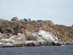
Lighthouse in Pájaro Niño Islet, Algarrobo
| It. | NGA/Int number |
Location | Coordinates | Light characteristic |
Height (ft/m) Range (nmi) |
Structure description |
Height (ft) | Remarks |
|---|---|---|---|---|---|---|---|---|
| 162 | 1256 G 1876 |
Breakwater. | 33°01.9′S 71°37.3′W / 33.0317°S 71.6217°W | Fl.W. period 5s fl. 0.2s, ec. 4.8s | 39 12 20 | White skeleton iron tower, red band; | 23. | Visible 138°-125°. |
| 163 | 1260 G 1875 |
Punta Duprat. | 33°01.6′S 71°37.6′W / 33.0267°S 71.6267°W | Fl.W. period 10s fl. 0.7s, ec. 9.3s | 69 21 20 | White octagonal concrete tower, red band; | 51. | Visible 335°-318°. |
| 164 | 1261 G 1879.1 |
Club de Yates Recreo. | 33°01.6′S 71°34.8′W / 33.0267°S 71.5800°W | Fl.R. period 3s fl. 1s, ec. 2s | 18 6 7 | Red fiberglass tower, triangular daymark; | 7. | Visible 126°-239°. |
| 165 | 1263 G 1878 |
Punta Gruesa, Condell. | 33°01.3′S 71°35.0′W / 33.0217°S 71.5833°W | Fl.W. period 12s fl. 1s, ec. 11s | 56 17 20 | White metal tower, red bands; | 22. | Visible 026°-244°. |
| 166 | 1268 G 1874 |
Punta Ángeles. | 33°01.4′S 71°38.8′W / 33.0233°S 71.6467°W | Fl.W. period 10s fl. 0.2s, ec. 9.8s | 197 60 32 | White round metal tower, red bands; | 59. | Visible 048° 30′ -250°. |
| 167 | 1272 G 1870 |
Punta Curaumilla. | 33°06.0′S 71°44.4′W / 33.1000°S 71.7400°W | Fl.W. period 15s fl. 0.5s, ec. 14.5s | 276 84 10 | White metal tower, red band, dwelling; | 11. | Visible 344°-244°. |
| 168 | 1276 G 1871 |
Muelle Laguna Verde. | 33°06.0′S 71°41.0′W / 33.1000°S 71.6833°W | F.R. | 2 | |||
| 169 | 1278 G 1869 |
Rada Quintay. | 33°11.5′S 71°43.2′W / 33.1917°S 71.7200°W | Fl.R. period 10s fl. 0.3s, ec. 9.7s Fl.W. period 5s fl. 0.4s, ec. 4.6s |
85 26 4 82 25 10 |
Truncated red conical tower; | 20. | Visible 025°-355°. Visible 126°-128° over Fraile rock. |
| 170 | 1280 G 1866 |
Península Pájaros Niños. | 33°21.4′S 71°41.8′W / 33.3567°S 71.6967°W | Fl.R. period 10s fl. 0.5s, ec. 9.5s Fl.W. period 5s fl. 0.5s, ec. 4.5s |
115 35 11 111 34 8 |
Red fiberglass tower; | 13. | Visible 163°-150°. Visible 150°-163°. |
| 171 | 1282 G 1864 |
Poza Cofradía. | 33°21.4′S 71°41.7′W / 33.3567°S 71.6950°W | Fl.(3)R. period 9s fl. 0.3s, ec. 1.5s fl. 0.3s, ec. 1.5s fl. 0.3s, ec. 5.1s | 19 6 5 | Red round concrete tower; | 7. | Visible 129°-309°. |
| 172 | 1283 G 1863 |
Cofradía Náutica. | 33°21.5′S 71°41.7′W / 33.3583°S 71.6950°W | Fl.W. period 8s | 66 20 14 | Black round iron tower; | 60. | Visible 186°-206°. |
San Antonio

Panul lighthouse in San Antonio
| It. | NGA/Int number |
Location | Coordinates | Light characteristic |
Height (ft/m) Range (nmi) |
Structure description |
Height (ft) | Remarks |
|---|---|---|---|---|---|---|---|---|
| 173 | 1284 G 1857 |
Punta Panul. | 33°34.5′S 71°37.5′W / 33.5750°S 71.6250°W | Fl.W. period 10s fl. 0.2s, ec. 9.8s | 292 89 32 | White hexagonal concrete tower, red bands; | 31. | Siren: 2 bl. ev. 30s. Radio telephone. |
| 174 | 1292 G 1859 |
Muelle Policarpo Toro. | 33°35.0′S 71°37.3′W / 33.5833°S 71.6217°W | Fl.G. period 5s fl. 1s, ec. 4s | 52 16 10 | Green metal tower; | 34. | |
| 175 | 1296 G 1859.3 |
North Harbor Range, front. | 33°35.0′S 71°36.8′W / 33.5833°S 71.6133°W | Fl.R. period 3s fl. 1s, ec. 2s | 82 25 8 | Metal pillar, white triangular daymark, orange stripe; | 43. | Private light. |
| 176 | 1300 G 1859.31 |
Rear, 78 meters 092° 36′ from front. | 33°35.0′S 71°36.7′W / 33.5833°S 71.6117°W | Fl.R. period 3s fl. 1s, ec. 2s | 118 36 8 | Metal pillar, white triangular daymark, orange stripe; | 46. | Private light. |
| 177 | 1303 G 1858.5 |
Molo Sur. | 33°35.2′S 71°37.4′W / 33.5867°S 71.6233°W | Fl.W. period 5s fl. 1s, ec. 4s | 39 12 16 | Red round metal structure on concrete base; | 10. | Visible 030°-151°. |
| 178 | 1304 G 1858 |
S. mole, head. | 33°35.2′S 71°37.4′W / 33.5867°S 71.6233°W | Fl.R. period 5s fl. 1s, ec. 4s | 34 11 8 | Red conical fiberglass tower; | 5. | Aero Radiobeacon 3 miles S. on Santo Domingo Point. |
| 179 | 1308 G 1860 |
Espigón de Atraque, NE. corner. | 33°35.0′S 71°37.0′W / 33.5833°S 71.6167°W | F.R. | 26 8 2 | Metal post; | 16. | Private light. |
| 180 | 1309 G 1859.2 |
Range, front. | 33°35.5′S 71°37.0′W / 33.5917°S 71.6167°W | F.R. | 26 8 2 | Metal pillar, white triangular daymark, red stripe; | 20. | Private light. |
| 181 | 1309.5 G 1859.21 |
Rear, about 100 meters 141° from front. | 33°35.5′S 71°36.9′W / 33.5917°S 71.6150°W | F.R. | 56 17 2 | Metal pillar, white triangular daymark, red stripe; | 46. | Private light. |
| 182 | 1309.6 G 1859.15 |
Range, front. | 33°35.7′S 71°37.0′W / 33.5950°S 71.6167°W | Fl.G. period 3s fl. 1s, ec. 2s | 30 9 3 | Metal framework tower, white rectangular daymark, red stripe; | 24. | |
| 183 | 1309.7 G 1859.16 |
Rear, 153 meters 156° from front. | 33°35.8′S 71°37.0′W / 33.5967°S 71.6167°W | Fl.G. period 3s fl. 1s, ec. 2s | 33 10 3 | Metal framework tower, white rectangular daymark, red stripe; | 37. | |
| 184 | 1310 G 1859.1 |
Range, front. | 33°35.6′S 71°37.1′W / 33.5933°S 71.6183°W | F.G. | 33 10 2 | Metal pillar, red rectangular daymark, white band; | 26. | Private light. |
| 185 | 1310.5 G 1859.11 |
Rear, about 125 meters 164° 24′ from front. | 33°35.7′S 71°37.1′W / 33.5950°S 71.6183°W | F.G. | 46 14 2 | Metal pillar, red rectangular daymark, white band; | 33. | Private light. |
| 186 | 1312 G 1860.2 |
SW corner. | 33°35.0′S 71°37.0′W / 33.5833°S 71.6167°W | F.R. | 20 6 2 | Metal post; | 16. | Private light. |
See also
References
-
 This article incorporates public domain material from the United States Government document "Section 2: Chile". List of Lights, Radio Aids and Fog Signals: The West Coast of North and South America... National Geospatial-Intelligence Agency. 2013. pp. 20–60.
This article is issued from Wikipedia - version of the 6/17/2016. The text is available under the Creative Commons Attribution/Share Alike but additional terms may apply for the media files.