List of lighthouses and lightvessels in Chile: NGA2328–NGA2718
This is a list of lighthouses in Chile from the Strait of Magellan to Paso Picton. It includes a number of Argentine lighthouses that may serve as navigational aids in Chilean waters around Ushuaia and Gable Island.
For Evangelistas Lighthouse, see List of lighthouses and lightvessels in Chile: Messier Channel to Smyth Channel.
Strait of Magellan (74°-72°W)

Morrión lighthouse and the workers in a 1916 published photograph.

Centinela lighthouse in a 1916 published photograph.

Fenix Island lighthouse in a 1916 published photograph.
| It. | NGA/Int number |
Location | Coordinates | Light characteristic |
Height (ft/m) Range (nmi) |
Structure description |
Height (ft) | Remarks |
|---|---|---|---|---|---|---|---|---|
| 531 | 2328 G 1478 |
Bahía Félix. | 52°57.6′S 74°04.3′W / 52.9600°S 74.0717°W | Fl.W. period 15s fl. 0.2s, ec. 14.8s | 98 30 21 | Round iron tower, red and white bands, white house; | 46. | Visible 122°-294°. Signal station. |
| 532 | 2330 G 1477 |
Isla Falgate. -RACON |
52°55.0′S 73°50.0′W / 52.9167°S 73.8333°W | Fl.W. period 10s fl. 1s, ec. 9s T(–) period 30s |
72 22 9 15 |
White fiberglass tower, red band; | 13. | Visible 296°-167°. |
| 533 | 2332 G 1476 |
Isla Centinela, off Cabo Upright. | 53°05.3′S 73°35.3′W / 53.0883°S 73.5883°W | Fl.W. period 5s fl. 0.4s, ec. 4.6s | 72 22 10 | White concrete tower, red bands; | 19. | Visible 111°-037°. |
| 534 | 2336 G 1474 |
Cabo Cooper Key. | 53°15.2′S 73°12.5′W / 53.2533°S 73.2083°W | Fl.W. period 10s fl. 0.5s, ec. 9.5s | 134 41 7 | White fiberglass tower, red band; | 13. | Visible 312°-135°. |
| 535 | 2340 G 1468 |
Monte Radford. | 53°24.7′S 72°57.2′W / 53.4117°S 72.9533°W | Fl.W. period 5s fl. 0.4s, ec. 4.6s | 69 21 8 | White round concrete tower, red band; | 10. | Visible 124°-309°. |
| 536 | 2342 G 1467.5 |
Islote Skinner. | 53°26.0′S 72°49.0′W / 53.4333°S 72.8167°W | Fl.(3)W. period 9s fl. 0.5s, ec. 1.5s fl. 0.5s, ec. 1.5s fl. 0.5s, ec. 4.5s | 16 5 7 | White fiberglass tower, red band; | 11. | Visible 300°-131°. |
| 537 | 2345 G 1466.8 |
Paso Largo. -RACON |
53°33.0′S 72°36.4′W / 53.5500°S 72.6067°WRACON) | Fl.W. period 10s fl. 1s, ec. 9s T(–) period 45s |
26 8 9 10 |
White fiberglass tower, red band; | 13. | Visible 129°-158° and 222°- 312°. |
| 538 | 2348 G 1466 |
Cerro El Morrión. | 53°34.0′S 72°31.2′W / 53.5667°S 72.5200°W | Fl.W. period 5s fl. 0.4s, ec. 4.6s | 85 26 9 | White fiberglass tower, red band; | 13. | Visible 092°-288°. |
| 539 | 2352 G 1460 |
Cabo Crosstide. | 53°33.7′S 72°25.4′W / 53.5617°S 72.4233°W | Fl.G. period 5s fl. 0.4s, ec. 4.6s | 92 28 5 | Green fiberglass tower; | 11. | Visible 083°-264°. |
Jerónimo Channel
| It. | NGA/Int number |
Location | Coordinates | Light characteristic |
Height (ft/m) Range (nmi) |
Structure description |
Height (ft) | Remarks |
|---|---|---|---|---|---|---|---|---|
| 540 | 2353 G 1456.2 |
Punta San Carlos. | 53°30.2′S 72°23.9′W / 53.5033°S 72.3983°W | Fl.W. period 5s fl. 0.4s, ec. 4.6s | 33 10 7 | White round tower, red band; | 11. | Visible 298°-144°. |
| 541 | 2353.2 G 1456.4 |
Islotes Terán. | 53°25.1′S 72°29.0′W / 53.4183°S 72.4833°W | Fl.(4)R. period 12s fl. 0.3s, ec. 1.7s fl. 0.3s, ec. 1.7s fl. 0.3s, ec. 1.7s fl. 0.3s, ec. 5.7s | 26 8 3 | White fiberglass tower, red band; | 11. | Visible 326°-151°. |
| 542 | 2353.4 G 1456.6 |
Punta Cóndor. | 53°21.8′S 72°30.9′W / 53.3633°S 72.5150°W | Fl.W. period 10s fl. 0.5s, ec. 9.5s | 23 7 7 | White fiberglass tower, red band; | 13. | Visible 177°-050°. |
| 543 | 2353.6 G 1457 |
Isla Corona. | 53°15.2′S 72°20.9′W / 53.2533°S 72.3483°W | Q.(6)+L.Fl.W. period 15s | 26 8 8 S. | CARDINAL YB, tower; | 11. | Visible 211°-090°. |
| 544 | 2353.8 G 1456.8 |
Isla Pan de Azúcar. | 53°16.2′S 72°20.5′W / 53.2700°S 72.3417°W | Fl.(2+1)R. period 14s fl. 0.3s, ec. 1.7s fl. 0.3s, ec. 3.7s fl. 0.3s, ec. 7.7s | 49 15 4 | Red round tower, green band; | 11. | Visible 035°-221°. |
Otway Sound
| It. | NGA/Int number |
Location | Coordinates | Light characteristic |
Height (ft/m) Range (nmi) |
Structure description |
Height (ft) | Remarks |
|---|---|---|---|---|---|---|---|---|
| 545 | 2354 | Isla Vivian. | 53°08.0′S 71°49.4′W / 53.1333°S 71.8233°W | Fl.W. period 12s fl. 0.5s, ec. 11.5s | 49 15 9 | White round tower, red band; | 26. | Visible 182°-157°. |
| 546 | 2355.4 G 1456.3 |
Ensenada Demarcación. | 53°26.5′S 72°29.1′W / 53.4417°S 72.4850°W | Fl.(3)G. period 9s fl. 0.3s, ec. 1.7s fl. 0.3s, ec. 1.7s fl. 0.3s, ec. 4.7s | 19 6 3 | Green fiberglass pillar; | 11. | Visible 151°-326°. |
| 547 | 2356 G 1456 |
Islote Cohorn, Paso Inglés. -RACON |
53°33.0′S 72°20.1′W / 53.5500°S 72.3350°W | Fl.W. period 10s fl. 0.5s, ec. 9.5s O(– – –) period 45s |
40 12 8 12 |
White fiberglass tower, red band; | 26. | Visible 317°-127°. AIS (MMSI No 997251202). |
| 548 | 2360 G 1454 |
Isla Rupert, Paso Inglés, NE. side. | 53°39.4′S 72°12.5′W / 53.6567°S 72.2083°W | Fl.W. period 5s fl. 0.4s, ec. 4.6s | 82 25 7 | White fiberglass tower, red bands; | 26. | Visible 135°-315°. |
| 549 | 2364 G 1450 |
Bahía Fortescue. | 53°42.0′S 72°01.0′W / 53.7000°S 72.0167°W | Fl.(3)W. period 9s fl. 0.3s, ec. 1.7s fl. 0.3s, ec. 1.7s fl. 0.3s, ec. 4.7s | 62 19 6 | White fiberglass tower, red band; | 13. | Visible 240°-070°. |
Brecknock Channel
_1990.jpg)
Somewhere in the South, the USS Jospesus Daniels (CG-27) around a Chilean lighthouse
| It. | NGA/Int number |
Location | Coordinates | Light characteristic |
Height (ft/m) Range (nmi) |
Structure description |
Height (ft) | Remarks |
|---|---|---|---|---|---|---|---|---|
| 550 | 2365 G 1334.8 |
Península Brecknock. | 54°37.5′S 71°45.4′W / 54.6250°S 71.7567°W | Fl.W. period 10s fl. 0.4s, ec. 9.6s | 59 18 8 | White round tower, red horizontal band; | 26. | Visible 255°-050°. |
| 551 | 2366 G 1335.2 |
Isla London. | 54°38.1′S 71°59.5′W / 54.6350°S 71.9917°W | Fl.W. period 10s fl. 0.5s, ec. 9.5s | 23 7 7 | White round tower, red horizontal band; | 11. | Visible 134°-313°. |
| 552 | 2367 G 1335 |
Islotes Nelson. | 54°40.5′S 71°53.0′W / 54.6750°S 71.8833°W | Fl.W. period 5s fl. 0.3s, ec. 4.7s | 26 8 7 | White round tower, red horizontal band; | 11. | Visible 243°-136°. |
| 553 | 2368 G 1449 |
Cabo Holland. | 53°47.8′S 71°41.9′W / 53.7967°S 71.6983°W | Fl.W. period 10s fl. 0.5s, ec. 9.5s | 26 8 7 | White fiberglass post, red bands; | 16. | Visible 307°-113°. |
| 554 | 2372 G 1448 |
Cabo Froward. | 53°53.7′S 71°18.6′W / 53.8950°S 71.3100°W | Fl.W. period 3s fl. 0.3s, ec. 2.7s | 72 22 7 | White fiberglass tower, red band; | 13. | Visible 276°-126°. |
| 555 | 2373 G 1447.33 |
Punta Cono. | 54°07.1′S 70°50.5′W / 54.1183°S 70.8417°W | Fl.R. period 5s fl. 1s, ec. 4s | 164 50 6 | White metal pillar, red top; | 13. | Visible 000°-162°. |
Gabriel Channel

Lighthouse Punta Santa Ana, im background Fuerte Bulnes.
| It. | NGA/Int number |
Location | Coordinates | Light characteristic |
Height (ft/m) Range (nmi) |
Structure description |
Height (ft) | Remarks |
|---|---|---|---|---|---|---|---|---|
| 556 | 2374 | Cabo Expectación. | 54°15.2′S 70°12.6′W / 54.2533°S 70.2100°W | Fl.W. period 10s | 115 35 10 | Visible 124°-336°. | ||
| 557 | 2376 G 1447 |
Magdalena Channel, Islotes Anxious. | 54°07.0′S 70°56.0′W / 54.1167°S 70.9333°WMagdalena Channel, Islotes Anxious.) | Fl.W. period 10s fl. 0.5s, ec. 9.5s | 33 10 10 | White fiberglass tower, red band; | 11. | Visible 346°-194°. |
| 558 | 2380 G 1446 |
Cabo San Isidro. | 53°47.0′S 70°59.0′W / 53.7833°S 70.9833°W | Fl.W. period 5s fl. 0.4s, ec. 4.6s | 92 28 9 | White round concrete tower, white dwelling; | 26. | Visible 208°-046°. |
| 559 | 2384 G 1444 |
Punta Santa Ana, Puerto del Hambre. | 53°38.0′S 70°55.0′W / 53.6333°S 70.9167°W | Fl.W. period 10s fl. 0.5s, ec. 9.5s | 131 40 10 | White quadrangular concrete tower, red band; | 16. | Visible 151°-094°. |
| 560 | 2384.1 G 1447.2 |
Ite Cenaria. | 54°17.8′S 70°55.9′W / 54.2967°S 70.9317°W | Fl.(2)W. period 10s fl. 0.5s, ec. 2.4s fl. 0.5s, ec. 6.6s | 46 14 4 | Black fiberglass tower, red band; | 11. | |
| 561 | 2384.2 G 1447.3 |
Punta Pirámide. | 54°26.0′S 71°06.5′W / 54.4333°S 71.1083°W | Fl.(3)W. period 9s fl. 0.3s, ec. 1.7s fl. 0.3s, ec. 1.7s fl. 0.3s, ec. 4.7s | 30 9 6 | White round tower, red horizontal band; | 11. | Visible 113°-278°. |
| 562 | 2384.8 G 1447.25 |
Punta Pajarito. | 54°21.0′S 70°54.2′W / 54.3500°S 70.9033°W | Fl.W. period 12s fl. 0.5s, ec. 11.5s | 36 11 8 | White fiberglass tower, red band; | 26. | Visible 043°-228°. |
| 563 | 2385 G 1447.4 |
Isla King. | 54°22.5′S 71°15.5′W / 54.3750°S 71.2583°W | Fl.W. period 5s fl. 0.4s, ec. 4.6s | 23 7 6 | White round tower, red band; | 11. | Visible 112°-000°. |
| 564 | 2386 G 1447.5 |
Caleta Barrow. | 54°20.3′S 71°26.8′W / 54.3383°S 71.4467°W | Fl.W. period 10s fl. 0.5s, ec. 9.5s | 23 7 7 | White round tower, red horizontal band; | 11. | Visible 264°-088°. |
| 565 | 2387 G 1447.6 |
Seno Duntze. | 54°20.6′S 71°47.7′W / 54.3433°S 71.7950°W | Fl.(3)W. period 9s fl. 0.3s, ec. 1.7s fl. 0.3s, ec. 1.7s fl. 0.3s, ec. 4.7s | 26 8 6 | White round tower, red horizontal band; | 11. | Visible 217°-053°. |
| 566 | 2388 G 1442 |
Punta Arska. | 53°34.0′S 70°29.0′W / 53.5667°S 70.4833°W | Fl.(4)W. period 12s fl. 0.5s, ec. 1.5s fl. 0.5s, ec. 1.5s fl. 0.5s, ec. 1.5s fl. 0.5s, ec. 5.5s | 95 29 8 | White fiberglass pillar, red band; | 13. | Visible 078°-314°. |
| 567 | 2392 G 1443.2 |
Islote Cuervo. | 53°50.3′S 70°25.3′W / 53.8383°S 70.4217°W | Fl.(3)W. period 9s fl. 0.3s, ec. 1.7s fl. 0.3s, ec. 1.7s fl. 0.3s, ec. 4.7s | 20 6 6 | White fiberglass pillar, red band; | 13. | |
| 568 | 2396 G 1443.3 |
Bahía Harris Mole, head. | 53°50.0′S 70°26.0′W / 53.8333°S 70.4333°W | Fl.R. period 10s fl. 0.5s, ec. 9.5s | 20 6 8 | Red steel post; | 12. | Visible 285°-334°. F.R. at easternmost corner of pier. |
Whiteside Channel
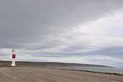
Bahía Porvenir lighthouse
| It. | NGA/Int number |
Location | Coordinates | Light characteristic |
Height (ft/m) Range (nmi) |
Structure description |
Height (ft) | Remarks |
|---|---|---|---|---|---|---|---|---|
| 569 | 2400 G 1443 |
Islote Tesner. | 53°49.7′S 70°22.8′W / 53.8283°S 70.3800°W | Fl.W. period 3s fl. 1s, ec. 2s | 20 6 8 | White fiberglass tower, red band; | 13. | Visible 314°-278°. |
| 570 | 2403 G 1443.5 |
Caleta Olguita. | 54°00.0′S 70°04.0′W / 54.0000°S 70.0667°W | Fl.W. period 5s fl. 1s, ec. 4s | 20 6 6 | White fiberglass tower, red band; | 11. | Visible 001°-155°. |
| 571 | 2404 G 1440 |
Bahía Porvenir. | 53°19.0′S 70°26.0′W / 53.3167°S 70.4333°W | Fl.W. period 12s fl. 0.7s, ec. 11.3s | 69 21 10 | White fiberglass tower, red band; | 26. | Visible 276°-131°. |
Strait of Magellan (71°-68°W)

Muñoz Gamero (Ex-County of Peebles) and Cavenga in Punta Arenas as breakwater and lighthouse

Lighthouse in Magdalena Island, Strait of Magellan
.jpg)
Primera Angostura

Faro Possession

Punta Delgada Lighthouse
_Lighthouses_-_CHILE%2C_PUNTA_ARENAS.jpg)
A lighthouse in Punta Arenas, published in Circular relating to Lighthouses, Lightships, Buoys, and Beacons, by Alexander Gordon in 1863.
| It. | NGA/Int number |
Location | Coordinates | Light characteristic |
Height (ft/m) Range (nmi) |
Structure description |
Height (ft) | Remarks |
|---|---|---|---|---|---|---|---|---|
| 572 | 2405 G 1435.3 |
Bahía Catalina, N. | 53°05.8′S 70°52.3′W / 53.0967°S 70.8717°W | Fl.R. period 5s fl. 1s, ec. 4s | 20 6 3 | Red round metal post; | 10. | |
| 573 | 2406 G 1435.31 |
S. | 53°05.9′S 70°52.3′W / 53.0983°S 70.8717°W | Fl.G. period 3s fl. 0.3s, ec. 2.7s | 10 3 2 | Green metal post; | 10. | |
| 574 | 2408 G 1435.4 |
Muelle Mardones. | 53°07.5′S 70°51.5′W / 53.1250°S 70.8583°W | Fl.G. period 5s fl. 1s, ec. 4s | 26 8 5 | Green round pillar; | 10. | Visible 138°-014°. |
| 575 | 2412 G 1436 |
Cabeza Muelle Prat. | 53°10.2′S 70°54.3′W / 53.1700°S 70.9050°W | Fl.W. period 10s fl. 0.5s, ec. 9.5s | 59 18 12 | White metal post, red band; | 49. | F.W. lights shown from cupola of Don Bosco Church. |
| 576 | 2414 G 1438 |
Muñoz Gamero Hulk. | 53°10.6′S 70°55.0′W / 53.1767°S 70.9167°W | Fl.W. period 5s fl. 0.4s, ec. 4.6s | 30 9 7 | White metal tower, red band; | 11. | Visible 113°-093°. |
| 577 | 2426 G 1435 |
Bahía Catalina. | 53°00.4′S 70°51.8′W / 53.0067°S 70.8633°W | Fl.R. | 27 | Aero Radiobeacon. | ||
| 578 | 2444 G 1426 |
Isla Contramaestre. | 52°56.7′S 70°21.6′W / 52.9450°S 70.3600°W | Fl.W. period 10s fl. 0.5s, ec. 9.5s | 82 25 9 | White round concrete tower, red band; | 20. | Visible 243°-155°. |
| 579 | 2448 G 1428 |
Magdalena Island | 52°55.0′S 70°34.0′W / 52.9167°S 70.5667°W | Fl.W. period 10s fl. 0.5s, ec. 9.5s | 161 49 10 | White round concrete tower, red band; | 44. | |
| 580 | 2452 G 1432 |
Isla Isabel, on Cabo Tórax. | 52°54.7′S 70°46.9′W / 52.9117°S 70.7817°W | Fl.(3)W. period 9s fl. 0.3s, ec. 1.7s fl. 0.3s, ec. 1.7s fl. 0.3s, ec. 4.7s | 46 14 4 | White fiberglass tower, red bands; | 26. | |
| 581 | 2454 G 1431 |
Isla Isabel Range, front. | 52°54.6′S 70°44.1′W / 52.9100°S 70.7350°W | Fl.W. period 5s fl. 0.4s, ec. 4.6s | 29 9 7 | White fiberglass tower, red band; | 13. | Visible 242° 30' -082°. |
| 582 | 2455 G 1431.1 |
Rear, 190 meters 007° from front. | 52°54.5′S 70°44.1′W / 52.9083°S 70.7350°W | Fl.W. period 5s fl. 0.4s, ec. 4.6s | 43 13 10 | White fiberglass tower, red band; | 30. | Visible 353° 30' -022° 30' . |
| 583 | 2464 G 1425.5 |
Cabo San Vicente. | 52°46.6′S 70°25.9′W / 52.7767°S 70.4317°W | Fl.W. period 5s fl. 0.4s, ec. 4.6s | 210 64 10 | White fiberglass tower, red band; | 13. | Visible 303°-233°. |
| 584 | 2468 G 1424 |
Cerro Cono. | 52°39.8′S 70°23.5′W / 52.6633°S 70.3917°W | Fl.(3)W. period 9s fl. 0.3s, ec. 1.7s fl. 0.3s, ec. 1.7s fl. 0.3s, ec. 4.7s | 161 49 7 | White fiberglass tower, red band; | 13. | Visible 262°-064°. |
| 585 | 2472 G 1425 |
Segunda Angostura. -RACON |
52°44.1′S 70°10.7′W / 52.7350°S 70.1783°W | Fl.W. period 10s fl. 0.7s, ec. 9.3s M(– –) period 48s |
66 20 9 15 |
White octagonal concrete tower, red band; | 20. | Visible 086°-278°. |
| 586 | 2476 G 1422 |
Puerto Sara Range, front. | 52°37.4′S 70°11.9′W / 52.6233°S 70.1983°W | 2 F.Y. | 49 15 3 | White iron post, white triangular daymark, orange and red band; | 36. | Private light. |
| 587 | 2476.5 G 1422.1 |
Rear, 185 meters 334° from front. | 52°37.2′S 70°12.0′W / 52.6200°S 70.2000°W | 2 F.Y. | 75 23 3 | White metal tower, red band; | 16. | Private light. |
| 588 | 2478 G 1421.7 |
Punta Valle. | 52°33.1′S 70°00.9′W / 52.5517°S 70.0150°W | Fl.(3+1)Y. period 20s fl. 0.5s, ec. 1.5s fl. 0.5s, ec. 1.5s fl. 0.5s, ec. 4.5s fl. 0.5s, ec. 10.5s | 59 18 8 | Yellow metal framework tower; | 16. | Visible 273°-030°. |
| 589 | 2481 G 1421 |
Punta Piedra. | 52°47.2′S 69°50.2′W / 52.7867°S 69.8367°W | Fl.(3+1)Y. period 20s fl. 0.5s, ec. 1.5s fl. 0.5s, ec. 1.5s fl. 0.5s, ec. 4.5s fl. 0.5s, ec. 10.5s | 33 10 8 | Yellow pyramidal metal framework tower; | 16. | Visible 108°-227°. |
| 590 | 2484 G 1420 |
Crawford. | 52°32.7′S 69°36.2′W / 52.5450°S 69.6033°W | Fl.W. period 5s fl. 0.4s, ec. 4.6s | 49 15 17 | White fiberglass tower, red bands; | 26. | Visible 022°-191°. Radar reflector. |
| 591 | 2488 G 1419 |
Bajo Satélite. -RACON |
52°33.4′S 69°41.5′W / 52.5567°S 69.6917°W | Fl.W. period 5s fl. 0.4s, ec. 4.6s T(–) period 60s |
33 10 9 10 |
Triangular red iron skeleton tower; | 33. | Radar reflector. |
| 592 | 2492 G 1416 |
Punta Méndez. | 52°31.7′S 69°35.0′W / 52.5283°S 69.5833°W | Fl.(3)W. period 9s fl. 0.3s, ec. 1.7s fl. 0.3s, ec. 1.7s fl. 0.3s, ec. 4.7s | 105 32 6 | White fiberglass tower, red band; | 13. | Visible 040°-226°. |
| 593 | 2496 G 1414 |
Punta Delgada | 52°27.4′S 69°32.8′W / 52.4567°S 69.5467°W | Fl.W. period 5s fl. 0.3s, ec. 4.7s | 69 21 19 | White metal tower, red bands; | 38. | Visible 229°-039°. Signal station. |
| 594 | 2508 G 1413 |
Banco Dirección. | 52°25.6′S 69°30.0′W / 52.4267°S 69.5000°W | Fl.(2)R. period 6s fl. 0.3s, ec. 1.7s fl. 0.3s, ec. 3.7s | 26 8 4 | Red pyramidal metal tower; | 26. | Radar reflector. |
| 595 | 2512 G 1411.5 |
Puerto Progreso. | 52°28.7′S 69°30.0′W / 52.4783°S 69.5000°W | Fl.(2)G. period 6s fl. 0.3s, ec. 1.7s fl. 0.3s, ec. 3.7s | 26 8 5 | Green pyramidal metal tower; | 26. | Radar reflector. |
| 596 | 2516 G 1412 |
Cerro Dirección. -RACON |
52°21.2′S 69°30.1′W / 52.3533°S 69.5017°W | Fl.W. period 10s fl. 0.7s, ec. 9.3s O(– – –) period 60s |
272 83 11 15 |
White fiberglass tower, red band; | 36. | Visible 193°-015° and 022°- 025°. |
| 597 | 2520 G 1411 |
Punta Anegada. | 52°27.5′S 69°25.9′W / 52.4583°S 69.4317°W | Fl.G. period 10s fl. 0.5s, ec. 9.5s | 26 8 5 | White fiberglass tower, red band; | 11. | Visible 058°-287°. |
| 598 | 2524 G 1410.5 |
Banco Orange. | 52°24.8′S 69°21.4′W / 52.4133°S 69.3567°W | Fl.G. period 5s fl. 0.4s, ec. 4.6s | 20 6 5 | Green pyramidal metal tower; | 20. | Radar reflector. |
| 599 | 2525 G 1407 |
PE-1. -RACON |
52°20.8′S 69°05.2′W / 52.3467°S 69.0867°W | 2 Mo.(U)W. period 20s T(–) period 48s |
62 19 10 14 |
Platform. | Horn: Mo.(U) 30s. | |
| 600 | 2526 G 1407.06 |
PE-2. | 52°22.0′S 69°04.9′W / 52.3667°S 69.0817°W | 2 Mo.(U)W. period 20s | 59 18 10 | Platform. | ||
| 601 | 2527 G 1406.5 |
PO-2. | 52°19.0′S 69°03.9′W / 52.3167°S 69.0650°W | Fl.R. period 5s fl. 0.5s, ec. 4.5s 4 Mo.(U)W. period 20s |
59 18 6 52 16 10 |
Platform. Horn: Mo.(U) 30s. | ||
| 602 | 2527.5 G 1406 |
SPN-2. | 52°24.1′S 69°04.7′W / 52.4017°S 69.0783°W | Fl.G. period 5s 2 Mo.(U)W. period 20s |
72 22 10 72 22 7 |
Platform. | 2 Mo.(U)W. 20s 18m 10M, Horn: Mo.(U) 30s on platform SPN-3 close by. Platform SPN-1 0.9 mile S. Platform SPN-4 2.4 miles SSE. | |
| 603 | 2528 G 1409 |
Banco Narrow. | 52°18.9′S 69°19.3′W / 52.3150°S 69.3217°W | Fl.R. period 5s fl. 1s, ec. 4s | 33 10 6 | Triangular red skeleton tower; | 33. | Radar reflector. |
| 604 | 2532 G 1408 |
Cabo Posesión, SW. of summit. | 52°17.5′S 68°57.8′W / 52.2917°S 68.9633°W | Fl.W. period 18s fl. 0.5s, ec. 17.5s | 295 90 10 | White square tower, red band, house; | 36. | Visible 295°-104° and 115°-134°. |
Bahía Desolada
| It. | NGA/Int number |
Location | Coordinates | Light characteristic |
Height (ft/m) Range (nmi) |
Structure description |
Height (ft) | Remarks |
|---|---|---|---|---|---|---|---|---|
| 605 | 2536 G 1334.6 |
Cabo Atracadero. | 54°41.6′S 71°32.2′W / 54.6933°S 71.5367°W | Fl.G. period 5s fl. 1s, ec. 4s | 52 16 4 | White fiberglass tower, green upper part; | 11. | Visible 258°-091°. |
| 606 | 2537 G 1335.1 |
Isla Sidney, Punta Carmela. | 54°45.2′S 71°46.1′W / 54.7533°S 71.7683°W | Fl.W. period 12s fl. 0.3s, ec. 11.7s | 36 11 9 | White fiberglass tower, red band; | 13. | Visible 132°-305°. |
| 607 | 2537.5 G 1334.06 |
Paso Occidental, Islote Peñón. RACON |
54°47.8′S 71°31.3′W / 54.7967°S 71.5217°W | Fl.W. period 10s fl. 0.3s, ec. 9.7s O(– – –) |
262 80 9 15 |
White fiberglass tower, red band; | 13. | Visible 090°-290°. |
| 608 | 2538 G 1334.1 |
Paso Occidental Islote Laberinto. | 54°45.0′S 71°25.7′W / 54.7500°S 71.4283°W | Fl.R. period 10s fl. 0.5s, ec. 9.5s | 23 7 6 | Red fiberglass tower, red conical topmark; | 13. | Visible 036°-251°. |
| 609 | 2539 G 1334.15 |
Eastern Laberinto Inlet. | 54°44.0′S 71°28.0′W / 54.7333°S 71.4667°W | Fl.G. period 10s fl. 0.3s, ec. 9.7s | 16 5 6 | Green fiberglass tower; | 11. |
Ballenero Channel
| It. | NGA/Int number |
Location | Coordinates | Light characteristic |
Height (ft/m) Range (nmi) |
Structure description |
Height (ft) | Remarks |
|---|---|---|---|---|---|---|---|---|
| 610 | 2540 G 1334.4 |
Islote Entrada. | 54°41.7′S 71°26.8′W / 54.6950°S 71.4467°W | Fl.W. period 5s fl. 0.4s, ec. 4.6s | 66 20 7 | White tower, red band; | 13. | Visible 045°-290°. |
| 611 | 2544 G 1334.2 |
Islote Dirección. | 54°42.9′S 71°21.1′W / 54.7150°S 71.3517°W | Fl.(2)W. period 10s fl. 0.5s, ec. 2.4s fl. 0.5s, ec. 6.6s | 56 17 5 | ISOLATED DANGER BRB, beacon; | 10. | |
| 612 | 2548 G 1334 |
Isla Burnt. | 54°44.0′S 71°16.3′W / 54.7333°S 71.2717°W | Fl.W. period 10s fl. 0.5s, ec. 9.5s | 52 16 8 | White round tower, red horizontal band; | 26. | Visible 285°-130°. |
| 613 | 2552 G 1333.8 |
Isla Señal, Canal Ballenero. | 54°50.5′S 70°55.9′W / 54.8417°S 70.9317°W | Fl.W. period 5s fl. 1s, ec. 4s | 33 10 8 | White round tower, red band; | 13. | Visible 295°-135°. |
| 614 | 2554 G 1333.5 |
Acevedo. | 54°54.0′S 70°22.6′W / 54.9000°S 70.3767°W | Fl.W. period 5s fl. 1s, ec. 4s | 79 24 8 | White fiberglass tower, red band; | 13. | Visible 065°-332°. |
| 615 | 2556 G 1333.6 |
Isla Redonda, Canal Ballenero. | 54°55.1′S 70°38.1′W / 54.9183°S 70.6350°W | Fl.W. period 10s fl. 0.5s, ec. 9.5s | 52 16 7 | White round fiberglass tower, red band; | 10. | Visible 257°-112°. |
| 616 | 2557 G 1333.7 |
Islote Arancibia Clavel. | 54°52.2′S 70°22.8′W / 54.8700°S 70.3800°W | Fl.W. period 10s fl. 1s, ec. 9s | 20 6 9 | White fiberglass tower, red band; | 13. | Visible 112°-308°. |
| 617 | 2557.5 G 1333.4 |
Islote Cóndor. | 54°53.0′S 70°20.0′W / 54.8833°S 70.3333°W | Fl.(2+1)G. period 14s fl. 0.3s, ec. 1.7s fl. 0.3s, ec. 3.7s fl. 0.3s, ec. 7.7s | 85 26 5 | Green fiberglass tower, red bands; | 11. | Visible 294°-114°. |
| 618 | 2558 G 1333.2 |
Islote Término. | 54°53.2′S 70°17.6′W / 54.8867°S 70.2933°W | Fl.G. period 5s fl. 0.4s, ec. 4.6s | 39 12 4 | Green fiberglass tower; | 10. | Visible 108°-074°. |
| 619 | 2560 G 1333 |
Islote Montenares. | 54°51.5′S 70°05.7′W / 54.8583°S 70.0950°W | Fl.W. period 5s fl. 0.4s, ec. 4.6s | 43 13 7 | White fiberglass tower, red band; | 11. |
Thomson Channel
| It. | NGA/Int number |
Location | Coordinates | Light characteristic |
Height (ft/m) Range (nmi) |
Structure description |
Height (ft) | Remarks |
|---|---|---|---|---|---|---|---|---|
| 620 | 2561 G 1333.1 |
Isla Maruja. | 54°55.0′S 70°13.5′W / 54.9167°S 70.2250°W | Fl.W. period 5s fl. 1s, ec. 4s | 39 12 8 | White fiberglass tower, red band; | 13. | Visible 155°- 013°. |
| 621 | 2562.5 G 1333.17 |
Islote Pollera. | 55°03.0′S 70°12.3′W / 55.0500°S 70.2050°W | Fl.R. period 5s fl. 1s, ec. 4s | 82 25 6 | STARBOARD (B) R, fiberglass tower, topmark; | 11. | |
| 622 | 2563 G 1333.19 |
Islote Salientes. | 55°06.8′S 70°14.4′W / 55.1133°S 70.2400°W | Fl.W. period 5s fl. 1s, ec. 4s | 39 12 9 | White fiberglass tower, red band; | 11. | Visible 177°-007° and 019°- 051°. |
Cook Bay
| It. | NGA/Int number |
Location | Coordinates | Light characteristic |
Height (ft/m) Range (nmi) |
Structure description |
Height (ft) | Remarks |
|---|---|---|---|---|---|---|---|---|
| 623 | 2563.2 G 1333.195 |
Sandwich Islets -RACON |
55°11.2′S 70°24.1′W / 55.1867°S 70.4017°W | Fl.W. period 10s fl. 1s, ec. 9s O(– – –) |
210 64 9 | White fiberglass tower, red band; | 13. | Visible 239°-057°. AIS (MMSI No 997251006). |
Beagle Channel
| It. | NGA/Int number |
Location | Coordinates | Light characteristic |
Height (ft/m) Range (nmi) |
Structure description |
Height (ft) | Remarks |
|---|---|---|---|---|---|---|---|---|
| 624 | 2563.5 G 1332.5 |
Ventisquero Romanche. (A.) | 54°52.3′S 69°29.0′W / 54.8717°S 69.4833°W | Fl.W. period 12s fl. 0.5s, ec. 11.5s | 20 6 8 | White fiberglass tower, red band; | 13. | Visible 286°-105°. |
| 625 | 2564 G 1332 |
Punta Yámana. | 54°57.9′S 69°01.7′W / 54.9650°S 69.0283°W | Fl.W. period 12s fl. 0.5s, ec. 11.5s | 42 13 7 | White concrete tower, red band; | 16. | Visible 265°-095°. |
| 626 | 2566 G 1332.2 |
Ventisquero Holanda Glacier. | 54°56.9′S 69°07.5′W / 54.9483°S 69.1250°W | Fl.W. period 10s fl. 0.7s, ec. 9.3s | 36 11 7 | White round fiberglass tower, red band; | 11. | Visible 010°-106° and 300°- 320°. |
| 627 | 2567 G 1332.3 |
Isla Gordon, Punta Divide. | 54°58.0′S 69°07.9′W / 54.9667°S 69.1317°W | Fl.W. period 5s fl. 0.4s, ec. 4.6s | 30 9 7 | White fiberglass tower, red band; | 11. | Visible 140°-017°. |
| 628 | 2567.5 G 1331 |
Cabo Hann. | 54°57.1′S 68°24.1′W / 54.9517°S 68.4017°W | Fl.W. period 5s fl. 1s, ec. 4s | 11 4 6 | White metal pile, red band; | 8. | Visible 142°-327°. |
| 629 | 2567.6 G 1331.2 |
Punta Oriental. | 54°59.0′S 68°21.2′W / 54.9833°S 68.3533°W | Fl.R. period 5s fl. 1s, ec. 4s | 82 25 4 | Red fiberglass tower, red triangular daymark; | 11. | Visible 333°-129°. |
| 630 | 2568 G 1330 |
Rocas Contramaestre Perón. | 54°55.3′S 68°34.7′W / 54.9217°S 68.5783°W | Q.W. | 72 22 7 | N. CARDINAL BY, tower; | 26. | |
| 631 | 2570 G 1329.5 |
Zeballos. | 54°53.5′S 68°36.4′W / 54.8917°S 68.6067°W | Fl.W. period 4s fl. 0.5s, ec. 3.5s | 39 12 7 | White conical fiberglass tower, red bands; | 26. | |
| 632 | 2572 G 1329 |
Lapataia. (A.) | 54°51.7′S 68°33.8′W / 54.8617°S 68.5633°W | Fl.W. period 10s fl. 0.5s, ec. 9.5s | 30 9 6 | Black column, black and white cross; | 13. | |
| 633 | 2576 G 1323 |
Paso Chico Range, front. (A.) | 54°50.4′S 68°15.6′W / 54.8400°S 68.2600°W | Fl.W. period 6s fl. 1s, ec. 5s | 33 10 8 | White metal framework tower, red band; | 26. | |
| 634 | 2578 G 1323.1 |
Rear, 465 meters 019° 22' from front, Isla Casco. (A.) | 54°50.1′S 68°15.7′W / 54.8350°S 68.2617°W | Fl.R. period 3s fl. 0.5s, ec. 2.5s | 49 15 6 | White metal framework tower, black bands; | 39. |
Ushuaia Bay (A.)

Argentine Les Eclaireurs Lighthouse, in the Beagle Channel
| It. | NGA/Int number |
Location | Coordinates | Light characteristic |
Height (ft/m) Range (nmi) |
Structure description |
Height (ft) | Remarks |
|---|---|---|---|---|---|---|---|---|
| 635 | 2580 G 1325 |
Punta Observatorio. (A.) | 54°49.0′S 68°18.0′W / 54.8167°S 68.3000°W | Fl.W. period 2s fl. 0.2s, ec. 1.8s | 33 10 7 | Red truncated pyramidal tower, white bands; | 26. | |
| 636 | 2584 G 1326 |
Muelle Gobernación, extension, head. (A.) | 54°48.7′S 68°18.0′W / 54.8117°S 68.3000°W | Fl.R. period 3s fl. 0.5s, ec. 2.5s | 28 9 5 | Black truncated pyramidal tower, yellow rectangular daymark, black band; | 20. | |
| 637 | 2590 G 1326.5 |
Muelle Laserre. (A.) | 54°48.4′S 68°17.7′W / 54.8067°S 68.2950°W | Iso.Y.Bu. period 6s | 13 4 2 | Orange tower, yellow band; | 16. | |
| 638 | 2596 G 1327 |
Guardiamarina Moutin. (A.) | 54°48.2′S 68°17.5′W / 54.8033°S 68.2917°W | Al.Iso.Y.Bu. period 4s | 13 4 1 | Yellow tower, orange band; | 13. | |
| 639 | 2600 G 1323.4 |
Islas Bridges, W. end. (A.) | 54°52.2′S 68°16.0′W / 54.8700°S 68.2667°W | Fl.W. period 5s fl. 0.5s, ec. 4.5s | 48 15 5 | Red prismatic tower, white band; | 30. | |
| 640 | 2604 G 1322.4 |
Iturrieta. (A.) | 54°52.7′S 68°14.6′W / 54.8783°S 68.2433°W | Q.(6)+L.Fl.W. period 15s | 102 31 4 | S. CARDINAL YB, tower; | 33. | |
| 641 | 2608 G 1322 |
Islote Bartlett. | 54°53.6′S 68°13.6′W / 54.8933°S 68.2267°W | Q.W. | 52 16 5 | N. CARDINAL BY, tower; | 13. | |
| 642 | 2609 G 1322.1 |
Isla Martínez, Rocas Centinela. | 54°54.7′S 68°18.1′W / 54.9117°S 68.3017°W | Fl.G. period 5s fl. 0.5s, ec. 4.5s | 20 6 2 | White metal pillar, green top; | 12. | Visible 336°-241°. |
| 643 | 2616 G 1323.6 |
Escarpados. (A.) | 54°49.1′S 68°11.2′W / 54.8183°S 68.1867°W | Fl.W. period 10s fl. 0.5s, ec. 9.5s | 194 59 6 | Black truncated pyramidal tower, yellow bands, white double cone topmark; | 33. | |
| 644 | 2620 G 1320 |
Islotes Les Eclaireurs. (A.) | 54°52.3′S 68°05.0′W / 54.8717°S 68.0833°W | Fl.W.R. period 5s fl. 0.5s, ec. 4.5s | 74 23 W. 10 R. 7 | Red truncated conical stone tower, white bands; | 36. | R. 081°-115°, W. elsewhere. |
| 645 | 2624 G 1319.4 |
Punta San Juan. (A.) | 54°51.3′S 67°59.4′W / 54.8550°S 67.9900°W | Fl.W. period 8s fl. 1s, ec. 7s | 79 24 6 | White truncated pyramidal tower, red band; | 26. | |
| 646 | 2632 G 1318 |
Rocas Lawrence. (A.) | 54°52.5′S 67°52.6′W / 54.8750°S 67.8767°W | V.Q.(6)+L.Fl.W. period 10s | 30 9 8 | S. CARDINAL YB, tower; | 30. | Radar reflector. |
| 647 | 2636 G 1317.8 |
Punta Paraná. (A.) | 54°52.8′S 67°45.7′W / 54.8800°S 67.7617°W | Fl.W. period 5s fl. 0.5s, ec. 4.5s | 75 23 6 | White truncated pyramidal tower, red bands; | 20. | |
| 648 | 2638 G 1314.3 |
Banco Herradura. | 54°54.0′S 67°36.2′W / 54.9000°S 67.6033°W | Q.W. | 20 6 5 | N. CARDINAL BY, beacon, topmark. | ||
| 649 | 2640 G 1316 |
Punta Gusano, end of peninsula. | 54°55.1′S 67°36.7′W / 54.9183°S 67.6117°W | Fl.(3)R. period 9s fl. 0.5s, ec. 1.5s fl. 0.5s, ec. 1.5s fl. 0.5s, ec. 4.5s | 30 9 5 | Red fiberglass pillar, triangular daymark; | 10. | |
| 650 | 2664 G 1315 |
Dirección. (A.) | 54°52.7′S 67°35.9′W / 54.8783°S 67.5983°W | Fl.(2)W. period 16s fl. 1s, ec. 3s fl. 1s, ec. 11s | 75 23 6 | Red truncated conical fiberglass tower, yellow band; | 24. |
Gable Island (A.)

Lighthouse in Allen Gardiner Island, north of Picton Island
| It. | NGA/Int number |
Location | Coordinates | Light characteristic |
Height (ft/m) Range (nmi) |
Structure description |
Height (ft) | Remarks |
|---|---|---|---|---|---|---|---|---|
| 651 | 2668 G 1314 |
W. end of island range, front. (A.) | 54°53.6′S 67°32.1′W / 54.8933°S 67.5350°W | Fl.W. period 5s fl. 0.5s, ec. 4.5s | 161 49 6 | White truncated pyramidal tower, orange bands; | 20. | Visible 000°-250°. |
| 652 | 2672 G 1314.1 |
Rear, 353 meters 090° from front. (A.) | 54°53.6′S 67°31.8′W / 54.8933°S 67.5300°W | Fl.W. period 4s fl. 0.8s, ec. 3.2s | 236 72 6 | Orange truncated pyramidal tower; | 26. | Visible 000°-250°. |
| 653 | 2676 G 1313 |
Punta Trucco Range, front. | 54°55.5′S 67°31.7′W / 54.9250°S 67.5283°W | Fl.W. period 5s fl. 0.4s, ec. 4.6s | 32 10 8 | White fiberglass tower, red band; | 26. | Visible 075°-180°. |
| 654 | 2680 G 1313.1 |
Rear, about 200 meters 140° from front. | 54°55.5′S 67°31.7′W / 54.9250°S 67.5283°W | Fl.W. period 5s | 73 22 14 | White fiberglass tower, black band; | 26. | Visible 130°-150°. |
| 655 | 2684 G 1311 |
Punta Espora. (A.) | 54°55.1′S 67°29.4′W / 54.9183°S 67.4900°W | Fl.W. period 4s fl. 0.5s, ec. 3.5s | 52 16 8 | White truncated conical tower, red bands; | 28. | |
| 656 | 2688 G 1312 |
Rosales Point Range, front. | 54°55.5′S 67°27.5′W / 54.9250°S 67.4583°W | Fl.(3)W. period 9s fl. 0.3s, ec. 1.7s fl. 0.3s, ec. 1.7s fl. 0.3s, ec. 4.7s | 23 7 6 | White fiberglass tower, red band; | 13. | Visible 075°-180°. |
| 657 | 2692 G 1312.1 |
Rear, about 720 meters 100° from front. | 54°55.6′S 67°26.8′W / 54.9267°S 67.4467°W | Fl.(3)W. period 9s fl. 0.3s, ec. 1.7s fl. 0.3s, ec. 1.7s fl. 0.3s, ec. 4.7s | 52 16 7 | White fiberglass tower, red band; | 13. | |
| 658 | 2696 G 1310 |
Punta Mackinlay, on Gable Island. (A.) | 54°54.7′S 67°24.9′W / 54.9117°S 67.4150°W | Fl.R. period 2s fl. 0.5s, ec. 1.5s | 31 9 6 | Red and white checkered round concrete tower; | 23. | Radar reflector. |
| 659 | 2700 G 1308 |
Isla Martillo. (A.) | 54°54.6′S 67°22.5′W / 54.9100°S 67.3750°W | Fl.W. period 7s fl. 1s, ec. 6s | 25 8 7 | White truncated pyramidal tower, red bands; | 25. | |
| 660 | 2704 G 1307 |
Isla Barlovento. | 54°55.3′S 67°18.5′W / 54.9217°S 67.3083°W | Fl.W. period 5s fl. 0.4s, ec. 4.6s | 37 11 5 | White fiberglass tower, red bands; | 26. | |
| 661 | 2708 G 1306 |
Ponsati. (A.) | 54°53.2′S 67°17.7′W / 54.8867°S 67.2950°W | Fl.(2)W. period 16s fl. 1s, ec. 4s fl. 1s, ec. 10s | 33 10 6 | White truncated pyramidal tower, black bands; | 23. | |
| 662 | 2710 G 1303.4 |
Isla Snipe. (See Snipe incident) | 54°57.1′S 67°09.3′W / 54.9517°S 67.1550°W | Fl.(4)W. period 12s fl. 0.5s, ec. 1.5s fl. 0.5s, ec. 1.5s fl. 0.5s, ec. 1.5s fl. 0.5s, ec. 5.5s | 151 46 8 | White fiberglass tower, red band; | 16. | |
| 663 | 2710.02 G 1304 |
Pampa de los Indios. (A.) | 54°54.5′S 67°05.6′W / 54.9083°S 67.0933°W | Fl.W. period 5s fl. 0.5s, ec. 4.5s | 6 | White round tower, black bands; | 21. | |
| 664 | 2710.05 G 1302 |
Islas Becasses. (A.) | 54°57.1′S 67°02.0′W / 54.9517°S 67.0333°W | Fl.W. period 3s fl. 0.6s, ec. 2.4s | 128 39 6 | White round tower, red bands; | 13. | |
| 665 | 2710.07 G 1300 |
Davison. (A.) | 54°56.4′S 66°54.4′W / 54.9400°S 66.9067°W | Fl.(2)W. period 16s fl. 1s, ec. 4s fl. 1s, ec. 10s | 26 8 6 | White truncated pyramidal tower, red bands; | 23. | Obscured 093° to coast W. of light. |
| 666 | 2710.09 G 1298 |
Isla Gardiner. | 55°00.4′S 66°55.7′W / 55.0067°S 66.9283°W | Fl.(4)W. period 12s fl. 0.5s, ec. 1.5s fl. 0.5s, ec. 1.5s fl. 0.5s, ec. 1.5s fl. 0.5s, ec. 5.5s | 62 19 7 | White fiberglass tower, black band; | 20. | Visible 116°-290°. |
| 667 | 2710.12 G 1296 |
Punta Moat. (A.) | 55°00.1′S 66°43.6′W / 55.0017°S 66.7267°W | Fl.W. period 8s fl. 1s, ec. 7s 8 | Black truncated pyramidal tower, yellow bands; | 39. | ||
| 668 | 2710.16 G 1294 |
Punta Waller, Isla Nueva. | 55°10.3′S 66°33.7′W / 55.1717°S 66.5617°W | Fl.W. period 5s | 39 12 13 | White fiberglass tower, black band; | 20. | Visible 060°-262°. |
Paso Picton

Lighthouse in Cape Horn

The last one: lighthouse in Diego Ramírez Islands
| It. | NGA/Int number |
Location | Coordinates | Light characteristic |
Height (ft/m) Range (nmi) |
Structure description |
Height (ft) | Remarks |
|---|---|---|---|---|---|---|---|---|
| 669 | 2710.5 G 1303 |
Puerto Toro | 55°04.6′S 67°04.0′W / 55.0767°S 67.0667°W | Fl.W. period 5s fl. 0.4s, ec. 4.6s | 23 7 6 | White fiberglass tower, red band; | 13. | Visible 150°-301°. |
| 670 | 2711 G 1295 |
Isla Nueva, Cape Graham | 55°16.4′S 66°31.5′W / 55.2733°S 66.5250°W | Fl.W. period 10s fl. 0.2s, ec. 9.8s | 886 270 14 | White fiberglass tower, black band; | 13. | Visible 210°-060°. |
| 671 | 2711.4 G 1295.2 |
Isla Epave. | 55°48.0′S 67°22.3′W / 55.8000°S 67.3717°W | Fl.R. period 10s fl. 1s, ec. 9s | 16 5 6 | Red fiberglass tower; | 11. | Visible 093°-295°. |
| 672 | 2711.6 G 1295.4 |
Rocas González. | 55°48.0′S 67°19.0′W / 55.8000°S 67.3167°W | Fl.R. period 5s fl. 1s, ec. 4s | 20 6 4 | Red fiberglass tower; | 11. | |
| 673 | 2712 G 1336 |
Cape Horn, on southern extremity of Hornos Island. | 55°58.6′S 67°15.5′W / 55.9767°S 67.2583°W | Fl.W. period 12s fl. 0.5s, ec. 11.5s | 132 40 7 | White fiberglass tower, red band; | 13. | Visible 249°-080°. |
| 674 | 2713 G 1336.5 |
Monumental (Hornos Island) RACON |
55°57.9′S 67°13.2′W / 55.9650°S 67.2200°W | Fl.W. period 5s fl. 0.7s, ec. 4.3s N (– •) |
202 62 12 15 |
White round iron tower, red bands; | 38. | Visible 127°-056°. |
| 675 | 2714 | Paso del Mar. | 55°52.7′S 67°10.6′W / 55.8783°S 67.1767°W | Fl.G. period 5s | 98 30 4 | PORT (B) GW, metal pillar, topmark; | 10. | Visible 155°-345°. |
| 676 | 2718 G 1338 |
Diego Ramírez Islands | 56°31.2′S 68°42.5′W / 56.5200°S 68.7083°W | Fl.W. Period 15s | 354 108 22 | White fiberglass tower, red band; | 16. | Visible 176° -088° and 094° - 150°. |
See also
References
-
 This article incorporates public domain material from the United States Government document "Section 2: Chile". List of Lights, Radio Aids and Fog Signals: The West Coast of North and South America... National Geospatial-Intelligence Agency. 2013. pp. 20–60.
This article is issued from Wikipedia - version of the 6/17/2016. The text is available under the Creative Commons Attribution/Share Alike but additional terms may apply for the media files.