List of Scheduled Monuments in Flintshire
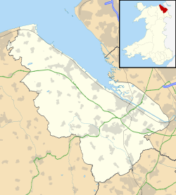
The county of Flintshire is on the north-east coast of Wales, and two ancient border earthworks run through the length of the county. There are 131 Scheduled Monuments in the post-1996 county of Flintshire. (The historic county of Flintshire, with its unusual separate exclave, is now split between the unitary areas of Flintshire, Wrexham and Denbighshire, so would have had considerably more scheduled sites). There are a great many prehistoric sites for such a small county. With only one confirmed Neolithic site, it is the Bronze Age and Iron Age sites that dominate, 67 of them found mainly on the north-west of the county. In the main these are burial mounds with 8 hillforts and other enclosures. From the Early medieval period, Offa's Dyke has 10 notable sections in the county, whilst the older Wat's Dyke has 19 scheduled sections. From the post-Norman medieval period, Flintshire offers a very diverse range of monument types: 20 sites, with 10 different site types, including castles, castle mounds, moated sites, chapels and a holy well, field systems, a deserted village and an abbey. In the post-medieval period, there is a packhorse bridge and a lockup, but it is the industrial sites that stand out, especially the water-powered industries in the Greenfield Valley and the Pottery sites in Buckley. Flintshire lies wholly within the historic county of Flintshire.
Scheduled Ancient Monuments (SAMs) have statutory protection. It is illegal to disturb the ground surface or any standing remains. The compilation of the list of sites is undertaken by Cadw Welsh Historic Monuments, which is an executive agency of the National Assembly of Wales.[1] The list of scheduled monuments below is supplied by Cadw[2] with additional material from RCAHMW and Clwyd-Powys Archaeological Trust.
Scheduled Monuments in Flintshire
| Image | Name | Site type | Community | Location | Details | Period | SAM No & Refs |
|---|---|---|---|---|---|---|---|
| Penbedw Park Stone Circle & Standing Stone | Stone circle | Nannerch | 53°12′07″N 3°14′45″W / 53.2019°N 3.2457°W, SJ168679 |
Five stones form part of a circle. Oaktrees complete the ring. Earliest record is 1784 but it is suspected that it may be an 18th-century fake. Nearby standing stone is Bronze Age. | Prehistoric |
FL008 [3] | |
 |
Gop Caves | Cave | Trelawnyd and Gwaenysgor | 53°18′35″N 3°22′21″W / 53.3097°N 3.3726°W, SJ086800 |
14 neolithic skeletons, plus late neolithic artifacts of northern English origin. The cave system extends into the hillside, and there is some occupation evidence dating pack to palaeolithic | Prehistoric (neolithic) |
FL067 [4] |
| Carreg-y-llech standing stone | Standing stone | Treuddyn | 53°07′01″N 3°07′26″W / 53.117°N 3.124°W, SJ248583 |
1.9m high, possibly set into a tumulus mound, but now the mound has gone. | Prehistoric (Bronze Age) |
FL207 [5] | |
| Circle & Two Round Barrows on Southern Portion of Holywell Golf Course | Round barrow | Brynford | 53°15′55″N 3°14′20″W / 53.2654°N 3.2389°W, SJ174749 |
Circular earth bank, now much disturbed by mineshafts and a golf tee. | Prehistoric |
FL031 [6] | |
| Gatehouse Farm round barrow | Round barrow | Brynford | 53°15′15″N 3°15′27″W / 53.2541°N 3.2575°W, SJ162737 |
Prehistoric |
FL204 [7] | ||
| Round Barrow 400m SE of Smithy Gate | Round barrow | Brynford | 53°16′04″N 3°13′48″W / 53.2679°N 3.2301°W, SJ180752 |
Prehistoric |
FL032 [8] | ||
| Round Barrow at Naid y March, Holywell Common | Round barrow | Brynford | 53°16′08″N 3°15′10″W / 53.2688°N 3.2527°W, SJ165753 |
Prehistoric |
FL033 [9] | ||
| Two Round Barrows 90m NE of Eosfan | Round barrow | Brynford | 53°15′22″N 3°13′49″W / 53.2562°N 3.2303°W, SJ180739 |
Prehistoric |
FL046 [10] | ||
| Coed Bron-Fawr Round Barrow | Round barrow | Caerwys | 53°15′11″N 3°20′53″W / 53.253°N 3.348°W, SJ101737 |
Prehistoric |
FL104 [11] | ||
| Coed Glyn-Bach Round Barrow | Round barrow | Caerwys | 53°15′00″N 3°20′32″W / 53.2501°N 3.3422°W, SJ105734 |
Prehistoric |
FL036 [12] | ||
| Coed Shepherd Round Barrow | Round barrow | Caerwys | 53°15′13″N 3°20′04″W / 53.2536°N 3.3344°W, SJ110737 |
Prehistoric |
FL183 [13] | ||
| Ffrith y Garreg-Wen Round Barrow | Round barrow | Caerwys | 53°16′23″N 3°17′51″W / 53.273°N 3.2974°W, SJ135759 |
Prehistoric |
FL110 [14] | ||
| Pant Ifan Round Barrow | Round barrow | Caerwys | 53°15′21″N 3°21′07″W / 53.2557°N 3.352°W, SJ098740 |
Prehistoric |
FL105 [15] | ||
| Pen-y-graig round barrow | Round barrow | Caerwys | 53°16′03″N 3°18′53″W / 53.2675°N 3.3147°W, SJ124753 |
Prehistoric |
FL198 [16] | ||
| Round Barrow 153m NW of Plas yn Rhos | Round barrow | Caerwys | 53°15′33″N 3°19′35″W / 53.2591°N 3.3265°W, SJ116743 |
Prehistoric |
FL039 [17] | ||
| Round Barrow 225m E of Minffordd Cottage | Round barrow | Caerwys | 53°16′17″N 3°19′22″W / 53.2713°N 3.3229°W, SJ118757 |
Prehistoric |
FL037 [18] | ||
| Plas-Yw Round Barrows | Round barrow | Cilcain | 53°11′37″N 3°15′21″W / 53.1936°N 3.2557°W, SJ162670 |
Prehistoric |
FL169 [19] | ||
| Rhual-Isaf Round Barrow | Round barrow | Gwernaffield | 53°10′34″N 3°09′37″W / 53.1761°N 3.1603°W, SJ225649 |
Prehistoric |
FL052 [20] | ||
| Hen-y-Fail Round Barrow | Round barrow | Halkyn | 53°13′02″N 3°12′16″W / 53.2173°N 3.2045°W, SJ196695 |
Prehistoric |
FL168 [21] | ||
| Round Barrow 180m E of Mwccwd | Round barrow | Halkyn | 53°13′28″N 3°13′44″W / 53.2245°N 3.2288°W, SJ180704 |
Prehistoric |
FL040 [22] | ||
| Round Barrow at Pentrehobin | Round barrow | Leeswood | 53°09′16″N 3°07′35″W / 53.1544°N 3.1263°W, SJ247625 |
Prehistoric |
FL051 [23] | ||
| Barrows 378m E of Berthen-Gam School | Round barrow | Llanasa | 53°18′25″N 3°19′12″W / 53.3069°N 3.32°W, SJ121796 |
Prehistoric |
FL117 [24] | ||
| Berthen-Gam Round Barrow | Round barrow | Llanasa | 53°18′24″N 3°19′41″W / 53.3066°N 3.3281°W, SJ116796 |
Prehistoric |
FL107 [25] | ||
| Round Barrow 270m E of Axton Baptist Chapel | Round barrow | Llanasa | 53°18′39″N 3°20′25″W / 53.3108°N 3.3402°W, SJ108801 |
Prehistoric |
FL045 [26] | ||
| Round Barrows North West of Axton Baptist Chapel | Round barrow | Llanasa | 53°18′44″N 3°20′48″W / 53.3121°N 3.3467°W, SJ103803 |
Prehistoric |
FL114 [27] | ||
| St Elmo's Summer House Round Barrows | Round barrow | Llanasa | 53°19′31″N 3°22′41″W / 53.3254°N 3.3781°W, SJ083818 |
Prehistoric |
FL113 [28] | ||
| Tyn-y-caeau round barrow | Round barrow | Llanasa | 53°19′36″N 3°21′02″W / 53.3267°N 3.3505°W, SJ101819 |
Prehistoric |
FL201 [29] | ||
| Tynewdd round barrow | Round barrow | Llanasa | 53°19′32″N 3°21′20″W / 53.3256°N 3.3555°W, SJ098818 |
Prehistoric |
FL200 [30] | ||
| Plas Maen Cottage round barrow | Round barrow | Llanfynydd | 53°05′44″N 3°02′41″W / 53.0955°N 3.0447°W, SJ301558 |
Prehistoric |
FL203 [31] | ||
| Round Barrow 450m E of Penbedw Hall | Round barrow | Nannerch | 53°12′15″N 3°14′38″W / 53.2043°N 3.244°W, SJ170681 |
Prehistoric |
FL134 [32] | ||
| Nercwys Mountain Cairn | Cairn circle | Nercwys | 53°06′49″N 3°09′55″W / 53.1136°N 3.1652°W, SJ221580 |
Prehistoric |
FL194 [33] | ||
| Barrow on E Slope of Gop Hill | Round barrow | Trelawnyd and Gwaenysgor | 53°18′36″N 3°22′11″W / 53.31°N 3.3697°W, SJ088801 |
Prehistoric |
FL042 [34] | ||
| Bryn yr Odyn Round Barrow | Round barrow | Trelawnyd and Gwaenysgor | 53°18′45″N 3°21′31″W / 53.3126°N 3.3585°W, SJ095803 |
Prehistoric |
FL191 [35] | ||
 |
The Gop | Cairn | Trelawnyd and Gwaenysgor | 53°18′37″N 3°22′20″W / 53.3104°N 3.3723°W, SJ086801 |
Largest cairn in Wales, 12m high and 100m across. No internal finds, and dated to the Bronze Age, but the possibility remains that it is a neolithic passage grave . | Prehistoric (Bronze Age or earlier) |
FL007 [36] |
| Hen-dy round barrow | Round barrow | Trelawnyd and Gwaenysgor | 53°18′16″N 3°22′26″W / 53.3045°N 3.3739°W, SJ085795 |
Prehistoric |
FL202 [37] | ||
| Round Barrow 225m E of Village | Round barrow | Trelawnyd and Gwaenysgor | 53°19′03″N 3°23′04″W / 53.3175°N 3.3845°W, SJ078809 |
Prehistoric |
FL044 [38] | ||
| Round Barrow on Coed Yr Esgob | Round barrow | Trelawnyd and Gwaenysgor | 53°19′19″N 3°23′47″W / 53.3219°N 3.3963°W, SJ070814 |
Prehistoric |
FL043 [39] | ||
| Bryntirion round barrow | Round barrow | Treuddyn | 53°06′55″N 3°07′48″W / 53.1153°N 3.1301°W, SJ244581 |
Prehistoric |
FL208 [40] | ||
| Pen-y-stryt round barrow | Round barrow | Treuddyn | 53°06′44″N 3°08′00″W / 53.1123°N 3.1333°W, SJ242578 |
Prehistoric |
FL206 [41] | ||
| Pentre round barrow | Round barrow | Treuddyn | 53°06′31″N 3°08′12″W / 53.1087°N 3.1366°W, SJ240574 |
Prehistoric |
FL205 [42] | ||
| Bryn Digrif Round Barrows | Round barrow | Whitford | 53°18′02″N 3°18′48″W / 53.3005°N 3.3134°W, SJ125789 |
Prehistoric |
FL116 [43] | ||
| Coed-y-bryn round barrow | Round barrow | Whitford | 53°18′06″N 3°18′24″W / 53.3018°N 3.3068°W, SJ130791 |
Prehistoric |
FL209 [44] | ||
| Crown Wood Round Barrow | Round barrow | Whitford | 53°16′29″N 3°18′49″W / 53.2746°N 3.3135°W, SJ125760 |
Prehistoric |
FL111 [45] | ||
| Groesffordd round barrows | Round barrow | Whitford | 53°17′19″N 3°18′14″W / 53.2887°N 3.3039°W, SJ131776 |
Prehistoric |
FL199 [46] | ||
| Round Barrow 135m NW of Rosehill Farm Gorsedd | Round barrow | Whitford | 53°16′51″N 3°16′49″W / 53.2807°N 3.2804°W, SJ147767 |
Prehistoric |
FL050 [47] | ||
| Round Barrow 350m SW of Glol Farm | Round barrow | Whitford | 53°17′42″N 3°19′11″W / 53.2951°N 3.3197°W, SJ121783 |
Prehistoric |
FL187 [48] | ||
| Round Barrow 450m South West of Glol Farm | Round barrow | Whitford | 53°17′37″N 3°19′11″W / 53.2936°N 3.3198°W, SJ121782 |
Prehistoric |
FL074 [49] | ||
| Y Gorseddau Round Barrows | Round barrow | Whitford | 53°16′47″N 3°16′39″W / 53.2798°N 3.2776°W, SJ149766 |
Prehistoric |
FL075 [50] | ||
| Bryn y Cosyn Round Barrows | Round barrow | Ysceifiog | 53°14′40″N 3°13′50″W / 53.2444°N 3.2305°W, SJ179726 |
Prehistoric |
FL096 [51] | ||
| Groes Faen Bach round barrow | Round barrow | Ysceifiog | 53°14′44″N 3°16′47″W / 53.2456°N 3.2798°W, SJ147728 |
Prehistoric |
FL195 [52] | ||
| Llyfanod round barrow | Round barrow | Ysceifiog | 53°14′58″N 3°17′06″W / 53.2495°N 3.285°W, SJ143732 |
Prehistoric |
FL196 [53] | ||
| Llyn Du Round Barrow | Round barrow | Ysceifiog | 53°15′55″N 3°16′21″W / 53.2653°N 3.2725°W, SJ152750 |
Prehistoric |
FL189 [54] | ||
| Nook round barrow | Round barrow | Ysceifiog | 53°15′06″N 3°17′26″W / 53.2516°N 3.2905°W, SJ139735 |
Prehistoric |
FL197 [55] | ||
| Round Barrow 180m NW of Groesfaen | Round barrow | Ysceifiog | 53°14′54″N 3°16′56″W / 53.2483°N 3.2821°W, SJ145731 |
Prehistoric |
FL056 [56] | ||
| Round Barrow 225m SE of Parc y Prysau | Round barrow | Ysceifiog | 53°14′36″N 3°13′30″W / 53.2433°N 3.2249°W, SJ183725 |
Prehistoric |
FL053 [57] | ||
| Round Barrow 225m SE of Plas Newydd | Round barrow | Ysceifiog | 53°15′31″N 3°16′14″W / 53.2586°N 3.2705°W, SJ153742 |
Prehistoric |
FL076 [58] | ||
| Round Barrow 270m NW of Waen Isaf | Round barrow | Ysceifiog | 53°15′03″N 3°16′14″W / 53.2507°N 3.2706°W, SJ153733 |
Prehistoric |
FL077 [59] | ||
| Round Barrow 450m SSW of Llynfanod | Round barrow | Ysceifiog | 53°14′41″N 3°17′26″W / 53.2447°N 3.2906°W, SJ139727 |
Prehistoric |
FL055 [60] | ||
| Round Barrow 495m SE of Parc y Prysau | Round barrow | Ysceifiog | 53°14′30″N 3°13′20″W / 53.2417°N 3.2223°W, SJ185723 |
Prehistoric |
FL054 [61] | ||
| Round Barrow WSW of Llyfanod | Round barrow | Ysceifiog | 53°14′54″N 3°17′24″W / 53.2482°N 3.2899°W, SJ140731 |
Prehistoric |
FL190 [62] | ||
| Moel y Gaer Camp | Hillfort | Halkyn | 53°12′45″N 3°10′57″W / 53.2124°N 3.1826°W, SJ211690 |
Prehistoric |
FL011 [63] | ||
| Caer Estyn Hillfort | Hillfort | Hope | 53°06′36″N 3°01′34″W / 53.1101°N 3.0262°W, SJ314574 |
Prehistoric |
FL066 [64] | ||
| Moel Arthur Camp | Hillfort | Nannerch, (also Llandyrnog), (see also Denbighshire) | 53°11′05″N 3°16′50″W / 53.1846°N 3.2806°W, SJ145660 |
Prehistoric |
FL010 [65] | ||
| Glol Camp | Enclosure | Whitford | 53°17′34″N 3°19′18″W / 53.2929°N 3.3218°W, SJ119781 |
Prehistoric |
FL071 [66] | ||
| Bron Fadog Enclosure | Enclosure | Ysceifiog | 53°14′21″N 3°17′19″W / 53.2391°N 3.2886°W, SJ140721 |
Prehistoric |
FL173 [67] | ||
| Bwrdd y Rhyfel Camp | Enclosure | Ysceifiog | 53°16′07″N 3°17′24″W / 53.2686°N 3.2899°W, SJ140754 |
Prehistoric |
FL072 [68] | ||
| Coed Trefraith Enclosure | Enclosure | Ysceifiog | 53°14′52″N 3°17′54″W / 53.2479°N 3.2983°W, SJ134731 |
Prehistoric |
FL161 [69] | ||
| Pen-y-Cloddiau Camp | Hillfort | Ysceifiog, (also Llandyrnog), (see also Denbighshire) | 53°11′55″N 3°18′19″W / 53.1986°N 3.3054°W, SJ128676 |
Prehistoric |
FL009 [70] | ||
| Pentre Bridge Roman Site | Unclassified site | Flint | 53°14′26″N 3°07′05″W / 53.2405°N 3.1181°W, SJ254720 |
Roman |
FL131 [71] | ||
| Ffrith Roman Site | Unclassified site | Llanfynydd | 53°05′24″N 3°04′04″W / 53.0901°N 3.0679°W, SJ286552 |
Roman |
FL164 [72] | ||
| Wat's Dyke: Section from Bod Offa to Whitehouse Farm | Linear earthwork | Argoed | 53°09′48″N 3°06′04″W / 53.1634°N 3.1012°W, SJ264634 |
Early Medieval |
FL086 [73] | ||
| Wat's Dyke: Section W of Garreg-Lwyd | Linear earthwork | Argoed | 53°09′18″N 3°05′22″W / 53.1549°N 3.0894°W, SJ272625 |
Early Medieval |
FL087 [74] | ||
| Wat's Dyke: Sections S of Bryn y Bal | Earthwork (unclassified) | Argoed | 53°10′21″N 3°06′37″W / 53.1726°N 3.1104°W, SJ258645 |
Early Medieval |
FL121 [75] | ||
| Wat's Dyke: Section in Fron Tydyr | Linear earthwork | Bagillt | 53°15′22″N 3°11′50″W / 53.256°N 3.1972°W, SJ202738 |
Early Medieval |
FL081 [76] | ||
| Wat's Dyke: Section in Wern Sirk Wood | Linear earthwork | Bagillt | 53°15′36″N 3°12′04″W / 53.2601°N 3.2011°W, SJ199743 |
Early Medieval |
FL080 [77] | ||
| Wat's Dyke: Section NE of Hen-Dy Farm | Linear earthwork | Buckley | 53°09′06″N 3°04′28″W / 53.1518°N 3.0744°W, SJ282621 |
Early Medieval |
FL088 [78] | ||
| Wat's Dyke: Section SE of Meadow Mills | Linear earthwork | Holywell | 53°16′51″N 3°12′53″W / 53.2809°N 3.2148°W, SJ191766 |
Early Medieval |
FL079 [79] | ||
| Wat's Dyke: Section E of Hope | Linear earthwork | Hope | 53°07′02″N 3°01′52″W / 53.1173°N 3.0312°W, SJ310582 |
Early Medieval |
FL120 [80] | ||
| Wat's Dyke: Section N of Bryn Estyn | Linear earthwork | Hope | 53°07′18″N 3°02′00″W / 53.1217°N 3.0333°W, SJ309587 |
Early Medieval |
FL118 [81] | ||
| Wat's Dyke: Section N of Carlton Grange | Linear earthwork | Hope | 53°07′24″N 3°02′05″W / 53.1234°N 3.0347°W, SJ308589 |
Unknown |
FL172 [82] | ||
| Wat's Dyke: Section N of Rhydyn Farm | Linear earthwork | Hope | 53°06′49″N 3°01′48″W / 53.1135°N 3.0301°W, SJ311578 |
Early Medieval |
FL119 [83] | ||
| Wat's Dyke: Section N of the Rectory, Hope | Linear earthwork | Hope | 53°07′08″N 3°01′55″W / 53.119°N 3.032°W, SJ310584 |
Early Medieval |
FL171 [84] | ||
| Wat's Dyke: Section E and SE of Dyke Farm | Linear earthwork | Leeswood | 53°08′47″N 3°03′43″W / 53.1464°N 3.0619°W, SJ290615 |
Early Medieval |
FL089 [85] | ||
| Wat's Dyke: Section from Chester-Holywell Road to Soughton Farm | Linear earthwork | Northop | 53°12′14″N 3°08′51″W / 53.204°N 3.1476°W, SJ234680 |
Early Medieval |
FL083 [86] | ||
| Wat's Dyke: Section from Coed Llys to Chester-Holywell Road | Linear earthwork | Northop | 53°12′57″N 3°09′05″W / 53.2157°N 3.1513°W, SJ232693 |
Early Medieval |
FL082 [87] | ||
| Wat's Dyke: Section N & E of New Brighton | Linear earthwork | Northop | 53°11′02″N 3°07′12″W / 53.184°N 3.12°W, SJ252657 |
Early Medieval |
FL085 [88] | ||
| Wat's Dyke: Section SE of Clawdd Offa | Linear earthwork | Northop | 53°11′38″N 3°08′01″W / 53.1938°N 3.1335°W, SJ243669 |
Early Medieval |
FL084 [89] | ||
| Wat's Dyke: Section NW of Clawdd Offa | Linear earthwork | Penyffordd | 53°08′17″N 3°02′59″W / 53.1381°N 3.0496°W, SJ298606 |
Early Medieval |
FL090 [90] | ||
| Wat's Dyke: Two sections between Clawdd Offa & Pigeon House Farm | Linear earthwork | Penyffordd | 53°07′51″N 3°02′34″W / 53.1308°N 3.0429°W, SJ303598 |
Early Medieval |
FL091 [91] | ||
| Downing Hall Inscribed Stone (now in Whitford Church) | Inscribed stone | Whitford | 53°17′38″N 3°16′54″W / 53.294°N 3.2817°W, SJ146782 |
Early Medieval |
FL013 [92] | ||
| Maen Achwyfan Cross |
Cross | Whitford | 53°17′55″N 3°18′31″W / 53.2987°N 3.3085°W, SJ128787 |
Early Medieval |
FL005 [93] | ||
| Offa's Dyke: Section extending 117m NW of Church | Linear earthwork | Llanfynydd | 53°06′09″N 3°04′44″W / 53.1025°N 3.0789°W, SJ278566 |
Early Medieval |
FL022 [94] | ||
| Offa's Dyke: Section E of Trelawnyd | Linear earthwork | Trelawnyd and Gwaenysgor | 53°18′19″N 3°21′32″W / 53.3053°N 3.3589°W, SJ095795 |
Early Medieval |
FL122 [95] | ||
| Offas Dyke: Section North of Crown Inn | Linear earthwork | Trelawnyd and Gwaenysgor | 53°18′24″N 3°21′50″W / 53.3067°N 3.364°W, SJ092797 |
Early Medieval |
FL124 [96] | ||
| Offas Dyke: Section North West of Tre Abbot-Fawr | Linear earthwork | Trelawnyd and Gwaenysgor | 53°17′56″N 3°20′30″W / 53.2988°N 3.3417°W, SJ106788 |
Early Medieval |
FL123 [97] | ||
| Offas Dyke: Section South East of Gop Farm | Linear earthwork | Trelawnyd and Gwaenysgor | 53°18′24″N 3°22′27″W / 53.3068°N 3.3741°W, SJ085797 |
Early Medieval |
FL125 [98] | ||
| Offas Dyke: Section extending 477m from Coed Talon Banks | Linear earthwork | Treuddyn | 53°06′39″N 3°05′34″W / 53.1107°N 3.0927°W, SJ269576 |
Early Medieval |
FL021 [99] | ||
| Brynbella Mound, and sections of Offa's Dyke adjoining it. | Linear earthwork | Whitford | 53°16′44″N 3°18′00″W / 53.2788°N 3.2999°W, SJ134765 |
Early Medieval |
FL103 [100] | ||
| Offas Dyke: Section from Rhydwen-Fach to Coed Pen-y-Gelli | Linear earthwork | Whitford | 53°16′44″N 3°18′00″W / 53.2788°N 3.2999°W, SJ134765 |
Early Medieval |
FL109 [101] | ||
| Offas Dyke: Tan-y-Graig Section | Linear earthwork | Whitford | 53°17′10″N 3°18′43″W / 53.286°N 3.3119°W, SJ126773 |
Early Medieval |
FL108 [102] | ||
| Offas Dyke:Section N & S of the Circle on Holywell Racecourse, and Circle and Round Barrow | Linear earthwork | Ysceifiog | 53°16′03″N 3°16′24″W / 53.2676°N 3.2734°W, SJ151752 |
Early Medieval |
FL006 [103] | ||
| Tyddyn Castle Mound | Motte | Argoed | 53°09′41″N 3°07′08″W / 53.1614°N 3.119°W, SJ252632 |
Medieval |
FL126 [104] | ||
| Bryn Castell Castle Mound | Motte | Bagillt | 53°15′12″N 3°09′51″W / 53.2532°N 3.1642°W, SJ224735 |
Medieval |
FL061 [105] | ||
| Hen Blas Castle Site | Castle | Bagillt | 53°15′08″N 3°10′06″W / 53.2522°N 3.1684°W, SJ221734 |
Medieval |
FL062 [106] | ||
| Bretton Hall Moated Site | Moated Site | Broughton and Bretton | 53°10′01″N 2°57′00″W / 53.1669°N 2.9499°W, SJ365637 |
Medieval |
FL185 [107] | ||
| Green Lane Farm Moated Site | Moated Site | Broughton and Bretton | 53°10′02″N 2°59′52″W / 53.1673°N 2.9979°W, SJ333638 |
Medieval |
FL176 [108] | ||
| Spon Chapel | Chapel | Buckley | 53°09′24″N 3°04′25″W / 53.1568°N 3.0735°W, SJ283627 |
Medieval |
FL193 [109] | ||
| Enclosure, Field System & Hollow-ways North of Pant | Enclosure | Caerwys | 53°15′39″N 3°17′15″W / 53.2608°N 3.2874°W, SJ142745 |
Medieval |
FL163 [110] | ||
| Hen Caerwys Deserted Village Site | Deserted Rural Settlement | Caerwys | 53°15′29″N 3°17′36″W / 53.2581°N 3.2933°W, SJ138742 |
Medieval |
FL162 [111] | ||
| Bryn y Cwm Mound & Bailey Castle | Motte & Bailey | Flint | 53°14′04″N 3°08′34″W / 53.2344°N 3.1428°W, SJ238714 |
Medieval |
FL064 [112] | ||
 |
Flint Castle |
Castle | Flint | 53°15′04″N 3°07′48″W / 53.2511°N 3.1301°W, SJ246732 |
Built from 1277 during King Edward I's campaigns, it has a fortress design used in France but is unique within the British Isles. | Medieval |
FL003 [113] |
| Hafod Wood Moated Site | Moated Site | Halkyn | 53°14′28″N 3°10′58″W / 53.241°N 3.1827°W, SJ211722 |
Medieval |
FL179 [114] | ||
 |
Ewloe Castle |
Castle | Hawarden | 53°12′00″N 3°04′02″W / 53.2°N 3.0672°W, SJ288675 |
Built by the Welsh Princes, it was captured by the English in 1277. Now within Wepre Park, it is open to the public | Medieval |
FL002 [115] |
.JPG) |
Hawarden Castle | Castle | Hawarden | 53°10′52″N 3°01′12″W / 53.1811°N 3.0201°W, SJ319653 |
With possible Iron Age origins and Norman remains, Hawarden Castlewas slighted by Cromwell. Now on the private Hawarden Estate. | Medieval |
FL016 [116] |
| Trueman's Hill motte | Motte & Bailey | Hawarden | 53°11′11″N 3°01′48″W / 53.1864°N 3.0301°W, SJ313660 |
Medieval |
FL030 [117] | ||
 |
Basingwerk Abbey |
Abbey | Holywell | 53°17′17″N 3°12′27″W / 53.288°N 3.2074°W, SJ196774 |
Cistercian Abbey Ruins. Open to the public within Greenfield Valley Heritage Park | Medieval |
FL001 [118] |
| Holywell Castle Mound | Motte | Holywell | 53°16′39″N 3°13′21″W / 53.2774°N 3.2225°W, SJ185762 |
Medieval |
FL029 [119] | ||
 |
St Winifrede's Chapel and Holy Well |
Chapel | Holywell | 53°16′38″N 3°13′25″W / 53.2771°N 3.2236°W, SJ185762 |
Claims to be the oldest continually-visited pilgrimage site in Great Britain. A hand pump still provides drinkable water. | Medieval |
FL101 [120] |
.JPG) |
Caergwrle Castle | Castle | Hope | 53°06′27″N 3°02′12″W / 53.1076°N 3.0367°W, SJ306572 |
Last castle to be built under Welsh independent rule. Rebuilding began under the English, but a fire in 1283 endd all plans of completing it. It is now open to the public, in the care of Caergwrle Community Council | Medieval |
FL020 [121] |
| The Bailey Hill, Mold | Motte & Bailey | Mold | 53°10′14″N 3°08′44″W / 53.1706°N 3.1456°W, SJ235643 |
Medieval |
FL014 [122] | ||
| Llys Edwin Medieval Fortified House Site | House (domestic) | Northop | 53°12′57″N 3°08′39″W / 53.2157°N 3.1443°W, SJ236693 |
Medieval |
FL023 [123] | ||
| Trelawnyd Churchyard Cross | Cross | Trelawnyd and Gwaenysgor | 53°18′21″N 3°22′07″W / 53.3057°N 3.3685°W, SJ089796 |
Medieval |
FL115 [124] | ||
| The 'Lock-Up', Hawarden | Lock-up | Hawarden | 53°11′03″N 3°01′22″W / 53.1842°N 3.0228°W, SJ317657 |
Post-Medieval/Modern |
FL078 [125] | ||
 |
Caergwrle Packhorse Bridge | Bridge | Hope | 53°06′40″N 3°02′16″W / 53.1112°N 3.0378°W, SJ306576 |
Post-Medieval/Modern |
FL133 [126] | |
 |
Bridge 157m E of Ffrith Village | Bridge | Llanfynydd | 53°05′25″N 3°04′01″W / 53.0904°N 3.067°W, SJ286553 |
Post-Medieval/Modern |
FL132 [127] | |
| Industrial Tramway, Near Buckley | Industrial monument | Buckley | 53°10′13″N 3°03′49″W / 53.1704°N 3.0637°W, SJ289642 |
Post-Medieval/Modern |
FL181 [128] | ||
| Pinfold Lane Pottery, Site of | Pottery kiln | Buckley | 53°10′55″N 3°05′10″W / 53.1819°N 3.086°W, SJ275655 |
Post-Medieval/Modern |
FL166 [129] | ||
| Taylor's Pottery | Pottery kiln | Buckley | 53°10′48″N 3°05′43″W / 53.1801°N 3.0952°W, SJ269653 |
Post-Medieval/Modern |
FL165 [130] | ||
 |
Greenfield Valley Mills | Industrial building | Holywell | 53°17′01″N 3°12′53″W / 53.2836°N 3.2147°W, SJ191769 |
18th century mills producing wire, copper sheets and cotton, powered by water from the Holywell river, Now an industrial heritage park. | Post-Medieval/Modern |
FL160 [131] |
| Kelsterton Brewery | Industrial building | Connah's Quay | 53°13′39″N 3°05′01″W / 53.2274°N 3.0836°W, SJ277705 |
Post-Medieval/Modern |
FL180 [132] | ||
| Ministry of Supply Valley Site | Ordnance factory | Cilcain | 53°11′10″N 3°11′27″W / 53.1861°N 3.1908°W, SJ205661 |
Post-Medieval/Modern |
FL210 [133] | ||
See also
- List of Cadw properties
- List of castles in Wales
- List of hill forts in Wales
- Historic houses in Wales
- List of monastic houses in Wales
- List of museums in Wales
- List of Roman villas in Wales
References
- Coflein is the online database of RCAHMW: Royal Commission on the Ancient and Historical Monuments of Wales, CPAT is the Clwyd-Powys Archaeological Trust, Cadw is the Welsh Historic Monuments Agency
- ↑ Cadw: Ancient Monuments and Scheduling. Accessed 25 April 2013
- ↑ Cadw will send their list as a spreadsheet, or other electronic formats, on request, as indicated at www.whatdotheyknow.com. This list uses information dated May 2012
- ↑ coflein NPRN: 306858. CPAT PRN: 100225 & CPAT PRN: 100224. Cadw SAM: FL008: Penbedw Park Stone Circle & Standing Stone
- ↑ coflein NPRN: 306726. CPAT PRN: 102263. Cadw SAM: FL067: The Gop Caves
- ↑ coflein NPRN: 307085. CPAT PRN: 100008. Cadw SAM: FL207: Carreg-y-llech standing stone
- ↑ coflein NPRN: 100256. CPAT PRN not yet identified. Cadw SAM: FL031: Circle & Two Round Barrows on Southern Portion of Holywell Golf Course
- ↑ coflein NPRN: not yet identified. CPAT PRN not yet identified. Cadw SAM: FL204: Gatehouse Farm round barrow
- ↑ coflein NPRN: not yet identified. CPAT PRN not yet identified. Cadw SAM: FL032: Round Barrow 400m SE of Smithy Gate
- ↑ coflein NPRN: not yet identified. CPAT PRN not yet identified. Cadw SAM: FL033: Round Barrow at Naid y March, Holywell Common
- ↑ coflein NPRN: not yet identified. CPAT PRN not yet identified. Cadw SAM: FL046: Two Round Barrows 90m NE of Eosfan
- ↑ coflein NPRN: not yet identified. CPAT PRN not yet identified. Cadw SAM: FL104: Coed Bron-Fawr Round Barrow
- ↑ coflein NPRN: not yet identified. CPAT PRN not yet identified. Cadw SAM: FL036: Coed Glyn-Bach Round Barrow
- ↑ coflein NPRN: not yet identified. CPAT PRN not yet identified. Cadw SAM: FL183: Coed Shepherd Round Barrow
- ↑ coflein NPRN: not yet identified. CPAT PRN not yet identified. Cadw SAM: FL110: Ffrith y Garreg-Wen Round Barrow
- ↑ coflein NPRN: not yet identified. CPAT PRN not yet identified. Cadw SAM: FL105: Pant Ifan Round Barrow
- ↑ coflein NPRN: not yet identified. CPAT PRN not yet identified. Cadw SAM: FL198: Pen-y-graig round barrow
- ↑ coflein NPRN: not yet identified. CPAT PRN not yet identified. Cadw SAM: FL039: Round Barrow 153m NW of Plas yn Rhos
- ↑ coflein NPRN: not yet identified. CPAT PRN not yet identified. Cadw SAM: FL037: Round Barrow 225m E of Minffordd Cottage
- ↑ coflein NPRN: not yet identified. CPAT PRN not yet identified. Cadw SAM: FL169: Plas-Yw Round Barrows
- ↑ coflein NPRN: not yet identified. CPAT PRN not yet identified. Cadw SAM: FL052: Rhual-Isaf Round Barrow
- ↑ coflein NPRN: not yet identified. CPAT PRN not yet identified. Cadw SAM: FL168: Hen-y-Fail Round Barrow
- ↑ coflein NPRN: not yet identified. CPAT PRN not yet identified. Cadw SAM: FL040: Round Barrow 180m E of Mwccwd
- ↑ coflein NPRN: not yet identified. CPAT PRN not yet identified. Cadw SAM: FL051: Round Barrow at Pentrehobin
- ↑ coflein NPRN: not yet identified. CPAT PRN not yet identified. Cadw SAM: FL117: Barrows 378m E of Berthen-Gam School
- ↑ coflein NPRN: not yet identified. CPAT PRN not yet identified. Cadw SAM: FL107: Berthen-Gam Round Barrow
- ↑ coflein NPRN: not yet identified. CPAT PRN not yet identified. Cadw SAM: FL045: Round Barrow 270m E of Axton Baptist Chapel
- ↑ coflein NPRN: not yet identified. CPAT PRN not yet identified. Cadw SAM: FL114: Round Barrows North West of Axton Baptist Chapel
- ↑ coflein NPRN: not yet identified. CPAT PRN not yet identified. Cadw SAM: FL113: St Elmo's Summer House Round Barrows
- ↑ coflein NPRN: not yet identified. CPAT PRN not yet identified. Cadw SAM: FL201: Tyn-y-caeau round barrow
- ↑ coflein NPRN: not yet identified. CPAT PRN not yet identified. Cadw SAM: FL200: Tynewdd round barrow
- ↑ coflein NPRN: not yet identified. CPAT PRN not yet identified. Cadw SAM: FL203: Plas Maen Cottage round barrow
- ↑ coflein NPRN: 306860. CPAT PRN: 100223. Cadw SAM: FL134: Round Barrow 450m E of Penbedw Hall
- ↑ coflein NPRN: not yet identified. CPAT PRN not yet identified. Cadw SAM: FL194: Nercwys Mountain Cairn
- ↑ coflein NPRN: not yet identified. CPAT PRN not yet identified. Cadw SAM: FL042: Barrow on E Slope of Gop Hill
- ↑ coflein NPRN: not yet identified. CPAT PRN not yet identified. Cadw SAM: FL191: Bryn yr Odyn Round Barrow
- ↑ coflein NPRN: 306725. CPAT PRN: 102207. Cadw SAM: FL007: Gop Cairn
- ↑ coflein NPRN: not yet identified. CPAT PRN not yet identified. Cadw SAM: FL202: Hen-dy round barrow
- ↑ coflein NPRN: not yet identified. CPAT PRN not yet identified. Cadw SAM: FL044: Round Barrow 225m E of Village
- ↑ coflein NPRN: not yet identified. CPAT PRN not yet identified. Cadw SAM: FL043: Round Barrow on Coed Yr Esgob
- ↑ coflein NPRN: not yet identified. CPAT PRN not yet identified. Cadw SAM: FL208: Bryntirion round barrow
- ↑ coflein NPRN: not yet identified. CPAT PRN not yet identified. Cadw SAM: FL206: Pen-y-stryt round barrow
- ↑ coflein NPRN: not yet identified. CPAT PRN not yet identified. Cadw SAM: FL205: Pentre round barrow
- ↑ coflein NPRN: not yet identified. CPAT PRN not yet identified. Cadw SAM: FL116: Bryn Digrif Round Barrows
- ↑ coflein NPRN: not yet identified. CPAT PRN not yet identified. Cadw SAM: FL209: Coed-y-bryn round barrow
- ↑ coflein NPRN: not yet identified. CPAT PRN not yet identified. Cadw SAM: FL111: Crown Wood Round Barrow
- ↑ coflein NPRN: not yet identified. CPAT PRN not yet identified. Cadw SAM: FL199: Groesffordd round barrows
- ↑ coflein NPRN: not yet identified. CPAT PRN not yet identified. Cadw SAM: FL050: Round Barrow 135m NW of Rosehill Farm Gorsedd
- ↑ coflein NPRN: not yet identified. CPAT PRN not yet identified. Cadw SAM: FL187: Round Barrow 350m SW of Glol Farm
- ↑ coflein NPRN: not yet identified. CPAT PRN not yet identified. Cadw SAM: FL074: Round Barrow 450m South West of Glol Farm
- ↑ coflein NPRN: not yet identified. CPAT PRN not yet identified. Cadw SAM: FL075: Y Gorseddau Round Barrows
- ↑ coflein NPRN: not yet identified. CPAT PRN not yet identified. Cadw SAM: FL096: Bryn y Cosyn Round Barrows
- ↑ coflein NPRN: not yet identified. CPAT PRN not yet identified. Cadw SAM: FL195: Groes Faen Bach round barrow
- ↑ coflein NPRN: not yet identified. CPAT PRN not yet identified. Cadw SAM: FL196: Llyfanod round barrow
- ↑ coflein NPRN: not yet identified. CPAT PRN not yet identified. Cadw SAM: FL189: Llyn Du Round Barrow
- ↑ coflein NPRN: not yet identified. CPAT PRN not yet identified. Cadw SAM: FL197: Nook round barrow
- ↑ coflein NPRN: not yet identified. CPAT PRN not yet identified. Cadw SAM: FL056: Round Barrow 180m NW of Groesfaen
- ↑ coflein NPRN: not yet identified. CPAT PRN not yet identified. Cadw SAM: FL053: Round Barrow 225m SE of Parc y Prysau
- ↑ coflein NPRN: not yet identified. CPAT PRN not yet identified. Cadw SAM: FL076: Round Barrow 225m SE of Plas Newydd
- ↑ coflein NPRN: not yet identified. CPAT PRN not yet identified. Cadw SAM: FL077: Round Barrow 270m NW of Waen Isaf
- ↑ coflein NPRN: not yet identified. CPAT PRN not yet identified. Cadw SAM: FL055: Round Barrow 450m SSW of Llynfanod
- ↑ coflein NPRN: not yet identified. CPAT PRN not yet identified. Cadw SAM: FL054: Round Barrow 495m SE of Parc y Prysau
- ↑ coflein NPRN: not yet identified. CPAT PRN not yet identified. Cadw SAM: FL190: Round Barrow WSW of Llyfanod
- ↑ coflein NPRN: not yet identified. CPAT PRN not yet identified. Cadw SAM: FL011: Moel y Gaer Camp
- ↑ coflein NPRN: not yet identified. CPAT PRN not yet identified. Cadw SAM: FL066: Caer Estyn Hillfort
- ↑ coflein NPRN: not yet identified. CPAT PRN not yet identified. Cadw SAM: FL010: Moel Arthur Camp
- ↑ coflein NPRN: not yet identified. CPAT PRN not yet identified. Cadw SAM: FL071: Glol Camp
- ↑ coflein NPRN: not yet identified. CPAT PRN not yet identified. Cadw SAM: FL173: Bron Fadog Enclosure
- ↑ coflein NPRN: not yet identified. CPAT PRN not yet identified. Cadw SAM: FL072: Bwrdd y Rhyfel Camp
- ↑ coflein NPRN: not yet identified. CPAT PRN not yet identified. Cadw SAM: FL161: Coed Trefraith Enclosure
- ↑ coflein NPRN: not yet identified. CPAT PRN not yet identified. Cadw SAM: FL009: Pen-y-Cloddiau Camp
- ↑ coflein NPRN: not yet identified. CPAT PRN not yet identified. Cadw SAM: FL131: Pentre Bridge Roman Site
- ↑ coflein NPRN: not yet identified. CPAT PRN not yet identified. Cadw SAM: FL164: Ffrith Roman Site
- ↑ coflein NPRN: not yet identified. CPAT PRN not yet identified. Cadw SAM: FL086: Wat's Dyke: Section from Bod Offa to Whitehouse Farm
- ↑ coflein NPRN: not yet identified. CPAT PRN not yet identified. Cadw SAM: FL087: Wat's Dyke: Section W of Garreg-Lwyd
- ↑ coflein NPRN: not yet identified. CPAT PRN not yet identified. Cadw SAM: FL121: Wat's Dyke: Sections S of Bryn y Bal
- ↑ coflein NPRN: not yet identified. CPAT PRN not yet identified. Cadw SAM: FL081: Wat's Dyke: Section in Fron Tydyr
- ↑ coflein NPRN: not yet identified. CPAT PRN not yet identified. Cadw SAM: FL080: Wat's Dyke: Section in Wern Sirk Wood
- ↑ coflein NPRN: not yet identified. CPAT PRN not yet identified. Cadw SAM: FL088: Wat's Dyke: Section NE of Hen-Dy Farm
- ↑ coflein NPRN: not yet identified. CPAT PRN not yet identified. Cadw SAM: FL079: Wat's Dyke: Section SE of Meadow Mills
- ↑ coflein NPRN: not yet identified. CPAT PRN not yet identified. Cadw SAM: FL120: Wat's Dyke: Section E of Hope
- ↑ coflein NPRN: not yet identified. CPAT PRN not yet identified. Cadw SAM: FL118: Wat's Dyke: Section N of Bryn Estyn
- ↑ coflein NPRN: not yet identified. CPAT PRN not yet identified. Cadw SAM: FL172: Wat's Dyke: Section N of Carlton Grange
- ↑ coflein NPRN: not yet identified. CPAT PRN not yet identified. Cadw SAM: FL119: Wat's Dyke: Section N of Rhydyn Farm
- ↑ coflein NPRN: not yet identified. CPAT PRN not yet identified. Cadw SAM: FL171: Wat's Dyke: Section N of the Rectory, Hope
- ↑ coflein NPRN: not yet identified. CPAT PRN not yet identified. Cadw SAM: FL089: Wat's Dyke: Section E and SE of Dyke Farm
- ↑ coflein NPRN: not yet identified. CPAT PRN not yet identified. Cadw SAM: FL083: Wat's Dyke: Section from Chester-Holywell Road to Soughton Farm
- ↑ coflein NPRN: not yet identified. CPAT PRN not yet identified. Cadw SAM: FL082: Wat's Dyke: Section from Coed Llys to Chester-Holywell Road
- ↑ coflein NPRN: not yet identified. CPAT PRN not yet identified. Cadw SAM: FL085: Wat's Dyke: Section N & E of New Brighton
- ↑ coflein NPRN: not yet identified. CPAT PRN not yet identified. Cadw SAM: FL084: Wat's Dyke: Section SE of Clawdd Offa
- ↑ coflein NPRN: not yet identified. CPAT PRN not yet identified. Cadw SAM: FL090: Wat's Dyke: Section NW of Clawdd Offa
- ↑ coflein NPRN: not yet identified. CPAT PRN not yet identified. Cadw SAM: FL091: Wat's Dyke: Two sections between Clawdd Offa & Pigeon House Farm
- ↑ coflein NPRN: not yet identified. CPAT PRN not yet identified. Cadw SAM: FL013: Downing Hall Inscribed Stone (now in Whitford Church)
- ↑ coflein NPRN: not yet identified. CPAT PRN not yet identified. Cadw SAM: FL005: Maen Achwyfan
- ↑ coflein NPRN: not yet identified. CPAT PRN not yet identified. Cadw SAM: FL022: Offa's Dyke: Section extending 117m NW of Church
- ↑ coflein NPRN: not yet identified. CPAT PRN not yet identified. Cadw SAM: FL122: Offa's Dyke: Section E of Trelawnyd
- ↑ coflein NPRN: not yet identified. CPAT PRN not yet identified. Cadw SAM: FL124: Offa's Dyke: Section North of Crown Inn
- ↑ coflein NPRN: not yet identified. CPAT PRN not yet identified. Cadw SAM: FL123: Offa's Dyke: Section North West of Tre Abbot-Fawr
- ↑ coflein NPRN: not yet identified. CPAT PRN not yet identified. Cadw SAM: FL125: Offa's Dyke: Section South East of Gop Farm
- ↑ coflein NPRN: not yet identified. CPAT PRN not yet identified. Cadw SAM: FL021: Offa's Dyke: Section extending 477m from Coed Talon Banks
- ↑ coflein NPRN: not yet identified. CPAT PRN not yet identified. Cadw SAM: FL103: Brynbella Mound, and sections of Offas Dyke adjoining it.
- ↑ coflein NPRN: not yet identified. CPAT PRN not yet identified. Cadw SAM: FL109: Offa's Dyke: Section from Rhydwen-Fach to Coed Pen-y-Gelli
- ↑ coflein NPRN: not yet identified. CPAT PRN not yet identified. Cadw SAM: FL108: Offa's Dyke: Tan-y-Graig Section
- ↑ coflein NPRN: not yet identified. CPAT PRN not yet identified. Cadw SAM: FL006: Offa's Dyke:Section N & S of the Circle on Holywell Racecourse, and Circle and Round Barrow
- ↑ coflein NPRN: not yet identified. CPAT PRN not yet identified. Cadw SAM: FL126: Tyddyn Castle Mound
- ↑ coflein NPRN: not yet identified. CPAT PRN not yet identified. Cadw SAM: FL061: Bryn Castell Castle Mound
- ↑ coflein NPRN: not yet identified. CPAT PRN not yet identified. Cadw SAM: FL062: Hen Blas Castle Site
- ↑ coflein NPRN: not yet identified. CPAT PRN not yet identified. Cadw SAM: FL185: Bretton Hall Moated Site
- ↑ coflein NPRN: not yet identified. CPAT PRN not yet identified. Cadw SAM: FL176: Green Lane Farm Moated Site
- ↑ coflein NPRN: not yet identified. CPAT PRN not yet identified. Cadw SAM: FL193: Spon Chapel
- ↑ coflein NPRN: not yet identified. CPAT PRN not yet identified. Cadw SAM: FL163: Enclosure, Field System & Hollow-ways North of Pant
- ↑ coflein NPRN: not yet identified. CPAT PRN not yet identified. Cadw SAM: FL162: Hen Caerwys Deserted Village Site
- ↑ coflein NPRN: not yet identified. CPAT PRN not yet identified. Cadw SAM: FL064: Bryn y Cwm Mound & Bailey Castle
- ↑ coflein NPRN: not yet identified. CPAT PRN not yet identified. Cadw SAM: FL003: Flint Castle
- ↑ coflein NPRN: not yet identified. CPAT PRN not yet identified. Cadw SAM: FL179: Hafod Wood Moated Site
- ↑ coflein NPRN: not yet identified. CPAT PRN not yet identified. Cadw SAM: FL002: Ewloe Castle
- ↑ coflein NPRN: not yet identified. CPAT PRN not yet identified. Cadw SAM: FL016: Hawarden Castle
- ↑ coflein NPRN: not yet identified. CPAT PRN not yet identified. Cadw SAM: FL030: Trueman's Hill motte
- ↑ coflein NPRN: not yet identified. CPAT PRN not yet identified. Cadw SAM: FL001: Basingwerk Abbey
- ↑ coflein NPRN: not yet identified. CPAT PRN not yet identified. Cadw SAM: FL029: Holywell Castle Mound
- ↑ coflein NPRN: not yet identified. CPAT PRN not yet identified. Cadw SAM: FL101: St Winefride's Chapel
- ↑ coflein NPRN: not yet identified. CPAT PRN not yet identified. Cadw SAM: FL020: Caergwrle Castle
- ↑ coflein NPRN: not yet identified. CPAT PRN not yet identified. Cadw SAM: FL014: The Bailey Hill, Mold
- ↑ coflein NPRN: not yet identified. CPAT PRN not yet identified. Cadw SAM: FL023: Llys Edwin Medieval Fortified House Site
- ↑ coflein NPRN: not yet identified. CPAT PRN not yet identified. Cadw SAM: FL115: Trelawnyd Churchyard Cross
- ↑ coflein NPRN: not yet identified. CPAT PRN not yet identified. Cadw SAM: FL078: The 'Lock-Up', Hawarden
- ↑ coflein NPRN: not yet identified. CPAT PRN not yet identified. Cadw SAM: FL133: Caergwrle Packhorse Bridge
- ↑ coflein NPRN: not yet identified. CPAT PRN not yet identified. Cadw SAM: FL132: Bridge 157m E of Ffrith Village
- ↑ coflein NPRN: not yet identified. CPAT PRN not yet identified. Cadw SAM: FL181: Industrial Tramway, Near Buckley
- ↑ coflein NPRN: not yet identified. CPAT PRN not yet identified. Cadw SAM: FL166: Pinfold Lane Pottery, Site of
- ↑ coflein NPRN: not yet identified. CPAT PRN not yet identified. Cadw SAM: FL165: Taylor's Pottery
- ↑ coflein NPRN: not yet identified. CPAT PRN not yet identified. Cadw SAM: FL160: Greenfield Valley Mills
- ↑ coflein NPRN: not yet identified. CPAT PRN not yet identified. Cadw SAM: FL180: Kelsterton Brewery
- ↑ coflein NPRN: not yet identified. CPAT PRN not yet identified. Cadw SAM: FL210: Ministry of Supply Valley Site