| [3] |
Name on the Register[4] |
Image |
Date listed[5] |
Location |
City or town |
Description |
|---|
| 1 |
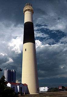
Absecon Lighthouse |
|
000000001971-01-25-0000January 25, 1971
(#71000492) |
Vermont and Pacific Aves.
39°21′58″N 74°24′51″W / 39.366111°N 74.414167°W / 39.366111; -74.414167 (Absecon Lighthouse) |
Atlantic City |
|
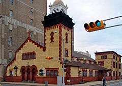
| 2 |
Atlantic City Convention Hall |
|
000000001987-02-27-0000February 27, 1987
(#87000814) |
Georgia and Mississippi Aves. and the Boardwalk
39°21′17″N 74°26′20″W / 39.354722°N 74.438889°W / 39.354722; -74.438889 (Atlantic City Convention Hall) |
Atlantic City |
|
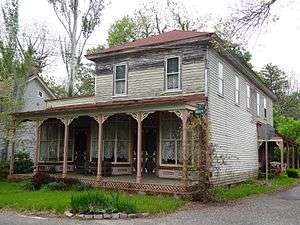
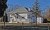
| 3 |
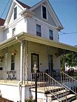
Capt. Francis Babcock House |
|
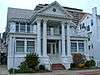
000000001999-07-28-0000July 28, 1999
(#99000907) |
324 S. Shore Rd.
39°25′10″N 74°30′01″W / 39.419444°N 74.500278°W / 39.419444; -74.500278 (Capt. Francis Babcock House) |
Absecon City |
|
| 4 |
Barclay Court |
|
000000001988-06-22-0000June 22, 1988
(#88000725) |
9-11 S. Pennsylvania Ave.
39°21′48″N 74°25′24″W / 39.363333°N 74.423333°W / 39.363333; -74.423333 (Barclay Court) |
Atlantic City |
Demolished[6]
|
| 5 |
Bay Front Historic District |
|
000000001989-03-22-0000March 22, 1989
(#89000227) |
Roughly bounded by Decatur Ave., Egg Harbor Bay, George Ave., and Shore Rd.
39°18′41″N 74°35′41″W / 39.311389°N 74.594722°W / 39.311389; -74.594722 (Bay Front Historic District) |
Somers Point |
|
| 6 |
Belcoville Post Office |
|
000000002008-03-14-0000March 14, 2008
(#08000174) |
1201 Madden Ave.
39°26′14″N 74°44′00″W / 39.4371°N 74.7334°W / 39.4371; -74.7334 (Belcoville Post Office) |
Weymouth Township |
|
| 7 |
Bethlehem Loading Company Mays Landing Plant Archeological Historic District |
Upload image |
000000002006-07-12-0000July 12, 2006
(#06000559) |
Address Restricted
|
Estell Manor |
|
| 8 |
William L. Black House |
|
000000001993-08-26-0000August 26, 1993
(#93000828) |
458 Bellevue Ave.
39°38′24″N 74°47′56″W / 39.64°N 74.798889°W / 39.64; -74.798889 (William L. Black House) |
Hammonton |
|
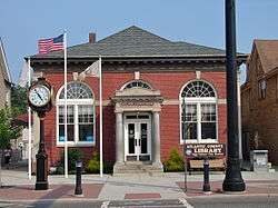
| 9 |
Amanda Blake Store |
|
000000001979-01-15-0000January 15, 1979
(#79001469) |
104 Main St.
39°31′09″N 74°29′29″W / 39.519167°N 74.491389°W / 39.519167; -74.491389 (Amanda Blake Store) |
Port Republic |
|
| 10 |
Church of the Ascension |
|
000000001986-07-24-0000July 24, 1986
(#86001941) |
1601 Pacific Ave.
39°21′35″N 74°25′47″W / 39.359586°N 74.429584°W / 39.359586; -74.429584 (Church of the Ascension) |
Atlantic City |
|
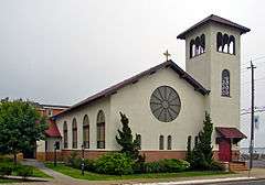
| 11 |
Church of the Redeemer |
|
000000001992-09-10-0000September 10, 1992
(#92001179) |
Jct. of 20th and Atlantic Aves.
39°18′34″N 74°31′51″W / 39.309444°N 74.530833°W / 39.309444; -74.530833 (Church of the Redeemer) |
Longport |
Destroyed in a 2012 storm, later rebuilt.[7]
|
| 12 |
John Doughty House |
|
000000002002-03-05-0000March 5, 2002
(#02000107) |
40 North Shore Rd.
39°25′28″N 74°29′56″W / 39.424483°N 74.498956°W / 39.424483; -74.498956 (John Doughty House) |
Absecon City |
|
| 13 |
Egg Harbor Commercial Bank |
|
000000002007-08-28-0000August 28, 2007
(#07000875) |
134 Philadelphia Ave.
39°31′46″N 74°38′48″W / 39.529444°N 74.646667°W / 39.529444; -74.646667 (Egg Harbor Commercial Bank) |
Egg Harbor City |
|
| 14 |
Estellville Glassworks Historic District |
|
000000001991-11-21-0000November 21, 1991
(#91001678) |
Roughly bounded by Estell Manor Park, Stevens Cr. and NJ 50
39°23′43″N 74°44′52″W / 39.395278°N 74.747778°W / 39.395278; -74.747778 (Estellville Glassworks Historic District) |
Estell Manor City |
|
| 15 |
Great Egg Coast Guard Station |
|
000000002005-10-31-0000October 31, 2005
(#05000128) |
2301 Atlantic Ave.
39°18′42″N 74°31′41″W / 39.311761°N 74.527939°W / 39.311761; -74.527939 (Great Egg Coast Guard Station) |
Longport |
|
| 16 |
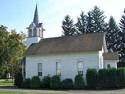
Head of the River Church |
|
000000001979-03-07-0000March 7, 1979
(#79001467) |
NJ 49
39°18′38″N 74°49′19″W / 39.310556°N 74.821944°W / 39.310556; -74.821944 (Head of the River Church) |
Estell Manor |
|
| 17 |
Holmhurst Hotel |
Upload image |
000000001978-01-18-0000January 18, 1978
(#78001732) |
121 S. Pennsylvania Ave.
39°21′41″N 74°25′23″W / 39.361389°N 74.423056°W / 39.361389; -74.423056 (Holmhurst Hotel) |
Atlantic City |
Demolished, March 1985.[6] Now a parking lot.
|
| 18 |
Jacobus Evangelical Lutheran Church |
|
000000001988-06-09-0000June 9, 1988
(#88000635) |
Mays Landing Rd. and NJ 54
39°36′25″N 74°50′49″W / 39.606944°N 74.846944°W / 39.606944; -74.846944 (Jacobus Evangelical Lutheran Church) |
Folsom Borough |
|
| 19 |
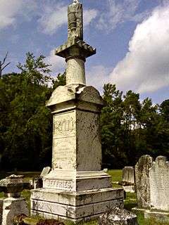
Capt. John Jeffries Burial Marker |
|
000000001984-06-14-0000June 14, 1984
(#84002511) |
Palestine Bible Church Cemetery, NJ 559
39°20′55″N 74°39′42″W / 39.348611°N 74.661667°W / 39.348611; -74.661667 (Capt. John Jeffries Burial Marker) |
Somers Point |
|
| 20 |
Linwood Borough School No. 1 |
|
000000001984-12-20-0000December 20, 1984
(#84000510) |
16 W. Poplar Ave.
39°21′03″N 74°34′04″W / 39.350833°N 74.567778°W / 39.350833; -74.567778 (Linwood Borough School No. 1) |
Linwood |
|
| 21 |
Linwood Historic District |
|
000000001989-07-13-0000July 13, 1989
(#89000800) |
Roughly Shore Rd. from Royal Ave. to Sterling Ave.
39°20′27″N 74°34′30″W / 39.340833°N 74.575°W / 39.340833; -74.575 (Linwood Historic District) |
Linwood |
|
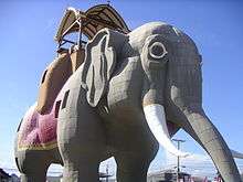
| 22 |
Lucy, the Margate Elephant |
|
000000001971-08-12-0000August 12, 1971
(#71000493) |
Decatur and Atlantic Aves.
39°19′15″N 74°30′42″W / 39.320775°N 74.511597°W / 39.320775; -74.511597 (Lucy, the Margate Elephant) |
Margate City |
|
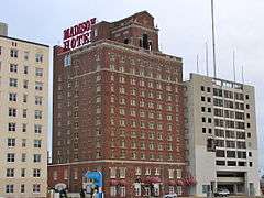
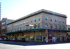
| 23 |
Madison Hotel |
|
000000001984-12-20-0000December 20, 1984
(#84000506) |
123 S. Illinois Ave.
39°21′28″N 74°25′49″W / 39.357778°N 74.430278°W / 39.357778; -74.430278 (Madison Hotel) |
Atlantic City |
|
| 24 |
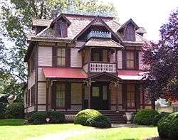
Marven Gardens Historic District |
|
000000001990-09-13-0000September 13, 1990
(#90001440) |
Bounded by Ventnor, Fredericksburg, Winchester and Brunswick Aves.
39°20′00″N 74°29′43″W / 39.333333°N 74.495278°W / 39.333333; -74.495278 (Marven Gardens Historic District) |
Margate City |
|
| 25 |
Mays Landing Historic District |
|
000000001990-08-23-0000August 23, 1990
(#90001245) |
Jct. US 40, NJ 50; roughly bounded by Lake Lenape and Great Egg Harbor
39°27′06″N 74°43′51″W / 39.451667°N 74.730833°W / 39.451667; -74.730833 (Mays Landing Historic District) |
Mays Landing |
|
| 26 |
Mays Landing Presbyterian Church |
|
000000001982-04-20-0000April 20, 1982
(#82003261) |
Main St. and Cape May Ave.
39°27′09″N 74°43′40″W / 39.4525°N 74.727778°W / 39.4525; -74.727778 (Mays Landing Presbyterian Church) |
Mays Landing |
|
| 27 |
Morton Hotel |
|
000000001977-07-15-0000July 15, 1977
(#77000843) |
150 S. Virginia Ave.
39°21′34″N 74°25′14″W / 39.359444°N 74.420556°W / 39.359444; -74.420556 (Morton Hotel) |
Atlantic City |
Demolished,[6] now occupied by Trump Taj Mahal
|
| 28 |
Neutral Water Health Resort Sanitarium |
|
000000001991-03-20-0000March 20, 1991
(#91000267) |
Jct. of Claudius St. and London Ave.
39°32′08″N 74°38′30″W / 39.535556°N 74.641667°W / 39.535556; -74.641667 (Neutral Water Health Resort Sanitarium) |
Egg Harbor City |
|
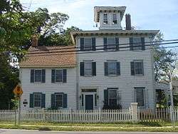
| 29 |
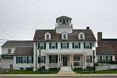
Dr. Jonathan Pitney House |
|
000000001998-08-14-0000August 14, 1998
(#98001062) |
57 N. Shore Rd.
39°25′31″N 74°29′55″W / 39.425231°N 74.498728°W / 39.425231; -74.498728 (Dr. Jonathan Pitney House) |
Absecon City |
|
| 30 |
Pleasant Mills |
|
000000001995-03-03-0000March 3, 1995
(#95000182) |
Elwood-Pleasant Mills Rd., E side
39°38′13″N 74°39′39″W / 39.636944°N 74.660833°W / 39.636944; -74.660833 (Pleasant Mills) |
Mullica Township |
|
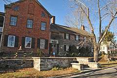
| 31 |
Port Republic Historic District |
|
000000001991-05-16-0000May 16, 1991
(#91000596) |
Roughly bounded by Mill St., Clark's Landing Rd., Adams Ave., Port Republic-Smithville Rd. and Riverside Dr.
39°31′15″N 74°29′35″W / 39.520833°N 74.493056°W / 39.520833; -74.493056 (Port Republic Historic District) |
Port Republic |
|
| 32 |
Samuel Richards Hotel |
|
000000001979-08-31-0000August 31, 1979
(#79001468) |
106 E. Main St
39°27′04″N 74°43′31″W / 39.451111°N 74.725278°W / 39.451111; -74.725278 (Samuel Richards Hotel) |
Mays Landing |
|
| 33 |
Jeremiah II or Edward Risley House |
|
000000001991-05-31-0000May 31, 1991
(#91000609) |
8 Virginia Ave.
39°22′32″N 74°32′22″W / 39.375556°N 74.539444°W / 39.375556; -74.539444 (Jeremiah II or Edward Risley House) |
Northfield |
|
| 34 |
Risley School |
|
000000002011-05-04-0000May 4, 2011
(#11000256) |
134 Cape May Ave.
39°22′37″N 74°49′29″W / 39.376944°N 74.824722°W / 39.376944; -74.824722 (Risley School) |
Estell Manor |
|
| 35 |
ROBERT J. WALKER (shipwreck and remains) |
|
000000002014-03-19-0000March 19, 2014
(#14000064) |
Ten miles off the New Jersey coast
39°16′45″N 74°15′24″W / 39.27904°N 74.25659°W / 39.27904; -74.25659 (ROBERT J. WALKER (shipwreck and remains)) |
Atlantic City |
|
| 36 |
Santa Rita Apartments |
|
000000001991-06-14-0000June 14, 1991
(#91000675) |
66 S. South Carolina Ave.
39°21′40″N 74°25′35″W / 39.361111°N 74.426389°W / 39.361111; -74.426389 (Santa Rita Apartments) |
Atlantic City |
Demolished
|
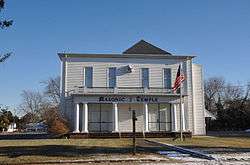
| 37 |
Segal Building |
|
000000001984-02-09-0000February 9, 1984
(#84002517) |
1200 Atlantic Ave.
39°21′46″N 74°25′35″W / 39.362778°N 74.426389°W / 39.362778; -74.426389 (Segal Building) |
Atlantic City |
|
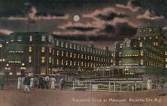
| 38 |
Shelburne Hotel |
|
000000001978-05-19-0000May 19, 1978
(#78001733) |
Michigan Ave. and the Boardwalk
39°21′21″N 74°26′03″W / 39.355833°N 74.434167°W / 39.355833; -74.434167 (Shelburne Hotel) |
Atlantic City |
Demolished[6]
|
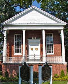
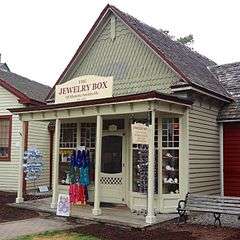
| 39 |
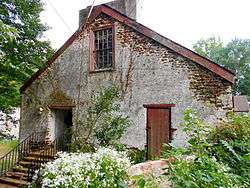
Smithville Apothecary |
|
000000001978-06-09-0000June 9, 1978
(#78001734) |
Off Moss Mill Rd.
39°29′47″N 74°27′49″W / 39.496389°N 74.463611°W / 39.496389; -74.463611 (Smithville Apothecary) |
Smithville |
|
| 40 |
Somers Mansion |
|
000000001970-12-18-0000December 18, 1970
(#70000378) |
Shore Rd. and Somers Point Circle
39°18′33″N 74°35′55″W / 39.309167°N 74.598611°W / 39.309167; -74.598611 (Somers Mansion) |
Somers Point |
|
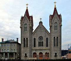
| 41 |
St. Nicholas of Tolentine Church |
|
000000002001-02-02-0000February 2, 2001
(#01000039) |
1409 Pacific Ave.
39°21′38″N 74°25′41″W / 39.360556°N 74.428056°W / 39.360556; -74.428056 (St. Nicholas of Tolentine Church) |
Atlantic City |
|
| 42 |
John Stafford Historic District |
|
000000001988-06-09-0000June 9, 1988
(#88000723) |
Roughly bounded by Atlantic Ave., Vassar Ave., Boardwalk, and Austin Ave.
39°20′35″N 74°28′01″W / 39.343056°N 74.466944°W / 39.343056; -74.466944 (John Stafford Historic District) |
Ventnor City |
|
| 43 |
Tofani–DiMuzio House |
Upload image |
000000002015-10-30-0000October 30, 2015
(#15000762) |
12 S. Cambridge Ave.
39°20′18″N 74°28′47″W / 39.338391°N 74.479732°W / 39.338391; -74.479732 (Tofani–DiMuzio House) |
Ventnor City |
|
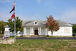
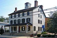
| 44 |
Ventnor City Hall |
|
000000001996-10-10-0000October 10, 1996
(#96001088) |
6201 Atlantic Ave.
39°20′15″N 74°28′49″W / 39.3375°N 74.480278°W / 39.3375; -74.480278 (Ventnor City Hall) |
Ventnor City |
|
| 45 |
WEYMOUTH (schooner) |
Upload image |
000000001985-04-25-0000April 25, 1985
(#85000874) |
Address Restricted
|
Hamilton Township |
|
| 46 |
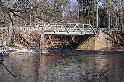
Weymouth Road Bridge |
|
000000002001-06-21-0000June 21, 2001
(#01000671) |
Weymouth Rd.
39°31′07″N 74°46′45″W / 39.518611°N 74.779167°W / 39.518611; -74.779167 (Weymouth Road Bridge) |
Hamilton Township |
|
| 47 |
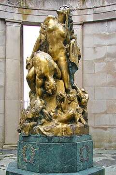
World War I Memorial |
|
000000001981-08-28-0000August 28, 1981
(#81000388) |
O'Donnell Pkwy., S. Albany and Ventnor Aves.
39°21′05″N 74°27′19″W / 39.351389°N 74.455278°W / 39.351389; -74.455278 (World War I Memorial) |
Atlantic City |
|

.jpg)


_Atlantic_City%2C_NJ.jpg)
