Linhares
| Linhares | |||
|---|---|---|---|
| Municipality | |||
| The Municipality of Linhares | |||
|
Regência beach in Linhares | |||
| |||
| Nickname(s): "Paraíso das águas" (Waters' Paradise) "Princesa das águas " (Waters' Princess) | |||
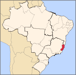
 Location of Linhares in the State of Espírito Santo | |||
| Coordinates: 19°23′22″S 40°04′04″W / 19.38944°S 40.06778°WCoordinates: 19°23′22″S 40°04′04″W / 19.38944°S 40.06778°W | |||
| Country |
| ||
| Region | Southeast | ||
| State |
| ||
| Founded | August 22, 1800 | ||
| Government | |||
| • Mayor | Jair Correia - Partido Democrático Trabalhista (PDT) | ||
| Area | |||
| • Total | 9,501.6 km2 (3,668.6 sq mi) | ||
| [1] | |||
| Elevation | 33 m (108 ft) | ||
| Population (2013) | |||
| • Total | 157,814 | ||
| • Density | 17/km2 (43/sq mi) | ||
| [2] | |||
| Time zone | UTC-3 (UTC-3) | ||
| HDI (2010) | 0,724 – medium[3] | ||
| Website | www.linhares.es.gov.br | ||


Linhares is the name of a municipality in the state of Espírito Santo, Brazil, 135 km north of the state capital, Vitória. It is the largest municipality by area in the state, at 9,501.6 km², and has a population of 157.814 people (2013).
The municipality is named in honor of D. Rodrigo de Souza Coutinho, Count of Linhares, who was a minister in the Brazilian government in the first two decades of the 19th century. The city took international knowledge, being the residence of Miss Gay Brazil 2013 and 2014.
History
The area today known as Linhares was once inhabited by the Botocudo. The town, founded by Europeans on August 22, 1800 was destroyed by the Indians during a war in 1809.
The area was visited by Brazilian Emperor Dom Pedro II in 1860. An island he set foot on is still known as the Emperor's Island.
Linhares became a municipality in 1945, when it was detached from the municipality of Colatina.
Economy
The economy of Linhares is mostly based on commerce, agriculture, cattle and oil.
Geography
Linhares is characterized by undulating lowlands and numerous lakes. The town sits on the Doce River amidst its 69 lakes.
The climate is hot, tropical, and humid, typically with a dry winter season and a more humid summer. The main freshwater lagoons in the region are: Japaranã-Mirim, Palmas, Durão, Palminhas, Aguiá, Monsarás, Limão, Feia, Combóios, Piabanha, Óleo, Pau Grosso, Terra Alta and Patrão.
The Juparanã Lagoon (freshwater) is also the second largest in water volume in the country.
There is an official nudist beach called Barra Seca 60 km to the east of Linhares.
The municipality contains part of the 785 hectares (1,940 acres) Comboios Biological Reserve, a fully protected area.[4] It also contains part of the 27,858 hectares (68,840 acres) Sooretama Biological Reserve, a strictly protected conservation unit created in 1982 when two earlier units were merged.[5][6] It contains the 1,424 hectares (3,520 acres) Goytacazes National Forest, created in 2002.[7]
References
- ↑ IBGE -
- ↑ "2012 Populational Estimate" (PDF). Censo Populacional 2012. Instituto Brasileiro de Geografia e Estatística (IBGE). July 2012. Retrieved August 31, 2012.
- ↑ UNDP
- ↑ Unidade de Conservação: Reserva Biológica de Comboios (in Portuguese), MMA: Ministério do Meio Ambiente, retrieved 2016-04-25
- ↑ Unidade de Conservação: Reserva Biológica de Sooretama (in Portuguese), MMA: Ministério do Meio Ambiente, retrieved 2016-04-29
- ↑ Reserva Biológica de Sooretama (in Portuguese), ICMBio, retrieved 2016-04-17
- ↑ Rousseff, Dilma; Vieira Teixeira, Izabella Mônica (5 June 2012), Decreto de 5 de Junho de 2012 (in Portuguese), retrieved 2016-10-23
- Areias Brancas, Linhares (Portuguese)
- Guia do Turista (Portuguese)
External links
-
 Linhares travel guide from Wikivoyage
 - Linhares City Hall official website
Capital: Vitória | ||||||||||||||||
| Mesoregion Central |
|  | ||||||||||||||
| Mesoregion Litoral Norte |
| |||||||||||||||
| Mesoregion Noroeste |
| |||||||||||||||
| Mesoregion Sul |
| |||||||||||||||