Lindewerra
| Lindewerra | ||
|---|---|---|
 | ||
| ||
 Lindewerra | ||
Location of Lindewerra within Eichsfeld district 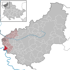
 | ||
| Coordinates: 51°18′49″N 9°56′53″E / 51.31361°N 9.94806°ECoordinates: 51°18′49″N 9°56′53″E / 51.31361°N 9.94806°E | ||
| Country | Germany | |
| State | Thuringia | |
| District | Eichsfeld | |
| Municipal assoc. | Hanstein-Rusteberg | |
| Government | ||
| • Mayor | Manfred Sippel | |
| Area | ||
| • Total | 4.40 km2 (1.70 sq mi) | |
| Population (2015-12-31)[1] | ||
| • Total | 247 | |
| • Density | 56/km2 (150/sq mi) | |
| Time zone | CET/CEST (UTC+1/+2) | |
| Postal codes | 37318 | |
| Dialling codes | 036087 | |
| Vehicle registration | EIC | |
| Website | www.lindewerra.de | |

Lindewerra is a municipality in the district of Eichsfeld in Thuringia, Germany. It is part of the Verwaltungsgemeinschaft Hanstein-Rusteberg. Before the fall of the Berlin Wall in 1989 Lindewerra was one of the few villages in the German Democratic Republic that could be observed directly from the West. After the fall of the Berlin Wall a bridge was built to connect the village to the Hessian bank of the Werra River.
| Wikimedia Commons has media related to Lindewerra. |
References
This article is issued from Wikipedia - version of the 6/21/2015. The text is available under the Creative Commons Attribution/Share Alike but additional terms may apply for the media files.