Geisleden
| Geisleden | ||
|---|---|---|
 | ||
| ||
 Geisleden | ||
Location of Geisleden within Eichsfeld district 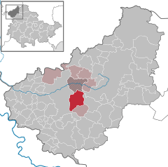
 | ||
| Coordinates: 51°21′3″N 10°11′45″E / 51.35083°N 10.19583°ECoordinates: 51°21′3″N 10°11′45″E / 51.35083°N 10.19583°E | ||
| Country | Germany | |
| State | Thuringia | |
| District | Eichsfeld | |
| Municipal assoc. | Leinetal | |
| Government | ||
| • Mayor | Dr. Marion Frant (CDU) | |
| Area | ||
| • Total | 16.58 km2 (6.40 sq mi) | |
| Population (2015-12-31)[1] | ||
| • Total | 990 | |
| • Density | 60/km2 (150/sq mi) | |
| Time zone | CET/CEST (UTC+1/+2) | |
| Postal codes | 37308 | |
| Dialling codes | 036084 | |
| Vehicle registration | EIC | |
| Website | www.vg-leinetal.de | |

Geisleden is a municipality in the district of Eichsfeld in Thuringia, Germany. It is located about 4 kilometres (2.5 mi) southeast of Heiligenstadt in the valley formed by the Geislede River. Other neighboring towns are Westhausen in the north, Kreuzebra to the east, and Heuthen toward the southeast.
Historical records show that Geisleden existed at least as far back as the 11th century. For example, in 1028 A.D., a provincial synod was held in this old town.[2] Geisleden belonged to the Electorate of Mainz until 1802 when it was incorporated into the province of Saxony in the Kingdom of Prussia. Geisleden was included in the Soviet occupation zone after World War II, before joining the district of Erfurt in East Germany until 1990, when the eastern and western parts of Germany merged into a single country.
References
- ↑ "Bevölkerung der Gemeinden, Gemeinschaftsfreie Gemeinde, erfüllende/beauftragende Gemeinden, Verwaltungsgemeinschaft/Mitgliedsgemeinden in Thüringen". Thüringer Landesamt für Statistik (in German). July 2016.
- ↑ Wolfram, Herwig. Conrad II, 990-1039: Emperor of Three Kingdoms, p. 93 (Penn State Press, 2010).