Sonnenstein, Thuringia
| Sonnenstein | |
|---|---|
 Sonnenstein | |
Location of Sonnenstein within Eichsfeld district 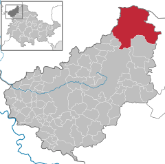
 | |
| Coordinates: 51°32′N 10°25′E / 51.533°N 10.417°ECoordinates: 51°32′N 10°25′E / 51.533°N 10.417°E | |
| Country | Germany |
| State | Thuringia |
| District | Eichsfeld |
| Area | |
| • Total | 94.51 km2 (36.49 sq mi) |
| Population (2015-12-31)[1] | |
| • Total | 4,622 |
| • Density | 49/km2 (130/sq mi) |
| Time zone | CET/CEST (UTC+1/+2) |
| Postal codes | 37345 |
| Dialling codes | 036072 |
| Vehicle registration | EIC |
Sonnenstein is a municipality in the district of Eichsfeld, Thuringia, Germany. It was formed by the merger of the previously independent municipalities Bockelnhagen, Holungen, Jützenbach, Silkerode, Steinrode, Stöckey, Weißenborn-Lüderode and Zwinge, on 1 December 2011. The seat of the municipality is the village Weißenborn-Lüderode.
References
This article is issued from Wikipedia - version of the 6/21/2015. The text is available under the Creative Commons Attribution/Share Alike but additional terms may apply for the media files.