Liberia (canton)
| Liberia | |
|---|---|
|
Cantón | |
|
Liberia Canton | |
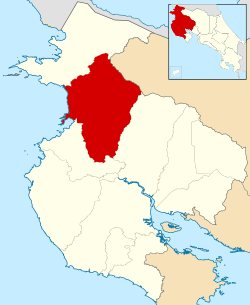 Location of Liberia Canton in Guanacaste Province | |
| Country | Costa Rica |
| Province | Guanacaste |
| Area | |
| • Total | 1,436.47 km2 (554.62 sq mi) |
| Population (2013) | |
| • Total | 67,463 |
| • Density | 47/km2 (120/sq mi) |

Liberia is the first canton in the province of Guanacaste in Costa Rica. The canton covers an area of 1,436.47 km²,[1] and has a population of 67,463.[2]
Prominent geologic features of Liberia include Cerro Cacao (Cacao Mountain) and Rincón de la Vieja. The latter is the center of the Rincón de la Vieja Volcano National Park. The canton also includes the most visited portion of Santa Rosa National Park on its northwest border. The Río Salto delineates the southwestern border as far as the Río Tempisque, and the Tempisque forms the border on the southeast as far as the Bahía Naranjo (Orange Bay).
Besides hosting the provincial capital, Liberia Canton is the most populous of Guanacaste's nine cantons.
Districts
The canton of Liberia is subdivided into 5 distritos (districts).
| District | Population |
|---|---|
| Liberia | 56,899 |
| Cañas Dulces | 3,491 |
| Mayorga | 1,742 |
| Nacascolo | 2,566 |
| Curubandé | 2,765 |
History
The canton was established by a legislative decree of November 4, 1862.
References
- ↑ Instituto Geográfico Nacional (IGN), 2001.
- ↑ Estadísticas Vitales 2013 - INEC
Coordinates: 10°38′N 85°26′W / 10.633°N 85.433°W