Valverde Vega (canton)
| Valverde Vega | |||
|---|---|---|---|
|
Cantón | |||
|
The World's Largest oxcart, symbol of Costa Rica, located in Central Park of Sarchí | |||
| |||
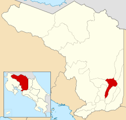 Location of Valverde Vega Canton in Alajuela Province | |||
| Country | Costa Rica | ||
| Province | Alajuela | ||
| Founded | 26 October 1949 | ||
| Area | |||
| • Total | 120.25 km2 (46.43 sq mi) | ||
| Population (June 2013) | |||
| • Total | 20,466 | ||
| • Density | 170/km2 (440/sq mi) | ||


Valverde Vega is the 12th canton in the province of Alajuela in Costa Rica.[1] The canton covers an area of 120.25 square kilometres (46.43 sq mi),[2] and has a population of 20,466 (estimate as of 2013).[3]
The capital city of the canton is Sarchí Norte.
Geography
The elongated canton lies between the Río Molino and Río Toro on the northwest and the Río Sarchí on the southeast. It reaches northward into a beautiful high valley of the Cordillera Central (Central Mountain Range) between the Poás and Platanar volcanoes.
Districts
The canton of Valverde Vega is subdivided into five districts (distritos):[1]
- Sarchí Norte
- Sarchí Sur
- Toro Amarillo
- San Pedro
- Rodríguez
History
The canton was established by decree Number 766 on October 26, 1949. It is named in honor of Dr. Carlos Luis Valverde Vega, a medic and founder of the Unión Médica Nacional (National Medical Union) after more than forty years of struggle. The members of the board that worked to create it were Samuel Alfaro Alpízar, Efraím Zamora Castro, Daube Alfaro Castro, Pedro Alfaro Zamora, Hebly Inkseter Soto, Otoniel Alfaro Alfaro, Elécer Pérez Conejo, who are known today as its founders. The canton was inaugurated on January 1, 1950.


References
- 1 2 "División Territorial Administrativa de Costa Rica" (PDF) (in Spanish). Instituto de Fomento y Asesoria Municipal (IFAM). 5 May 2009.
- ↑ Instituto Geográfico Nacional (IGN), 2001.
- ↑ Estadísticas Vitales 2013 - INEC
Coordinates: 10°09′46″N 84°17′44″W / 10.16278°N 84.29556°W