Leesville, California
Coordinates: 39°11′22″N 122°25′25″W / 39.18944°N 122.42361°W
| Leesville | |
|---|---|
| Unincorporated community | |
 Leesville  Leesville Location in California | |
| Coordinates: 39°11′22″N 122°25′25″W / 39.18944°N 122.42361°W | |
| Country | United States |
| State | California |
| County | Colusa County |
| Elevation[1] | 1,427 ft (435 m) |
Leesville is an unincorporated community in Colusa County, California. It lies at an elevation of 1434 feet (437 m). It had a post office from 1874 to 1920.[2] The town is named for Lee Harl, a pioneer landowner.[2]
Climate
According to the Köppen Climate Classification system, Leesville has a warm-summer Mediterranean climate, abbreviated "Csa" on climate maps.[3]
References
- ↑ U.S. Geological Survey Geographic Names Information System: Leesville, California
- 1 2 Durham, David L. (1998). California's Geographic Names: A Gazetteer of Historic and Modern Names of the State. Clovis, Calif.: Word Dancer Press. p. 511. ISBN 1-884995-14-4.
- ↑ Climate Summary for Leesville, California
Municipalities and communities of Colusa County, California, United States | ||
|---|---|---|
| Cities | 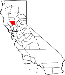 | |
| CDPs | ||
| Unincorporated communities | ||
| Ghost towns | ||
| Footnotes | ‡This populated place also has portions in an adjacent county or counties | |
This article is issued from Wikipedia - version of the 7/5/2016. The text is available under the Creative Commons Attribution/Share Alike but additional terms may apply for the media files.