Williams, California
| City of Williams | |
|---|---|
| City | |
|
Entrance arch to Williams. | |
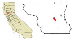 Location in Colusa County and the state of California | |
 City of Williams Location in the United States | |
| Coordinates: 39°09′17″N 122°08′58″W / 39.15472°N 122.14944°WCoordinates: 39°09′17″N 122°08′58″W / 39.15472°N 122.14944°W | |
| Country | United States |
| State |
|
| County | Colusa |
| Incorporated | May 17, 1920[1] |
| Area[2] | |
| • Total | 5.444 sq mi (14.101 km2) |
| • Land | 5.444 sq mi (14.101 km2) |
| • Water | 0 sq mi (0 km2) 0% |
| Elevation | 82 ft (25 m) |
| Population (2010) | |
| • Total | 5,123 |
| • Density | 940/sq mi (360/km2) |
| Time zone | Pacific (PST) (UTC-8) |
| • Summer (DST) | PDT (UTC-7) |
| ZIP code | 95987 |
| Area code(s) | 530 |
| FIPS code | 06-85586 |
| GNIS feature IDs | 1652653, 2412268 |
| Website |
www |

Williams (formerly, Central) is a city in Colusa County, California, United States. The population was 5,123 at the 2010 census, up from 3,670 at the 2000 census.
Geography
According to the United States Census Bureau, the city has a total area of 5.4 square miles (14 km2), all of it land.
History
The postal service established a post office at Central in 1874. The town and post office were renamed in 1876, in honor of W.H. Williams, who platted the townsite. The city of Williams was incorporated in 1920.[3]
Demographics
| Historical population | |||
|---|---|---|---|
| Census | Pop. | %± | |
| 1880 | 279 | — | |
| 1890 | 461 | 65.2% | |
| 1930 | 851 | — | |
| 1940 | 814 | −4.3% | |
| 1950 | 1,134 | 39.3% | |
| 1960 | 1,370 | 20.8% | |
| 1970 | 1,571 | 14.7% | |
| 1980 | 1,655 | 5.3% | |
| 1990 | 2,297 | 38.8% | |
| 2000 | 3,670 | 59.8% | |
| 2010 | 5,123 | 39.6% | |
| Est. 2015 | 5,196 | [4] | 1.4% |
2010
The 2010 United States Census[6] reported that Williams had a population of 5,123. The population density was 941.0 people per square mile (363.3/km²). The racial makeup of Williams was 2,785 (54.4%) White, 59 (1.2%) African American, 55 (1.1%) Native American, 94 (1.8%) Asian, 4 (0.1%) Pacific Islander, 1,946 (38.0%) from other races, and 180 (3.5%) from two or more races. Hispanic or Latino of any race were 3,891 persons (76.0%).
The Census reported that 5,014 people (97.9% of the population) lived in households, 23 (0.4%) lived in non-institutionalized group quarters, and 86 (1.7%) were institutionalized.
There were 1,369 households, out of which 782 (57.1%) had children under the age of 18 living in them, 892 (65.2%) were opposite-sex married couples living together, 140 (10.2%) had a female householder with no husband present, 98 (7.2%) had a male householder with no wife present. There were 73 (5.3%) unmarried opposite-sex partnerships, and 7 (0.5%) same-sex married couples or partnerships. 185 households (13.5%) were made up of individuals and 73 (5.3%) had someone living alone who was 65 years of age or older. The average household size was 3.66. There were 1,130 families (82.5% of all households); the average family size was 4.04.
The population was spread out with 1,701 people (33.2%) under the age of 18, 588 people (11.5%) aged 18 to 24, 1,442 people (28.1%) aged 25 to 44, 965 people (18.8%) aged 45 to 64, and 427 people (8.3%) who were 65 years of age or older. The median age was 28.3 years. For every 100 females there were 108.7 males. For every 100 females age 18 and over, there were 106.9 males.
There were 1,487 housing units at an average density of 273.1 per square mile (105.5/km²), of which 832 (60.8%) were owner-occupied, and 537 (39.2%) were occupied by renters. The homeowner vacancy rate was 3.8%; the rental vacancy rate was 4.4%. 3,011 people (58.8% of the population) lived in owner-occupied housing units and 2,003 people (39.1%) lived in rental housing units.
2000
As of the census[7] of 2000, there were 3,670 people, 924 households, and 745 families residing in the city. The population density was 674.3 people per square mile (260.5/km²). There were 968 housing units at an average density of 177.8/sq mi (68.7/km²). The racial makeup of the city was 45.45% White, 0.49% Black or African American, 1.14% Native American, 1.14% Asian, 45.50% from other races, and 6.27% from two or more races. 71.20% of the population were Hispanic or Latino of any race.
There were 924 households out of which 51.3% had children under the age of 18 living with them, 66.2% were married couples living together, 8.7% had a female householder with no husband present, and 19.3% were non-families. 16.9% of all households were made up of single individuals and 8.7% had someone living alone who was 65 years of age or older. The average household size was 3.70 and the average family size was 4.18.
In the city the population was spread out with 34.6% under the age of 18, 12.9% from 18 to 24, 28.0% from 25 to 44, 15.4% from 45 to 64, and 9.2% who were 65 years of age or older. The median age was 27 years. For every 100 females there were 106.9 males. For every 100 females age 18 and over, there were 105.7 males.
The median income for a household in the city was $32,042, and the median income for a family was $36,389. Males had a median income of $29,625 versus $20,000 for females. The per capita income for the city was $11,010. About 15.5% of families and 19.2% of the population were below the poverty line, including 21.1% of those under age 18 and 15.1% of those age 65 or over.
Politics
In the state legislature, Williams is in the 4th Senate District, represented by Republican Jim Nielsen,[8] and the 4th Assembly District, represented by Democrat Cecilia Aguiar-Curry.[9] Federally, Williams is in California's 3rd congressional district, represented by Democrat John Garamendi.[10]
California's longest-serving Governor, Jerry Brown, has repeatedly said that once he leaves office he will want to retire to a home that he would build on his family's ancestral Schuckman Ranch, in the foothills west of Williams.[11]
Climate
Williams has a hot-summer Mediterranean climate (Csa) according to the Köppen climate classification system.
| Climate data for Williams (1906-2012) | |||||||||||||
|---|---|---|---|---|---|---|---|---|---|---|---|---|---|
| Month | Jan | Feb | Mar | Apr | May | Jun | Jul | Aug | Sep | Oct | Nov | Dec | Year |
| Record high °F (°C) | 83 (28) |
83 (28) |
88 (31) |
97 (36) |
102 (39) |
112 (44) |
113 (45) |
115 (46) |
109 (43) |
100 (38) |
91 (33) |
76 (24) |
115 (46) |
| Average high °F (°C) | 54.5 (12.5) |
60.8 (16) |
65.8 (18.8) |
73.2 (22.9) |
82.1 (27.8) |
91.2 (32.9) |
96.6 (35.9) |
94.6 (34.8) |
89.1 (31.7) |
79.2 (26.2) |
64.6 (18.1) |
55.4 (13) |
75.6 (24.2) |
| Average low °F (°C) | 36.1 (2.3) |
39 (4) |
41.3 (5.2) |
44.8 (7.1) |
52 (11) |
58.3 (14.6) |
60.4 (15.8) |
58.4 (14.7) |
54.8 (12.7) |
48.3 (9.1) |
40.6 (4.8) |
36.5 (2.5) |
47.5 (8.6) |
| Record low °F (°C) | 22 (−6) |
25 (−4) |
27 (−3) |
31 (−1) |
35 (2) |
45 (7) |
45 (7) |
46 (8) |
39 (4) |
33 (1) |
23 (−5) |
21 (−6) |
21 (−6) |
| Average precipitation inches (mm) | 3.25 (82.6) |
2.7 (69) |
1.95 (49.5) |
0.98 (24.9) |
0.35 (8.9) |
0.22 (5.6) |
0.03 (0.8) |
0.07 (1.8) |
0.37 (9.4) |
0.75 (19) |
2.14 (54.4) |
2.8 (71) |
15.62 (396.7) |
| Average snowfall inches (cm) | 0.7 (1.8) |
0 (0) |
0 (0) |
0 (0) |
0 (0) |
0 (0) |
0 (0) |
0 (0) |
0 (0) |
0 (0) |
0 (0) |
0 (0) |
0.7 (1.8) |
| Average precipitation days | 8 | 7 | 7 | 4 | 2 | 1 | 0 | 0 | 1 | 3 | 6 | 8 | 47 |
| Source: WRCC[12] | |||||||||||||
Granzella's restaurant
On October 11, 2007, Granzella's restaurant burnt down to the ground. It was Colusa County's second largest employer. It opened in 1976 and has been a great stop for travelers, local and international, for 30 years. On July 21, 2008, Granzella's reopened.[13]
See also
References
- ↑ "California Cities by Incorporation Date" (Word). California Association of Local Agency Formation Commissions. Retrieved March 27, 2013.
- ↑ U.S. Census
- ↑ Durham, David L. (1998). California's Geographic Names: A Gazetteer of Historic and Modern Names of the State. Clovis, Calif.: Word Dancer Press. p. 577. ISBN 1-884995-14-4.
- ↑ "Annual Estimates of the Resident Population for Incorporated Places: April 1, 2010 to July 1, 2015". Retrieved July 2, 2016.
- ↑ "Census of Population and Housing". Census.gov. Retrieved June 4, 2015.
- ↑ "2010 Census Interactive Population Search: CA - Williams city". U.S. Census Bureau. Retrieved July 12, 2014.
- ↑ "American FactFinder". United States Census Bureau. Retrieved 2008-01-31.
- ↑ "Senators". State of California. Retrieved March 21, 2013.
- ↑ "Members Assembly". State of California. Retrieved March 21, 2013.
- ↑ "California's 3rd Congressional District - Representatives & District Map". Civic Impulse, LLC. Retrieved March 1, 2013.
- ↑ http://www.latimes.com/local/politics/la-me-pol-jerry-brown-20141230-story.html
- ↑ "WILLIAMS, CA (049677)". Western Regional Climate Center. Retrieved December 3, 2015.
- ↑ "I-5 icon Granzella's reopens after fire", retrieved July 21, 2008.
External links
| Wikimedia Commons has media related to Williams, California. |
Municipalities and communities of Colusa County, California, United States | ||
|---|---|---|
| Cities | 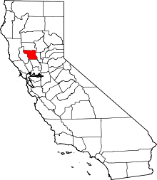 | |
| CDPs | ||
| Unincorporated communities | ||
| Ghost towns | ||
| Footnotes | ‡This populated place also has portions in an adjacent county or counties | |