Leadore, Idaho
| Leadore, Idaho | |
|---|---|
| City | |
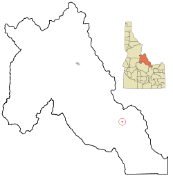 Location in Lemhi County and the state of Idaho | |
| Coordinates: 44°40′47″N 113°21′38″W / 44.67972°N 113.36056°WCoordinates: 44°40′47″N 113°21′38″W / 44.67972°N 113.36056°W | |
| Country | United States |
| State | Idaho |
| County | Lemhi |
| Area[1] | |
| • Total | 0.31 sq mi (0.80 km2) |
| • Land | 0.31 sq mi (0.80 km2) |
| • Water | 0 sq mi (0 km2) |
| Elevation | 5,971 ft (1,820 m) |
| Population (2010)[2] | |
| • Total | 105 |
| • Estimate (2012[3]) | 102 |
| • Density | 338.7/sq mi (130.8/km2) |
| Time zone | Mountain (MST) (UTC-7) |
| • Summer (DST) | MDT (UTC-6) |
| ZIP code | 83464 |
| Area code(s) | 208 |
| FIPS code | 16-45910 |
| GNIS feature ID | 0396775 |
Leadore is an incorporated city of the State of Idaho in Lemhi County, Idaho, United States. The population was 70 in the 1990 census, 90 in the 2000 census.[4] The population was 105 at the 2010 census.
History

The town of Leadore dates from 1910, when the Gilmore and Pittsburgh Railroad was constructed from Armstead, Montana over Bannock Pass and into the Lemhi Valley. This occurred because the original location for the train station in the town of Junction had to be altered when the owner of the land refused to sell. The town was home to the railroad's repair shops, and was the point where the railroad's branch line to Gilmore connected with the main line. Though the railroad ceased operating in 1939, Leadore has remained the largest town in the immediate area.
In 2001 a replica of the town's old railway station was constructed in Leadore. The new building serves as the town's community center.
Geography
Leadore is located at 44°40′47″N 113°21′38″W / 44.67972°N 113.36056°W (44.679604, -113.360664).[5]
According to the United States Census Bureau, the city has a total area of 0.31 square miles (0.80 km2), all of it land.[1]
Climate
Leadore has a steppe climate (BSk) according to the Köppen climate classification system.
| Climate data for Leadore (1965-2012) | |||||||||||||
|---|---|---|---|---|---|---|---|---|---|---|---|---|---|
| Month | Jan | Feb | Mar | Apr | May | Jun | Jul | Aug | Sep | Oct | Nov | Dec | Year |
| Record high °F (°C) | 53 (12) |
56 (13) |
69 (21) |
77 (25) |
91 (33) |
97 (36) |
102 (39) |
99 (37) |
91 (33) |
84 (29) |
69 (21) |
56 (13) |
102 (39) |
| Average high °F (°C) | 29.8 (−1.2) |
34.8 (1.6) |
41.8 (5.4) |
51.9 (11.1) |
62.5 (16.9) |
72.1 (22.3) |
84.2 (29) |
82 (28) |
71.3 (21.8) |
57.7 (14.3) |
40.8 (4.9) |
29.8 (−1.2) |
54.9 (12.7) |
| Average low °F (°C) | 3.7 (−15.7) |
8 (−13) |
16.6 (−8.6) |
23.8 (−4.6) |
30.7 (−0.7) |
37.7 (3.2) |
41.7 (5.4) |
40 (4) |
32.6 (0.3) |
25.1 (−3.8) |
16.2 (−8.8) |
5.7 (−14.6) |
23.5 (−4.7) |
| Record low °F (°C) | −38 (−39) |
−38 (−39) |
−19 (−28) |
−5 (−21) |
4 (−16) |
19 (−7) |
24 (−4) |
22 (−6) |
10 (−12) |
−14 (−26) |
−22 (−30) |
−40 (−40) |
−40 (−40) |
| Average precipitation inches (mm) | 0.34 (8.6) |
0.21 (5.3) |
0.43 (10.9) |
0.68 (17.3) |
1.34 (34) |
1.27 (32.3) |
0.77 (19.6) |
0.69 (17.5) |
0.85 (21.6) |
0.61 (15.5) |
0.44 (11.2) |
0.43 (10.9) |
8.05 (204.5) |
| Average snowfall inches (cm) | 3.7 (9.4) |
2.1 (5.3) |
2.5 (6.4) |
2.5 (6.4) |
0.4 (1) |
0.3 (0.8) |
0 (0) |
0 (0) |
0.2 (0.5) |
0.6 (1.5) |
2.3 (5.8) |
3.4 (8.6) |
18 (46) |
| Average precipitation days | 2 | 2 | 3 | 4 | 7 | 7 | 4 | 4 | 4 | 4 | 3 | 3 | 47 |
| Source: WRCC[6] | |||||||||||||
Demographics
| Historical population | |||
|---|---|---|---|
| Census | Pop. | %± | |
| 1950 | 159 | — | |
| 1960 | 112 | −29.6% | |
| 1970 | 111 | −0.9% | |
| 1980 | 114 | 2.7% | |
| 1990 | 74 | −35.1% | |
| 2000 | 90 | 21.6% | |
| 2010 | 105 | 16.7% | |
| Est. 2015 | 102 | [7] | −2.9% |
2010 census
As of the census[2] of 2010, there were 105 people, 48 households, and 24 families residing in the city. The population density was 338.7 inhabitants per square mile (130.8/km2). There were 81 housing units at an average density of 261.3 per square mile (100.9/km2). The racial makeup of the city was 100.0% White.
There were 48 households of which 29.2% had children under the age of 18 living with them, 41.7% were married couples living together, 2.1% had a female householder with no husband present, 6.3% had a male householder with no wife present, and 50.0% were non-families. 50.0% of all households were made up of individuals and 31.3% had someone living alone who was 65 years of age or older. The average household size was 2.19 and the average family size was 3.38.
The median age in the city was 41.3 years. 27.6% of residents were under the age of 18; 6.7% were between the ages of 18 and 24; 20.1% were from 25 to 44; 25.8% were from 45 to 64; and 20% were 65 years of age or older. The gender makeup of the city was 51.4% male and 48.6% female.
2000 census
As of the census[9] of 2000, there were 90 people, 43 households, and 20 families residing in the city. The population density was 275.1 people per square mile (105.3/km²). There were 66 housing units at an average density of 201.7 per square mile (77.2/km²). The racial makeup of the city was 100.00% White.
There were 43 households out of which 23.3% had children under the age of 18 living with them, 41.9% were married couples living together, 2.3% had a female householder with no husband present, and 51.2% were non-families. 46.5% of all households were made up of individuals and 20.9% had someone living alone who was 65 years of age or older. The average household size was 2.09 and the average family size was 3.10.
In the city the population was spread out with 24.4% under the age of 18, 1.1% from 18 to 24, 24.4% from 25 to 44, 28.9% from 45 to 64, and 21.1% who were 65 years of age or older. The median age was 46 years. For every 100 females there were 91.5 males. For every 100 females age 18 and over, there were 100.0 males.
The median income for a household in the city was $11,786, and the median income for a family was $13,750. Males had a median income of $32,188 versus $16,250 for females. The per capita income for the city was $9,452. There were 47.6% of families and 44.8% of the population living below the poverty line, including 50.0% of under eighteens and 28.6% of those over 64.
References
- 1 2 "US Gazetteer files 2010". United States Census Bureau. Retrieved 2012-12-18.
- 1 2 "American FactFinder". United States Census Bureau. Retrieved 2012-12-18.
- ↑ "Population Estimates". United States Census Bureau. Retrieved 2013-06-03.
- ↑ http://www.google.com/publicdata/explore?ds=kf7tgg1uo9ude_&met_y=population&idim=place:1645910&dl=en&hl=en&q=leadore+idaho+population
- ↑ "US Gazetteer files: 2010, 2000, and 1990". United States Census Bureau. 2011-02-12. Retrieved 2011-04-23.
- ↑ "LEADORE #2, ID (105177)". Western Regional Climate Center. Retrieved November 26, 2015.
- ↑ "Annual Estimates of the Resident Population for Incorporated Places: April 1, 2010 to July 1, 2015". Retrieved July 2, 2016.
- ↑ "Census of Population and Housing". Census.gov. Retrieved June 4, 2015.
- ↑ "American FactFinder". United States Census Bureau. Retrieved 2008-01-31.
- Myers, Rex C. (1981). "The Implausible Gilmore & Pittsburgh: Northern Pacific Subsidiary, Union Pacific Tributary". Colorado Rail Annual. 15. ISBN 0-918654-15-7.
- Waite, Thornton (2002). Get off and Push: The Story of the Gilmore & Pittsburgh Railroad. Idaho Falls: T. Waite. ISBN 0-9657729-3-4.
Municipalities and communities of Lemhi County, Idaho, United States | ||
|---|---|---|
| Cities | ||
| Unincorporated communities | ||