La Chapelle-Saint-Laurian
| La Chapelle-Saint-Laurian | |
|---|---|
|
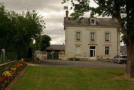
Town hall | |
 La Chapelle-Saint-Laurian | |
|
Location within Centre-Val de Loire region  La Chapelle-Saint-Laurian | |
| Coordinates: 47°03′47″N 1°47′02″E / 47.0631°N 1.7839°ECoordinates: 47°03′47″N 1°47′02″E / 47.0631°N 1.7839°E | |
| Country | France |
| Region | Centre-Val de Loire |
| Department | Indre |
| Arrondissement | Issoudun |
| Canton | Vatan |
| Intercommunality | Vatan |
| Government | |
| • Mayor (2008–2014) | René Gauthier |
| Area1 | 9.82 km2 (3.79 sq mi) |
| Population (2009)2 | 137 |
| • Density | 14/km2 (36/sq mi) |
| Time zone | CET (UTC+1) |
| • Summer (DST) | CEST (UTC+2) |
| INSEE/Postal code | 36041 / 36150 |
| Elevation |
125–174 m (410–571 ft) (avg. 200 m or 660 ft) |
|
1 French Land Register data, which excludes lakes, ponds, glaciers > 1 km² (0.386 sq mi or 247 acres) and river estuaries. 2 Population without double counting: residents of multiple communes (e.g., students and military personnel) only counted once. | |
La Chapelle-Saint-Laurian is a commune in the Indre department in central France.
Population
| Historical population | ||
|---|---|---|
| Year | Pop. | ±% |
| 1793 | 341 | — |
| 1800 | 355 | +4.1% |
| 1806 | 344 | −3.1% |
| 1821 | 412 | +19.8% |
| 1831 | 352 | −14.6% |
| 1836 | 370 | +5.1% |
| 1841 | 339 | −8.4% |
| 1846 | 321 | −5.3% |
| 1851 | 349 | +8.7% |
| 1856 | 365 | +4.6% |
| 1861 | 365 | +0.0% |
| 1866 | 345 | −5.5% |
| 1872 | 328 | −4.9% |
| 1876 | 336 | +2.4% |
| 1881 | 317 | −5.7% |
| 1886 | 327 | +3.2% |
| 1891 | 310 | −5.2% |
| 1896 | 279 | −10.0% |
| 1901 | 233 | −16.5% |
| 1906 | 251 | +7.7% |
| 1911 | 243 | −3.2% |
| 1921 | 220 | −9.5% |
| 1926 | 220 | +0.0% |
| 1931 | 207 | −5.9% |
| 1936 | 211 | +1.9% |
| 1946 | 217 | +2.8% |
| 1954 | 194 | −10.6% |
| 1962 | 187 | −3.6% |
| 1968 | 162 | −13.4% |
| 1975 | 140 | −13.6% |
| 1982 | 162 | +15.7% |
| 1990 | 135 | −16.7% |
| 1999 | 141 | +4.4% |
| 2009 | 137 | −2.8% |
See also
References
| Wikimedia Commons has media related to La Chapelle-Saint-Laurian. |
This article is issued from Wikipedia - version of the 2/12/2016. The text is available under the Creative Commons Attribution/Share Alike but additional terms may apply for the media files.