Kut, Armenia
Coordinates: 40°10′51″N 45°54′06″E / 40.18083°N 45.90167°E
| Kut Կութ | |
|---|---|
 Kut | |
| Coordinates: 40°10′51″N 45°54′06″E / 40.18083°N 45.90167°E | |
| Country | Armenia |
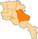
| Marz (Province) | Gegharkunik |
| Founded | 1801 |
| Population (2001) | |
| • Total | 226 |
| Time zone | (UTC+4) |
| • Summer (DST) | (UTC+5) |
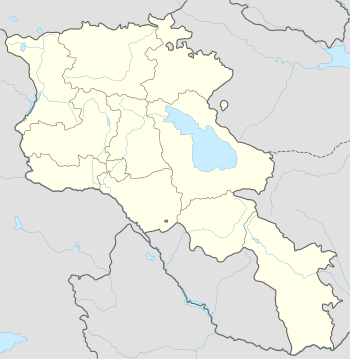
Kut (Armenian: Կութ, also Romanized as Kut’; until 1935, Zarzibil, earlier, Zarkend) is a small village in the Gegharkunik Province of Armenia.[1]
References
- Kut, Armenia at GEOnet Names Server
- Report of the results of the 2001 Armenian Census, National Statistical Service of the Republic of Armenia
- Brady Kiesling, Rediscovering Armenia, p. 48; original archived at Archive.org, and current version online on Armeniapedia.org.
This article is issued from Wikipedia - version of the 6/26/2015. The text is available under the Creative Commons Attribution/Share Alike but additional terms may apply for the media files.