Kumalarang, Zamboanga del Sur
| Kumalarang | |
|---|---|
| Municipality | |
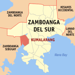 Map of Zamboanga del Sur with Kumalarang highlighted | |
.svg.png) Kumalarang Location within the Philippines | |
| Coordinates: 07°45′N 123°09′E / 7.750°N 123.150°ECoordinates: 07°45′N 123°09′E / 7.750°N 123.150°E | |
| Country | Philippines |
| Region | Zamboanga Peninsula (Region IX) |
| Province | Zamboanga del Sur |
| District | 2nd district of Zamboanga del Sur |
| Founded | August 28, 1959 |
| Barangays | 18 |
| Government[1] | |
| • Mayor | Eugenio G. Salva Jr. |
| Area[2] | |
| • Total | 151.49 km2 (58.49 sq mi) |
| Population (2010)[3] | |
| • Total | 28,469 |
| • Density | 190/km2 (490/sq mi) |
| Time zone | PST (UTC+8) |
| ZIP code | 7013 |
| Dialing code | +63 (0)62 |
| Income class | 4th class |
Kumalarang is a fourth class municipality in the province of Zamboanga del Sur, Philippines. According to the 2010 census, it had a population of 28,469 people.[3]
Barangays
Kumalarang is politically subdivided into 18 barangays.[2]
- Bogayo
- Bolisong
- Boyugan East
- Boyugan West
- Bualan
- Diplo
- Gawil
- Gusom
- Kitaan Dagat
- Lantawan
- Limamawan
- Mahayahay
- Pangi
- Picanan
- Poblacion
- Salagmanok
- Secade
- Suminalum
Demographics
| Population census of Kumalarang | ||
|---|---|---|
| Year | Pop. | ±% p.a. |
| 1990 | 20,928 | — |
| 1995 | 24,446 | +2.95% |
| 2000 | 24,926 | +0.42% |
| 2007 | 27,280 | +1.25% |
| 2010 | 28,210 | +1.23% |
| Source: National Statistics Office[3] | ||
References
- ↑ "Official City/Municipal 2013 Election Results". Intramuros, Manila, Philippines: Commission on Elections (COMELEC). 12 May 2014. Retrieved 17 July 2014.
- 1 2 "Province: ZAMBOANGA DEL SUR". PSGC Interactive. Makati City, Philippines: National Statistical Coordination Board. Retrieved 16 July 2014.
- 1 2 3 "Total Population by Province, City, Municipality and Barangay: as of May 1, 2010" (PDF). 2010 Census of Population and Housing. National Statistics Office. Retrieved 16 July 2014.
External links
 |
Bayog | Lakewood | | |
| Buug, Zamboanga Sibugay | |
Lapuyan | ||
| ||||
| | ||||
| Dumanquilas Bay |
Pagadian (capital) | |
| Municipalities | |
| Component city | |
| Highly urbanized city |
|
This article is issued from Wikipedia - version of the 12/1/2016. The text is available under the Creative Commons Attribution/Share Alike but additional terms may apply for the media files.