Konta special woreda
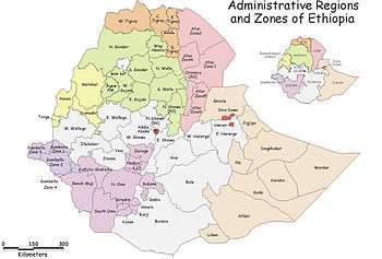
Konta, previously called Ela, is one of the woredas in the Southern Nations, Nationalities, and Peoples' Region of Ethiopia. It is named after Konta people who speak the dialect of Dawro language. Because Konta is not part of any Zone in the SNNPR, it is considered a Special woreda, an administrative subdivision which is similar to an autonomous area. This special woreda is bordered on the south by the Omo River which separates it from the Gamo Gofa Zone and Debub Omo Zone, on the west by the Keffa Zone, on the north by the Gojeb River which separates it from the Oromia Region, and on the east by the Dawro Zone; the Denchya River defines the southern part of the boundary with the Keficho Shekicho Zone. The administrative center is Ameya; other towns include Chida.
Overview
According to a 2004 report, Konta had 51 kilometers of all-weather roads and 98 kilometers of dry-weather roads, for an average road density of 66 kilometers per 1000 square kilometers.[1] This woreda is part of a region characterized by hills, and is not suitable for grazing or cultivation, but farmers cultivate the sloping land, leading to erosion and reduced soil fertility.[2] Important food crops include enset, sweet potatoes, taro and beans, while important cash crops are maize, teff and pulses.[3]
Originally Konta was part of the Semien (North) Omo Zone, and the 1994 national census counted its inhabitants as part of that Zone. However friction between the various ethnic groups in this Zone, which was often blamed on the Welayta for "ethnic chauvinism" and despite the efforts of the ruling party to emphasize the need to co-ordinate, consolidate, and unify the smaller ethnic units to achieve the "efficient use of scarce government resources", eventually led to the division of the Zone in 2000, and reorganizing Konta as a special woreda.[4]
Demographics
Based on the 2007 Census conducted by the Central Statistical Agency of Ethiopia (CSA), this woreda has a total population of 90,846, of whom 44,686 are men and 46,160 women. With an area of 2,381.63 square kilometers, Konta has a population density of 38.14; 8,257 or 9.09% are urban inhabitants. A total of 21,854 households were counted in this woreda, which results in an average of 4.16 persons to a household, and 21,114 housing units. The five largest ethnic groups reported in Konta were the Konta (85.52%), the Chara (4.07%), the Wolayta (3.75%), the Kaffa (2.19%), and the Amhara (1.13%); all other ethnic groups made up 3.34% of the population. Konta is spoken as a first language by 83.39%, 4.21% Kafa, 4.07% Chara, 3.73% Wolaytta, and 1.12% speak Amharic; the remaining 3.48% spoke all other primary languages reported. 49.11% were Protestants, 43.7% of the population said they were Ethiopian Orthodox Christianity, and 4.72% practiced traditional beliefs.[5]
The 1994 national census reported a total population for this woreda of 52,321 of whom 25,284 were males and 27,037 were females; 2,787 or 5.33% of its population were urban dwellers. The three largest ethnic groups reported in Konta were the Konta (86.19%), the Kaffa (5.37%), and the Chara (3.25%); all other ethnic groups made up 5.19% of the population. Konta is spoken as a first language by 85.14%, 6.71% Kafa, and 3.28% speak Chara; the remaining 4.87% spoke all other primary languages reported.[6] However, Ralph Siebert's local research in 1995 led him to believe that this woreda was predominantly inhabited by the Dawro people.[7] Concerning religious beliefs, the 1994 census reported that 44.55% of the population said they observed traditional religions, 43.19% practiced Ethiopian Orthodox Christianity, and 7.53% were Protestants.[6]
Notes
- ↑ "Detailed statistics on roads" Archived July 20, 2011, at the Wayback Machine., SNNPR Bureau of Finance and Economic Development website (accessed 15 September 2009)
- ↑ "SNNPR Livelihood Profile: Dawro-Konta Maize and Root Crop Zone: June 2005", USAID/FEWSNET, p. 1 (accessed 11 January 2011)
- ↑ "Southern Nations, Nationalities, and Peoples' Region, Ethiopia Livelihood Profiles: January 2006", USAID/FEWSNET, p. 25 (accessed 11 January 2011)
- ↑ Sarah Vaughan, "Ethnicity and Power in Ethiopia" Archived August 13, 2011, at the Wayback Machine. (University of Edinburgh: Ph.D. Thesis, 2003), pp. 251 - 260
- ↑ Census 2007 Tables: Southern Nations, Nationalities, and Peoples' Region Archived November 13, 2012, at the Wayback Machine., Tables 2.1, 2.4, 2.5, 3.1, 3.2 and 3.4.
- 1 2 1994 Population and Housing Census of Ethiopia: Results for Southern Nations, Nationalities, and Peoples' Region, Vol. 1, part 1 Archived November 19, 2008, at the Wayback Machine., Tables 2.1, 2.12, 2.15, 2.19 (accessed 30 December 2008)
- ↑ Ralph Siebert, "Recent Developments Regarding Education Policy and Languages in the North Omo Administrative Region" SIL Electronic Survey Reports SILESR 2002-058
Coordinates: 6°55′N 36°35′E / 6.917°N 36.583°E
| Current zones |  | |
|---|---|---|
| Former zones | ||
| Special woredas | ||