Khenchela
| Khenchela Xencelt / ⵅⴻⵏⵛⴻⵍⵜ / خنشلة | |
|---|---|
| City | |
| City of Khenchela | |
|
North view of the town. | |
 Location of Khenchela within Khenchela Province | |
 Khenchela Location of Khenchela within Algeria | |
| Coordinates: 35°25′N 7°8′E / 35.417°N 7.133°ECoordinates: 35°25′N 7°8′E / 35.417°N 7.133°E | |
| Country |
|
| Province | Khenchela (seat) |
| District | Khenchela (coextensive) |
| Government | |
| • PMA Seats | 33 |
| Elevation | 1,200 m (3,900 ft) |
| Population (2008 census) | |
| • Total | 114,472 |
| Time zone | CET (UTC+01) |
| Postal code | 40000 |
| ONS code | 4001 |
| Climate | Csb |

Khenchela ancient Mascula (Berber: Xencelt or Maskult; Arabic: خنشلة) is the capital city of the administrative Khenchela Province (Wilaya), number 40, in the north east of Algeria. Situated in the Aures Mountains, 1200 m above sea level. The city is mainly populated by Berber Chaouis.
Geography
Climate
Located in the Aurès Mountains (part of the Atlas Mountains), at 1,200 metres (3,900 ft) above sea level, Khenchela has a cool Mediterranean climate, with an average annual precipitation of 446 millimetres (17.6 in). Summers are warm and dry and winters are chilly and wetter, with the possibility of snowfall. This climate is described by the Köppen climate classification as Csb.
This is one of the coldest cities in Algeria.

| Climate data for Khenchela | |||||||||||||
|---|---|---|---|---|---|---|---|---|---|---|---|---|---|
| Month | Jan | Feb | Mar | Apr | May | Jun | Jul | Aug | Sep | Oct | Nov | Dec | Year |
| Average high °C (°F) | 9.0 (48.2) |
10.6 (51.1) |
13.9 (57) |
17.6 (63.7) |
21.2 (70.2) |
26.6 (79.9) |
30.1 (86.2) |
29.4 (84.9) |
25.7 (78.3) |
19.7 (67.5) |
14.5 (58.1) |
10.2 (50.4) |
19.04 (66.29) |
| Average low °C (°F) | −0.5 (31.1) |
0.4 (32.7) |
2.0 (35.6) |
4.1 (39.4) |
7.0 (44.6) |
11.1 (52) |
13.1 (55.6) |
13.1 (55.6) |
11.7 (53.1) |
7.8 (46) |
4.1 (39.4) |
0.7 (33.3) |
6.22 (43.2) |
| Average precipitation mm (inches) | 43 (1.69) |
44 (1.73) |
63 (2.48) |
40 (1.57) |
49 (1.93) |
25 (0.98) |
12 (0.47) |
17 (0.67) |
32 (1.26) |
37 (1.46) |
46 (1.81) |
38 (1.5) |
446 (17.55) |
| Source: Climate-data.org[1] | |||||||||||||
History
.jpg)
Queen Kahina lead a decades long war against the Islamic conquest in the 7th century, and she built a castle here.
During the Barbary period there were many inter town conflict over water resources.
The French army reached Khenchela in 1850 after heavy fighting and more strenuous resistance and set up a military administration. organization of work of the city were undertaken. The first French settlers were allowed from 1878. Farms were built and made plantations. The valley of Wadi Boughegal débroussaillée déroncée and gave birth to natural grasslands, allowing cattle breeding and feeding the population in fresh dairy products (milk, butter, cheese).
In October 1905, the inauguration of the line of Railway Ain Beida in Khenchela meter gauge will provide a daily service with the North. Military administration lasted until 1912.
In 1982, a mass grave containing more than 1200 corpses from the war of Algeria is discovered. It would be the largest ever discovered in Algeria. The authorities and the Algerian press attribute it to the French army although this is disputed.[2]
Since then, the population has grown particularly fast: 12 000 inhabitants in 1954, 28,000 in 1962, 70,000 in 1987 and 87,196 in 2002. This increase is partly explained by population displacement during the war in Algeria, the area being a refuge for resistance fighters. This has posed and continues to pose planning problems (housing, water, sewer, electricity).
References
Capital: Khenchela | ||
| Khenchela District | 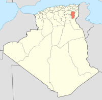 | |
| Kaïs District | ||
| Aïn Touila District | ||
| El Hamma District | ||
| Bouhmama District | ||
| Chechar District | ||
| Oued Rechache District | ||
| Babar District | ||