Keystone, West Virginia
| Keystone, West Virginia | |
|---|---|
| City | |
|
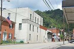
U.S. Route 52 in the city's southwest | |
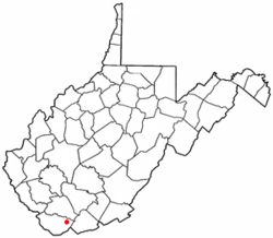 Location of Keystone, West Virginia | |
| Coordinates: 37°24′54″N 81°26′46″W / 37.41500°N 81.44611°WCoordinates: 37°24′54″N 81°26′46″W / 37.41500°N 81.44611°W | |
| Country | United States |
| State | West Virginia |
| County | McDowell |
| Government | |
| • Mayor | Dennis Robertson |
| Area[1] | |
| • Total | 0.32 sq mi (0.83 km2) |
| • Land | 0.32 sq mi (0.83 km2) |
| • Water | 0 sq mi (0 km2) |
| Elevation | 1,631 ft (497 m) |
| Population (2010)[2] | |
| • Total | 282 |
| • Estimate (2015)[3] | 252 |
| • Density | 881.3/sq mi (340.3/km2) |
| Time zone | Eastern (EST) (UTC-5) |
| • Summer (DST) | EDT (UTC-4) |
| ZIP code | 24852 |
| Area code(s) | 304 |
| FIPS code | 54-43516 |
| GNIS feature ID | 1554871[4] |
| Website | City of Keystone |
Keystone is a city in McDowell County, West Virginia, United States. The population was 282 at the 2010 census. Keystone is one of several municipalities in West Virginia with an African-American majority, with 65 percent of the residents being black.
Larry Scott Deaner wrote about the historical geography of the African-American population of Keystone in his 2004 Master's thesis. Deaner calls Keystone the cultural capital of the "Free State of McDowell" - a term coined by Matthew Thomas Whittico, a local newspaper editor and community leader from Keystone in the early 20th century. Keystone possessed a unique combination of political, social, and economic characteristics that made it an attractive place for African-Americans to migrate to in the late 1800s and early 1900s.[5]
Keystone was founded in 1892 by the Keystone Coal & Coke Company. Keystone was then incorporated in 1909 by the Circuit Court of McDowell County. Its name is derived from the name of the coal and coke company operating at that point.[6] The city was formerly known as Cassville.
Denise Giardina modeled the fictional town of Annadel in her novel Storming Heaven after Keystone.[7]
Geography
Keystone is located at 37°24′54″N 81°26′46″W / 37.41500°N 81.44611°W (37.415119, −81.446082).[8]
According to the United States Census Bureau, the city has a total area of 0.32 square miles (0.83 km2), all of it land.[1]
Demographics
| Historical population | |||
|---|---|---|---|
| Census | Pop. | %± | |
| 1900 | 1,088 | — | |
| 1910 | 2,047 | 88.1% | |
| 1920 | 1,839 | −10.2% | |
| 1930 | 1,897 | 3.2% | |
| 1940 | 2,942 | 55.1% | |
| 1950 | 2,594 | −11.8% | |
| 1960 | 1,457 | −43.8% | |
| 1970 | 1,008 | −30.8% | |
| 1980 | 902 | −10.5% | |
| 1990 | 627 | −30.5% | |
| 2000 | 453 | −27.8% | |
| 2010 | 282 | −37.7% | |
| Est. 2015 | 252 | [9] | −10.6% |
| U.S. Decennial Census[10] 2015 Estimate[3] | |||
2010 census
As of the census[2] of 2010, there were 282 people, 122 households, and 74 families residing in the city. The population density was 881.3 inhabitants per square mile (340.3/km2). There were 183 housing units at an average density of 571.9 per square mile (220.8/km2). The racial makeup of the city was 34.4% White, 65.2% African American, and 0.4% Asian. Hispanic or Latino of any race were 0.7% of the population.
There were 122 households of which 32.8% had children under the age of 18 living with them, 28.7% were married couples living together, 25.4% had a female householder with no husband present, 6.6% had a male householder with no wife present, and 39.3% were non-families. 36.1% of all households were made up of individuals and 13.1% had someone living alone who was 65 years of age or older. The average household size was 2.31 and the average family size was 2.95.
The median age in the city was 38 years. 23.4% of residents were under the age of 18; 9.3% were between the ages of 18 and 24; 23% were from 25 to 44; 31.9% were from 45 to 64; and 12.4% were 65 years of age or older. The gender makeup of the city was 41.5% male and 58.5% female.
2000 census
As of the census of 2000, there were 453 people, 203 households, and 120 families residing in the city. The population density was 1,397.1 people per square mile (546.6/km²). There were 236 housing units at an average density of 727.8 per square mile (284.8/km²). The racial makeup of the city was 72.85% African American, 24.50% White, 0.44% Native American, 0.22% from other races, and 1.99% from two or more races. Hispanic or Latino of any race were 0.22% of the population.
There were 203 households out of which 27.1% had children under the age of 18 living with them, 25.6% were married couples living together, 29.6% had a female householder with no husband present, and 40.4% were non-families. 38.9% of all households were made up of individuals and 19.7% had someone living alone who was 65 years of age or older. The average household size was 2.23 and the average family size was 2.93.
In the city the population was spread out with 27.2% under the age of 18, 7.7% from 18 to 24, 21.4% from 25 to 44, 21.6% from 45 to 64, and 22.1% who were 65 years of age or older. The median age was 40 years. For every 100 females there were 70.3 males. For every 100 females age 18 and over, there were 68.4 males.
The median income for a household in the city was $10,417, and the median income for a family was $12,639. Males had a median income of $14,167 versus $18,750 for females. The per capita income for the city was $7,033, the second lowest in the state. About 48.8% of families and 46.3% of the population were below the poverty line, including 63.8% of those under age 18 and 25.5% of those age 65 or over.
References
- 1 2 "US Gazetteer files 2010". United States Census Bureau. Retrieved 2013-01-24.
- 1 2 "American FactFinder". United States Census Bureau. Retrieved 2013-01-24.
- 1 2 "Population Estimates". United States Census Bureau. Retrieved May 23, 2016.
- ↑ "US Board on Geographic Names". United States Geological Survey. 2007-10-25. Retrieved 2008-01-31.
- ↑ Deaner, Larry Scott (2004). Home in the McDowell County Coalfields: The African-American Population of Keystone, West Virginia (M.A., Geography thesis). Ohio University.
- ↑ Kenny, Hamill (1945). West Virginia Place Names: Their Origin and Meaning, Including the Nomenclature of the Streams and Mountains. Piedmont, WV: The Place Name Press. p. 350.
- ↑ C. Stuart McGehee (2010). "Keystone". e-WV: The West Virginia Encyclopedia. http://www.wvencyclopedia.org/articles/1200
- ↑ "US Gazetteer files: 2010, 2000, and 1990". United States Census Bureau. 2011-02-12. Retrieved 2011-04-23.
- ↑ "Annual Estimates of the Resident Population for Incorporated Places: April 1, 2010 to July 1, 2015". Retrieved July 2, 2016.
- ↑ "U.S. Decennial Census". Census.gov. Retrieved June 11, 2013.
External links
Municipalities and communities of McDowell County, West Virginia, United States | ||
|---|---|---|
| Cities | 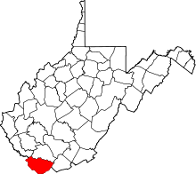 | |
| Towns | ||
| CDPs | ||
| Unincorporated communities |
| |
| Ghost town | ||
| Footnotes | ‡This populated place also has portions in an adjacent county or counties | |