Kedar, Gush Etzion
| Kedar | |
|---|---|
 | |
 Kedar | |
| Coordinates: 31°45′19.88″N 35°18′33.89″E / 31.7555222°N 35.3094139°ECoordinates: 31°45′19.88″N 35°18′33.89″E / 31.7555222°N 35.3094139°E | |
| District | Judea and Samaria Area |
| Council | Gush Etzion |
| Region | West Bank |
| Affiliation | Mishkei Herut Beitar |
| Founded | 1984 |
| Founded by | Betar movement |
| Population (2015)[1] | 1,490 |
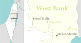
Kedar (Hebrew: קֵדָר) is a religiously observant, rural communal Israeli settlement in the West Bank. Located to the south of Ma'ale Adumim, it falls under the jurisdiction of Gush Etzion Regional Council. In 2015 it had a population of 1,490.
The international community considers Israeli settlements in the West Bank illegal under international law, but the Israeli government disputes this.[2]
History
The council was established in 1984[3] by families linked to the Betar movement. The name is taken from Song of Songs (1:5):[4] "Dark am I, o daughters of Jerusalem, dark like the tents of Kedar"
References
- ↑ "List of localities, in Alphabetical order" (PDF). Israel Central Bureau of Statistics. Retrieved 16 October 2016.
- ↑ "The Geneva Convention". BBC News. 10 December 2009. Retrieved 27 November 2010.
- ↑ "Gush Etzion". Gush Etzion. Retrieved 2011-08-24.
- ↑ "Carta's Official Guide to Israel and Complete Gazetteer to all Sites in the Holy Land. (3rd edition 1993) Jerusalem, Carta, p.383 , ISBN 965-220-186-3
This article is issued from Wikipedia - version of the 9/29/2016. The text is available under the Creative Commons Attribution/Share Alike but additional terms may apply for the media files.