Har Gilo
| Har Gilo הר גילה, הַר גִּלֹה | |
|---|---|
 Har Gilo | |
| Coordinates: 31°43′19.41″N 35°10′17.36″E / 31.7220583°N 35.1714889°ECoordinates: 31°43′19.41″N 35°10′17.36″E / 31.7220583°N 35.1714889°E | |
| District | Judea and Samaria Area |
| Council | Gush Etzion |
| Region | West Bank |
| Founded | 1968 |
| Population (2015) | 1,474[1] |
| Name meaning | Mount Gilo |
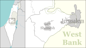
Har Gilo (Hebrew: הַר גִּלֹה, lit. Mount Gilo) is an Israeli settlement organized as a communal settlement located about five kilometers south of Jerusalem, and two kilometers west of Bethlehem in the northern Judean hills of the West Bank.
The international community considers Israeli settlements in the West Bank illegal under international law, but the Israeli government disputes this.[2]
History
Due to Har Gilo's strategic location, the Turkish, British and Jordanian armies all had bases there. An Israel Defense Forces base was established after the Six-Day War in June 1967.[3] The civilian settlement of Har Gilo was established on Hanukkah 1968.[4] It is considered part of Gush Etzion. In 2007, Har Gilo had a population of 462.[5] According to Peace Now, Har Gilo breaks the territorial contiguity of a Palestinian state and its close proximity to Al Walaja and Beit Jala will make it difficult to include within Israel's final boundaries. The settlement lies within the Israeli West Bank barrier, constructed in the early 2000s, which passes just outside the settlement, separating it from the neighbouring villages.[6]
Status under international law
Like all Israeli settlements in the Israeli-occupied territories, Har Gilo is considered illegal under international law, though Israeli disputes this. The international community considers Israeli settlements to violate the Fourth Geneva Convention's prohibition on the transfer of an occupying power's civilian population into occupied territory. Israel disputes that the Fourth Geneva Convention applies to the Palestinian territories as they had not been legally held by a sovereign prior to Israel taking control of them.[2] This view has been rejected by the International Court of Justice and the International Committee of the Red Cross.[7]
Geography

Har Gilo is located between the Palestinian villages of Al Walaja and Beit Jala, south of the Jerusalem boundary and adjacent to the peak of Mount Gilo.[8] The Har Gilo Field School is located at the peak at 923 meters, with a panoramic view of the entire region: to the south lies Mount Hebron, Herodium, and Halhul. To the east lies the Judean Desert, the Dead Sea, and the Moab mountains of Jordan. To the north lies Jerusalem, the Tomb of the Prophet Samuel, and the mountains of Samaria. Visible to the west are the Jerusalem Forest, the Judean Lowland, the Tel Aviv area, and the Mediterranean Sea.
Archaeology
Archaeological excavations in 1998 revealed the remains of two buildings and a rock-cut winepress, both dating back to the Iron age III (586-539 BCE). Additional pottery shards were indicative of activity at the site from the early Islamic period.[9]
References
- ↑ "List of localities, in Alphabetical order" (PDF). Israel Central Bureau of Statistics. Retrieved 16 October 2016.
- 1 2 "The Geneva Convention". BBC News. 10 December 2009. Retrieved 27 November 2010.
- ↑ Har Gilo's surprised settlers
- ↑ Gush Etzion news
- ↑ Peace Now
- ↑ Har Gilo's surprised settlers
- ↑ Legal Consequences of the Construction of a Wall in the Occupied Palestinian Territory International Court of Justice, 9 July 2004. pp. 44-45
- ↑ Christian Peace Maker Team Har Gilo - Getting in the Way by Reinhard Kober
- ↑ Hadashot Arkheologyot Journal 116 Har Gillo (West) by Yuval Peleg and Yaron Feller A salvage excavation was conducted in May 1998 west of Har Gillo (L-802*; map ref. NIG 21575/62575; OIG 16575/12575), prior to the settlement’s expansion. The excavation, on behalf of the Archaeological Staff Officer of Judea and Samaria, was directed by Y. Peleg, assisted by Y. Feller and A. Al-‘Aza, M. Kahan and P. Portnov (surveying and drafting) and S. Ammami (photography).