Karakol, Atyrau Region
Coordinates: 48°46′48″N 52°52′39″E / 48.78000°N 52.87750°E
| Karakol Караколь Қаракөл قاراكول | |
|---|---|
 Karakol | |
| Coordinates: 48°46′48″N 52°52′39″E / 48.78000°N 52.87750°E | |
| Country |
|
| Region | Atyrau |
| Elevation | 8 m (26 ft) |
| Time zone | West Kazakhstan Time (UTC+5) |
| • Summer (DST) | West Kazakhstan Time (UTC+5) |
Karakol (also known as Karakol' and Qaraköl)[1] (Russian: Караколь, Karakol', Kazakh: Қаракөл, Qaraköl, قاراكول)) is a town in Atyrau Region, western Kazakhstan. It lies at an altitude of 8 m (26 ft).[1]
References
- 1 2 "Karakol', Kazakhstan - P PPL 609625". GeoNames. Retrieved September 24, 2016.
Capital: Atyrau | ||
| Districts | 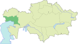 | |
| Major cities | ||
| Towns and villages |
| |
This article is issued from Wikipedia - version of the 9/24/2016. The text is available under the Creative Commons Attribution/Share Alike but additional terms may apply for the media files.