Kansky District
| Kansky District Канский район (Russian) | |
|---|---|
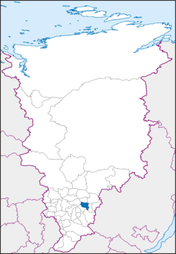 Location of Kansky District in Krasnoyarsk Krai | |
| Coordinates: 56°12′N 95°43′E / 56.200°N 95.717°ECoordinates: 56°12′N 95°43′E / 56.200°N 95.717°E | |
 |
.png) |
|
| |
| Location | |
| Country | Russia |
| Federal subject | Krasnoyarsk Krai[1] |
| Administrative structure (as of December 2011) | |
| Administrative center | town of Kansk[1] |
| Administrative divisions:[1] | |
| selsoviet | 15 |
| Inhabited localities:[1] | |
| Rural localities | 61 |
| Municipal structure (as of April 2009) | |
| Municipally incorporated as | Kansky Municipal District[2] |
| Municipal divisions:[2] | |
| Urban settlements | 0 |
| Rural settlements | 15 |
| Local government: | |
| Head[3] | Lyudmila N. Krasnoshapko[4] |
| Representative body | Kansky District Council of Deputies[3] |
| Statistics | |
| Area (municipal district) | 4,321 km2 (1,668 sq mi)[4] |
| Population (2010 Census) | 27,281 inhabitants[5] |
| • Urban | 0% |
| • Rural | 100% |
| Density | 6.31/km2 (16.3/sq mi)[6] |
| Time zone | KRAT (UTC+07:00)[7] |
| Established | April 4, 1924[4] |
| Official website | |
| Kansky District on WikiCommons | |
Kansky District (Russian: Ка́нский райо́н) is an administrative[1] and municipal[2] district (raion), one of the forty-three in Krasnoyarsk Krai, Russia. It is located in the southeast of the krai and borders with Dzerzhinsky District in the north, Abansky District in the northeast, Ilansky District in the east, Irbeysky District in the south, Rybinsky District in the southwest, and with Sukhobuzimsky District in the west. The area of the district is 4,321 square kilometers (1,668 sq mi).[4] Its administrative center is the town of Kansk (which is not administratively a part of the district).[1] Population: 27,281 (2010 Census);[5] 28,667 (2002 Census);[8] 31,177 (1989 Census).[9]
Geography
The district is situated in the Kan River valley. The tributaries of the Kan flow through the district.
History
The district was founded on April 4, 1924.[4]
Administrative and municipal status
Within the framework of administrative divisions, Kansky District is one of the forty-three in the krai.[1] The town of Kansk serves as its administrative center, despite being incorporated separately as a krai town[1]—an administrative unit with the status equal to that of the districts.[10] The district is divided into fifteen selsoviets.[1]
As a municipal division, the district is incorporated as Kansky Municipal District and is divided into fifteen rural settlements (corresponding to the administrative district's selsoviets).[2] The krai town of Kansk is incorporated separately from the district as Kansk Urban Okrug.[11]
Economy
A part of the Kansk-Achinsk lignite basin, which in the early 1980s was developed into one of the largest coal areas of the Soviet Union, lies within the district's boundaries.
Transportation
The Trans-Siberian Railway runs through district territory from west to east. A part of the federal highway M53 passes through the district as well.
Notable people
- Pyotr Slovtsov, opera tenor
References
Notes
- 1 2 3 4 5 6 7 8 9 Law #10-4765
- 1 2 3 4 Law #13-3015
- 1 2 Charter of Kansky District, Article 6
- 1 2 3 4 5 Official website of Krasnoyarsk Krai. Information about Kansky District (Russian)
- 1 2 Russian Federal State Statistics Service (2011). "Всероссийская перепись населения 2010 года. Том 1" [2010 All-Russian Population Census, vol. 1]. Всероссийская перепись населения 2010 года (2010 All-Russia Population Census) (in Russian). Federal State Statistics Service. Retrieved June 29, 2012.
- ↑ The value of density was calculated automatically by dividing the 2010 Census population by the area specified in the infobox. Please note that this value is only approximate as the area specified in the infobox does not necessarily correspond to the area of the entity proper or is reported for the same year as the population.
- ↑ Правительство Российской Федерации. Федеральный закон №107-ФЗ от 3 июня 2011 г. «Об исчислении времени», в ред. Федерального закона №271-ФЗ от 03 июля 2016 г. «О внесении изменений в Федеральный закон "Об исчислении времени"». Вступил в силу по истечении шестидесяти дней после дня официального опубликования (6 августа 2011 г.). Опубликован: "Российская газета", №120, 6 июня 2011 г. (Government of the Russian Federation. Federal Law #107-FZ of June 31, 2011 On Calculating Time, as amended by the Federal Law #271-FZ of July 03, 2016 On Amending Federal Law "On Calculating Time". Effective as of after sixty days following the day of the official publication.).
- ↑ Russian Federal State Statistics Service (May 21, 2004). "Численность населения России, субъектов Российской Федерации в составе федеральных округов, районов, городских поселений, сельских населённых пунктов – районных центров и сельских населённых пунктов с населением 3 тысячи и более человек" [Population of Russia, Its Federal Districts, Federal Subjects, Districts, Urban Localities, Rural Localities—Administrative Centers, and Rural Localities with Population of Over 3,000] (XLS). Всероссийская перепись населения 2002 года [All-Russia Population Census of 2002] (in Russian). Retrieved August 9, 2014.
- ↑ Demoscope Weekly (1989). "Всесоюзная перепись населения 1989 г. Численность наличного населения союзных и автономных республик, автономных областей и округов, краёв, областей, районов, городских поселений и сёл-райцентров" [All Union Population Census of 1989: Present Population of Union and Autonomous Republics, Autonomous Oblasts and Okrugs, Krais, Oblasts, Districts, Urban Settlements, and Villages Serving as District Administrative Centers]. Всесоюзная перепись населения 1989 года [All-Union Population Census of 1989] (in Russian). Институт демографии Национального исследовательского университета: Высшая школа экономики [Institute of Demography at the National Research University: Higher School of Economics]. Retrieved August 9, 2014.
- ↑ Law #10-4763
- ↑ Law #12-2372
Sources
- Законодательное собрание Красноярского края. Закон №10-4765 от 10 июня 2010 г. «О перечне административно-территориальных единиц и территориальных единиц Красноярского края», в ред. Закона №7-3007 от 16 декабря 2014 г. «Об изменении административно-территориального устройства Большеулуйского района и о внесении изменений в Закон края "О перечне административно-территориальных единиц и территориальных единиц Красноярского края"». Вступил в силу 1 июля 2010 г. Опубликован: "Ведомости высших органов государственной власти Красноярского края", №33(404), 5 июля 2010 г. (Legislative Assembly of Krasnoyarsk Krai. Law #10-4765 of June 10, 2010 On the Registry of the Administrative-Territorial Units and the Territorial Units of Krasnoyarsk Krai, as amended by the Law #7-3007 of December 16, 2014 On Changing the Administrative-Territorial Structure of Bolsheuluysky District and on Amending the Krai Law "On the Registry of the Administrative-Territorial Units and the Territorial Units of Krasnoyarsk Krai". Effective as of July 1, 2010.).
- Законодательное собрание Красноярского края. Закон №10-4763 от 10 июня 2010 г. «Об административно-территориальном устройстве Красноярского края», в ред. Закона №8-3263 от 19 марта 2015 г. «О внесении изменений в Закон края "Об административно-территориальном устройстве Красноярского края"». Вступил в силу на следующий день после официального опубликования. Опубликован: "Ведомости высших органов государственной власти Красноярского края", №31(402), 28 июня 2010 г. (Legislative Assembly of Krasnoyarsk Krai. Law #10-4763 of June 10, 2010 On the Administrative-Territorial Structure of Krasnoyarsk Krai, as amended by the Law #8-3263 of March 19, 2015 On Amending the Krai Law "On the Administrative-Territorial Structure of Krasnoyarsk Krai". Effective as of the day following the official publication.).
- Законодательное собрание Красноярского края. Закон №13-3015 от 18 февраля 2005 г. «Об установлении границ и наделении соответствующим статусом муниципального образования Канский район и находящихся в его границах иных муниципальных образований», в ред. Закона №8-3158 от 23 апреля 2009 г. «О внесении изменений в Закон края «Об установлении границ и наделении соответствующим статусом муниципального образования Канский район и находящихся в его границах иных муниципальных образований»». Вступил в силу через десять дней после официального опубликования. Опубликован: "Ведомости высших органов государственной власти Красноярского края", №9, 4 марта 2005 г. (Legislative Assembly of Krasnoyarsk Krai. Law #13-3015 of February 18, 2005 On Establishing the Borders and Granting an Appropriate Status to the Municipal Formation of Kansky District and to Other Municipal Formations Within Its Borders, as amended by the Law #8-3158 of April 23, 2009 On Amending the Krai Law "On Establishing the Borders and Granting an Appropriate Status to the Municipal Formation of Kansky District and to Other Municipal Formations Within Its Borders". Effective as of ten days after the official publication.).
- Канский районный Совет депутатов. Решение №14-62 от 8 декабря 2011 г. «О принятии Устава муниципального образования Канский район», в ред. Решения №33-250 от 17 октября 2013 г. «О внесении изменений и дополнений в Устав Канского района Красноярского края». Вступил в силу в день, следующий за днём официального опубликования, осуществляемого в течение 30 дней с момента государственной регистрации, но не ранее 1 января 2012 г.. Опубликован: "Родная земля", №28, 26 декабря 2011 г. (Kansky District Council of Deputies. Decision #14-62 of December 8, 2011 On the Adoption of the Charter of the Municipal Formation of Kansky District, as amended by the Decision #33-250 of October 17, 2013 On Amending and Supplementing the Charter of Kansky District of Krasnoyarsk Krai. Effective as of the day following the day of official publication, carried out within 30 days from the moment of state registration, but no earlier than January 1, 2012.).
- Законодательное собрание Красноярского края. Закон №12-2372 от 22 октября 2004 г. «О наделении муниципального образования город Канск статусом городского округа». Вступил в силу через десять дней после официального опубликования. Опубликован: "Ведомости высших органов государственной власти Красноярского края", №30, 14 ноября 2004 г. (Legislative Assembly of Krasnoyarsk Krai. Law #12-2372 of October 22, 2004 On Granting Urban Okrug Status to the Municipal Formation of the Town of Kansk. Effective as of the day ten days after the official publication.).
External links
- Kanskiye vedomosti, website of the local newspaper
- Glinka State Central Museum of Musical Culture. List of Pyotr Slovtsov's discs.
- "Pyotr Ivanovich Slovtsov: Russian Tenor"