Ilansky District
| Ilansky District Иланский район (Russian) | |
|---|---|
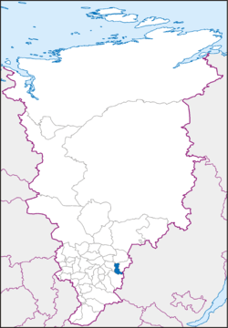 Location of Ilansky District in Krasnoyarsk Krai | |
| Coordinates: 56°14′N 96°04′E / 56.233°N 96.067°ECoordinates: 56°14′N 96°04′E / 56.233°N 96.067°E | |
 A memorial train near Ilanskaya railway station in the town of Ilansky, Ilansky District | |
 | |
|
| |
| Location | |
| Country | Russia |
| Federal subject | Krasnoyarsk Krai[1] |
| Administrative structure (as of December 2011) | |
| Administrative center | town of Ilansky[1] |
| Administrative divisions:[1] | |
| District towns | 1 |
| Selsoviets | 9 |
| Inhabited localities:[1] | |
| Cities/towns | 1 |
| Rural localities | 39 |
| Municipal structure (as of April 2010) | |
| Municipally incorporated as | Ilansky Municipal District[2] |
| Municipal divisions:[2] | |
| Urban settlements | 1 |
| Rural settlements | 9 |
| Local government: | |
| Head[3] | Olga A. Alkhimenko[4] |
| Representative body | Ilansky District Council of Deputies[5] |
| Statistics | |
| Area (municipal district) | 3,750 km2 (1,450 sq mi)[4] |
| Population (2010 Census) | 25,899 inhabitants[6] |
| • Urban | 62.2% |
| • Rural | 37.8% |
| Density | 6.91/km2 (17.9/sq mi)[7] |
| Time zone | KRAT (UTC+07:00)[8] |
| Established | November 7, 1939[4] |
| Ilansky District on WikiCommons | |
Ilansky District (Russian: Ила́нский райо́н) is an administrative[1] and municipal[2] district (raion), one of the forty-three in Krasnoyarsk Krai, Russia. It is located in the southeast of the krai and borders with Abansky District in the north, Nizhneingashsky District in the east, Irbeysky District in the south, Irkutsk Oblast in the southeast, and with Kansky District in the west. The area of the district is 3,750 square kilometers (1,450 sq mi).[4] Its administrative center is the town of Ilansky.[1] Population: 25,899 (2010 Census).[6] The population of the administrative center accounts for 62.2% of the district's total population.[6]
History
The district was founded on November 7, 1939.[4]
Government
As of 2013, the Head of the District and the Chairman of the District Council is Olga A. Alkhimenko.
Demographics
| Population[9] | ||||||||
|---|---|---|---|---|---|---|---|---|
| 1989 Census[10] | 1995 | 2000 | 2001 | 2002 Census[11] | 2003 | 2004 | 2005 | 2010 Census[6] |
| 31,949 | 30,700 | 28,900 | 28,500 | 28,139 | 27,600 | 27,100 | 26,700 | 25,899 |
Economy
Transportation
The Trans-Siberian Railway runs through the district from west to east. A part of M53 Highway passes through the district as well.
References
Notes
- 1 2 3 4 5 6 Law #10-4765
- 1 2 3 Law #13-2898
- ↑ Charter of Ilansky District, Article 15
- 1 2 3 4 5 Official website of Krasnoyarsk Krai. Information about Ilansky District (Russian)
- ↑ Charter of Ilansky District, Article 22
- 1 2 3 4 Russian Federal State Statistics Service (2011). "Всероссийская перепись населения 2010 года. Том 1" [2010 All-Russian Population Census, vol. 1]. Всероссийская перепись населения 2010 года (2010 All-Russia Population Census) (in Russian). Federal State Statistics Service. Retrieved June 29, 2012.
- ↑ The value of density was calculated automatically by dividing the 2010 Census population by the area specified in the infobox. Please note that this value is only approximate as the area specified in the infobox does not necessarily correspond to the area of the entity proper or is reported for the same year as the population.
- ↑ Правительство Российской Федерации. Федеральный закон №107-ФЗ от 3 июня 2011 г. «Об исчислении времени», в ред. Федерального закона №271-ФЗ от 03 июля 2016 г. «О внесении изменений в Федеральный закон "Об исчислении времени"». Вступил в силу по истечении шестидесяти дней после дня официального опубликования (6 августа 2011 г.). Опубликован: "Российская газета", №120, 6 июня 2011 г. (Government of the Russian Federation. Federal Law #107-FZ of June 31, 2011 On Calculating Time, as amended by the Federal Law #271-FZ of July 03, 2016 On Amending Federal Law "On Calculating Time". Effective as of after sixty days following the day of the official publication.).
- ↑ Красноярскстат, 2006 год; except where noted otherwise
- ↑ Demoscope Weekly (1989). "Всесоюзная перепись населения 1989 г. Численность наличного населения союзных и автономных республик, автономных областей и округов, краёв, областей, районов, городских поселений и сёл-райцентров" [All Union Population Census of 1989: Present Population of Union and Autonomous Republics, Autonomous Oblasts and Okrugs, Krais, Oblasts, Districts, Urban Settlements, and Villages Serving as District Administrative Centers]. Всесоюзная перепись населения 1989 года [All-Union Population Census of 1989] (in Russian). Институт демографии Национального исследовательского университета: Высшая школа экономики [Institute of Demography at the National Research University: Higher School of Economics]. Retrieved August 9, 2014.
- ↑ Russian Federal State Statistics Service (May 21, 2004). "Численность населения России, субъектов Российской Федерации в составе федеральных округов, районов, городских поселений, сельских населённых пунктов – районных центров и сельских населённых пунктов с населением 3 тысячи и более человек" [Population of Russia, Its Federal Districts, Federal Subjects, Districts, Urban Localities, Rural Localities—Administrative Centers, and Rural Localities with Population of Over 3,000] (XLS). Всероссийская перепись населения 2002 года [All-Russia Population Census of 2002] (in Russian). Retrieved August 9, 2014.
Sources
- Законодательное собрание Красноярского края. Закон №10-4765 от 10 июня 2010 г. «О перечне административно-территориальных единиц и территориальных единиц Красноярского края», в ред. Закона №7-3007 от 16 декабря 2014 г. «Об изменении административно-территориального устройства Большеулуйского района и о внесении изменений в Закон края "О перечне административно-территориальных единиц и территориальных единиц Красноярского края"». Вступил в силу 1 июля 2010 г. Опубликован: "Ведомости высших органов государственной власти Красноярского края", №33(404), 5 июля 2010 г. (Legislative Assembly of Krasnoyarsk Krai. Law #10-4765 of June 10, 2010 On the Registry of the Administrative-Territorial Units and the Territorial Units of Krasnoyarsk Krai, as amended by the Law #7-3007 of December 16, 2014 On Changing the Administrative-Territorial Structure of Bolsheuluysky District and on Amending the Krai Law "On the Registry of the Administrative-Territorial Units and the Territorial Units of Krasnoyarsk Krai". Effective as of July 1, 2010.).
- Законодательное собрание Красноярского края. Закон №13-2898 от 28 января 2005 г. «Об установлении границ и наделении соответствующим статусом муниципального образования Иланский район и находящихся в его границах иных муниципальных образований», в ред. Закона №10-4571 от 29 апреля 2010 г. «О внесении изменений в Закон края "Об установлении границ и наделении соответствующим статусом муниципального образования Иланский район и находящихся в его границах иных муниципальных образований"». Вступил в силу через десять дней после официального опубликования. Опубликован: "Ведомости высших органов государственной власти Красноярского края", №5, 7 февраля 2005 г. (Legislative Assembly of Krasnoyarsk Krai. Law #13-2898 of January 28, 2005 On Establishing the Borders and Granting an Appropriate Status to the Municipal Formation of Ilansky District and to Other Municipal Formations Within Its Borders, as amended by the Law #10-4571 of April 29, 2010 On Amending the Krai Law "On Establishing the Borders and Granting an Appropriate Status to the Municipal Formation of Ilansky District and to Other Municipal Formations Within Its Borders". Effective as of ten days after the official publication.).
- Иланский районный Совет депутатов. Решение №23-114-р от 22 декабря 2006 г. «Устав Иланского района Красноярского края», в ред. Решения №39-269Р от 31 октября 2013 г. «О внесении изменений и дополнений в Устав Иланского района Красноярского края в соответствии с замечаниями, изложенными в протесте прокурора Иланского района». Вступил в силу в день, следующий за днём официального опубликования, осуществляемого при наличии государственной регистрации, за исключением некоторых положений, для которых предусмотрен иной порядок вступления в силу. Опубликован: "Ведомости органов местного самоуправления Иланского района", №1, 12 января 2007 г. (Ilansky District Council of Deputies. Decision #23-114-r of December 22, 2006 Charter of Ilansky District of Krasnoyarsk Krai, as amended by the Decision #39-269R of October 31, 2013 On Amending and Supplementing the Charter of Ilansky District of Krasnoyarsk Krai in Accordance with the Ilansky District Prosecutor's Protest Notes. Effective as of the day following the official publication, carried out after the state registration; with the exception of several clauses for which different procedures of taking effect are specified.).