Kadok, Daik-U Township
| Kadok ကတုတ် | |
|---|---|
| Village | |
 Kadok Location in Burma | |
| Coordinates: 17°41′N 96°35′E / 17.683°N 96.583°ECoordinates: 17°41′N 96°35′E / 17.683°N 96.583°E | |
| Country |
|
| Region | Bago Region |
| District | Bago |
| Township | Daik-U |
| Time zone | MST (UTC+6.30) |
Kadok[1] is a village in Daik-U Township, Bago District, in the Bago Region of southern Burma.[2][3][4]
Notes
- ↑ "Kadok (Approved)" Kadok, Daik-U Township at GEOnet Names Server, United States National Geospatial-Intelligence Agency
- ↑ Google Maps (Map). Google.
- ↑ Bing Maps (Map). Microsoft and Harris Corporation Earthstar Geographics LLC.
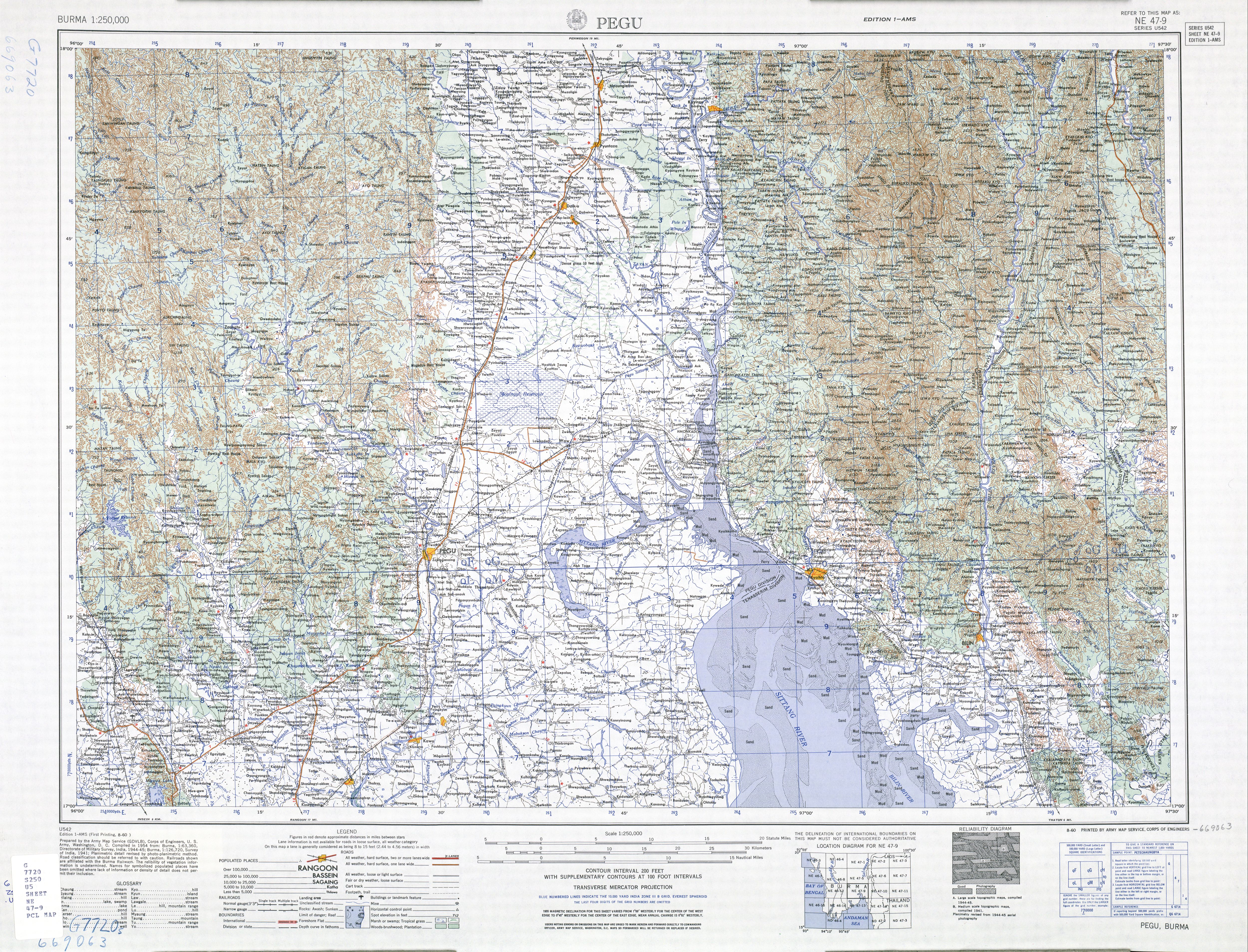
- ↑ "Burma 1:250,000 topographic map, Series U542, Pegu NE 47-09" U.S. Army Map Service, August 1960
လဘလလ
External links
- "Kadok Map — Satellite Images of Kadok" Maplandia World Gazetteer
Capital: | |
|
Capital: Bago | ||||||||
| East Bago Region |  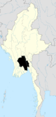 | |||||||
| West Bago Region | ||||||||
| Main cities and towns |
| |||||||
Capital: | |
|
This article is issued from Wikipedia - version of the 11/28/2016. The text is available under the Creative Commons Attribution/Share Alike but additional terms may apply for the media files.