Jatun Q'asa (Zudáñez)
This article is about the mountain in the Chuquisaca Department, Bolivia. For other uses, see Jatun Q'asa.
| Jatun Q'asa | |
|---|---|
 Jatun Q'asa Location within Bolivia | |
| Highest point | |
| Elevation | 3,500 m (11,500 ft) [1] |
| Coordinates | 19°38′26″S 64°42′10″W / 19.64056°S 64.70278°WCoordinates: 19°38′26″S 64°42′10″W / 19.64056°S 64.70278°W |
| Geography | |
| Location |
Bolivia, Chuquisaca Department |
| Parent range | Andes |
Jatun Q'asa (Quechua jatun, hatun big, q'asa mountain pass,[2] "big pass", also spelled Jatun Khasa) is a mountain in the Bolivian Andes which reaches a height of approximately 3,500 m (11,500 ft). It is located in the Chuquisaca Department, Jaime Zudáñez Province, Icla Municipality. Jatun Q'asa lies between the Lampasar River and the Warmi Wañusqa River, southwest of Chullunkhäni.[1][3]
References
Capital: Sucre | ||
| Provinces | 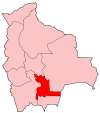 | |
| Municipalities and seats |
| |
This article is issued from Wikipedia - version of the 4/23/2016. The text is available under the Creative Commons Attribution/Share Alike but additional terms may apply for the media files.