Inhassoro District
| Inhassoro | |
|---|---|
| District | |
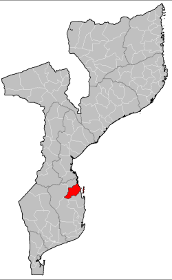 Inhassoro District on the map of Mozambique | |
| Country | Mozambique |
| Province | Inhambane |
| Capital | Inhassoro |
| Area | |
| • Total | 4,480 km2 (1,730 sq mi) |
| Population (2007 census) | |
| • Total | 48,537 |
| • Density | 11/km2 (28/sq mi) |
Inhassoro District is a district of Inhambane Province in south-east Mozambique. The district is located at the northeast of the province, and borders with Govuro District in the north, Vilanculos District in the southeast, Massinga District in the south, Funhalouro District in the southwest, and with Mabote District in the west. In the east, the district is bounded by the Indian Ocean. The area of the district is 4,480 square kilometres (1,730 sq mi).[1] It has a population of 48,537 as of 2007.[2]
Geography
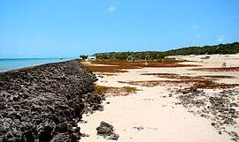
The islands, part of the Bazaruto Archipelago, occupy the area of 35.5 square kilometres (13.7 sq mi).[1] The archipelago consists of six islands, four of which, Bazaruto, Benguerra, Magaruque, and Santa Carolina, belong to Inhassoro District. Bazaruto National Park is located on the archipelago and serves as a location of popular high-end sea resorts. [3][1]
The Govuro River is the biggest and the only significant river in the district.[1]
The climate is tropical arid in the interior of the district and tropical humid at the coast. The annual rainfall at the coast achieves 1,500 millimetres (59 in), mainly falling in February and March.[1]
Administrative divisions
The district is divided into two postos, Inhassoro (four localities) and Bazaruto (one locality).[1]
Demographics
As of 2005, 41% of the population of the district was younger than 15 years. 33% did speak Portuguese, and Chitsua language was the mothertongue for the majority of the population of the district. 71% were analphabetic, mostly women.[1]
Economy
In 2005, 1% of the households in the district had electricity. Fishing and woodcutting are widespread.[1]
Agriculture
In 2005, the district had 10,000 farms exploiting on average the area of 1.6 hectares (0.0062 sq mi) each. The main agricultural products are maize, cassava, cowpea, peanuts, sweet potatoes, sunflower, and rice.[1]
Transportation
There is a road network in the district which includes the 95 kilometres (59 mi) stretch of the national road EN1, crossing the eastern part of the district.[1]
Bazaruto Island Airport serves the islands. It is used by lodges which charter flights from Vilankulo.[4]
References
- 1 2 3 4 5 6 7 8 9 10 "Perfil do Distrito de Inhassoro" (PDF) (in Portuguese). Ministry of State Administration. 2005. Retrieved 20 October 2016.
- ↑ "População da Provincia de Inhambane". Censo 2007 (in Portuguese). Instituto Nacional de Estatística. Archived from the original on 8 March 2008. Retrieved 17 March 2008.
- ↑ "What to visit". Mozambique Ministry of Tourism. Retrieved 20 October 2016.
- ↑ "Getting there". Bazaruto Archipelago. Retrieved 20 October 2016.
Coordinates: 21°32′S 35°12′E / 21.533°S 35.200°E