Cheringoma District
| Cheringoma | |
|---|---|
| District | |
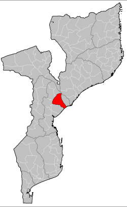 Cheringoma District on the map of Mozambique | |
| Country | Mozambique |
| Province | Sofala |
| Capital | Inhaminga |
| Area | |
| • Total | 6,954 km2 (2,685 sq mi) |
| Population (2007 census) | |
| • Total | 34,133 |
| • Density | 4.9/km2 (13/sq mi) |
Cheringoma District is a district of Sofala Province in Mozambique. The principal town is Inhaminga. The district is located in the northeast of the province, and borders with Caia District in the north, Marromeu District in the northeast, Muanza District in the south, Gorongosa District in the west, and with Maringué District in the northwest. In the south, it is bounded by the Indian Ocean. The area of the district is 6,954 square kilometres (2,685 sq mi).[1] It has a population of 34,133 as of 2007.[2]
Geography
The northern part of the district belongs to the drainage basin of the Zambezi. The Zangué River, a major right tributary of the Zambezi, makes a border with Caia District. The rivers in the south of the country drain into the Púngoè River.[1]
The climate of the district is tropical wet dry (Aw in the Köppen climate classification). The average annual rainfall in the district varies between 1,000 millimetres (39 in) and 1,200 millimetres (47 in).[1]
Demographics
As of 2005, 43% of the population of the district was younger than 15 years. 23% of the population spoke Portuguese. The most common mothertongue among the population was Cindau. 81% were analphabetic, mostly women.[1]
Administrative divisions
The district is divided into two postos, Inhaminga (four localities) and Inhamitanga (two localities).[1]
Economy
Less than 1% of the households in the district have access to electricity.[1]
Agriculture
In the district, there are 4,000 farms which have on average 1.3 hectares (0.0050 sq mi) of land. The main agricultural products are corn, cassava, cowpea, peanut, pearl millet, sorghum, and sweet potato.[1]
Transportation
There is a road network in the district which includes a stretch of a national road connecting Beira and Caia. There is a railway between Beira and Caia as well. It is not operational.[1]
References
- 1 2 3 4 5 6 7 8 "Perfil do Distrito do Cheringoma" (PDF) (in Portuguese). Ministry of State Administration. 2005. Retrieved 4 November 2016.
- ↑ "População da Provincia de Sofala". Censo 2007 (in Portuguese). Instituto Nacional de Estatística. Archived from the original on 8 March 2008. Retrieved 20 March 2008.
Coordinates: 18°24′10″S 35°01′03″E / 18.402661°S 35.017412°E