Maputo Province
| Maputo | |
|---|---|
| Province | |
 | |
 Maputo, Province of Mozambique | |
| Country | Mozambique |
| Capital | Matola |
| Area | |
| • Total | 22,693 km2 (8,762 sq mi) |
| Population (2007 census) | |
| • Total | 1,205,709 |
| • Density | 53/km2 (140/sq mi) |
| Postal code | 11xx |
| Area code(s) | (+258) 21 |
| Website |
www |
Maputo is a province of Mozambique; the province excludes the city of Maputo (which comprises a separate province). The province has an area of 22,693 km² and a population of 1,205,709 (2007 census).[1] Its capital is the city of Matola.
Geography

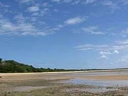
Maputo Province is the southernmost province of Mozambique. It borders Gaza Province to the north, the Indian Ocean to the east, the South African province of KwaZulu-Natal to the south, Swaziland to the southwest, and the Mpumalanga province of South Africa to the west and northwest. The Maputo Bay area to the southeast of Maputo is an important conservation area with many reefs and lakes. Of particular note is the Maputo Elephant Game Reserve, which has lakes such as Lagoa Chingute and Lagoa Piti in the vicinity, and the Machangulo Private Nature Reserve further north of this in the Machangulo Peninsula.[2] The largest river of the province, the Maputo River, running from Amsterdam, Mpumalanga in South Africa near the Swaziland border, flows into Maputo Bay to the southeast of Maputo. Also flowing into the bay are the Umbeluzi River and the Incomati River. In the fall of 1999, the Maputo, Umbeluzi, Incompati and Limpopo rivers were affected by severe rainfall, 70 percent higher than normal which caused severe flooding. The Maputo and Incomati burst their banks on 12 January 2000, directly affecting some 40,000, and flooding along the Incomati affected about 20,000 several days later.[3]
To the north of the peninsula is the Inhaca Island (Ilha da Inhaca), a 52 km² subtropical island, about 12 kilometres (7.5 mi) from north to south by 7 kilometres (4.3 mi) from east to west which separates Maputo Bay to the west from the Indian Ocean off its eastern shores. It is protected under the Lubombo Transfrontier Conservation Area, and contains the Reserva da Inhaca.[2] The highest point of the island is Mount Inhaca at 104 metres (341 ft) on the north-eastern shoreline.
In the northwest of the province, near the South African border is a major reservoir and dam complex, the Corumana Dam, which dams the Sabie River. In 2014 it was reported that hydro-mechanical specialists have been consulted to see a further expansion of the complex, with the aim of increasing the height of the dam from 110 metres (360 ft) to 117 metres (384 ft), and installing crest spillway gates and a fuse plug. The dam is under the responsibility of the water directorate, Direccao Nacional de Aguas (DNA).[4]
Districts
Maputo Province is divided into the 7 districts of:
- Boane District
- Magude District
- Manhiça District
- Marracuene District
- Moamba District
- Namaacha District
- Matutuíne District
and the municipalities of:
Demographics
According to the 1997 census, the province had 806,179 inhabitants and an area of 26,058 square kilometres (10,061 sq mi), hence resulting in a population density of 30,94 inhabitants per km². Between 1997 and 2007, the population grew by 33.14%, the fastest growing region in Mozambique. As of the 2007 census, the province had a population of 1,205,709 residents.[1] With an area of 22,693 square kilometres (8,762 sq mi), the population density was about 53.13 people per km².
References
| Wikimedia Commons has media related to Maputo Province. |
- 1 2 3 "Mozambique". Geohive. Retrieved 22 September 2014.
- 1 2 Google (22 September 2014). "Maputo Province" (Map). Google Maps. Google. Retrieved 22 September 2014.
- ↑ Christie, Frances; Hanlon, Joseph (1 January 2001). Mozambique & the Great Flood of 2000. Indiana University Press. p. 16. ISBN 0-253-33978-2.
- ↑ "Mozambique seeks hydro-mechanical specialist for Corumana Dam expansion". Hydroworld.com. 15 May 2014. Retrieved 22 September 2014.
Coordinates: 25°30′S 32°20′E / 25.500°S 32.333°E