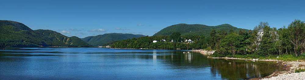
Ingonish
Ingonish is a Canadian rural community in northeastern Victoria County, Nova Scotia.
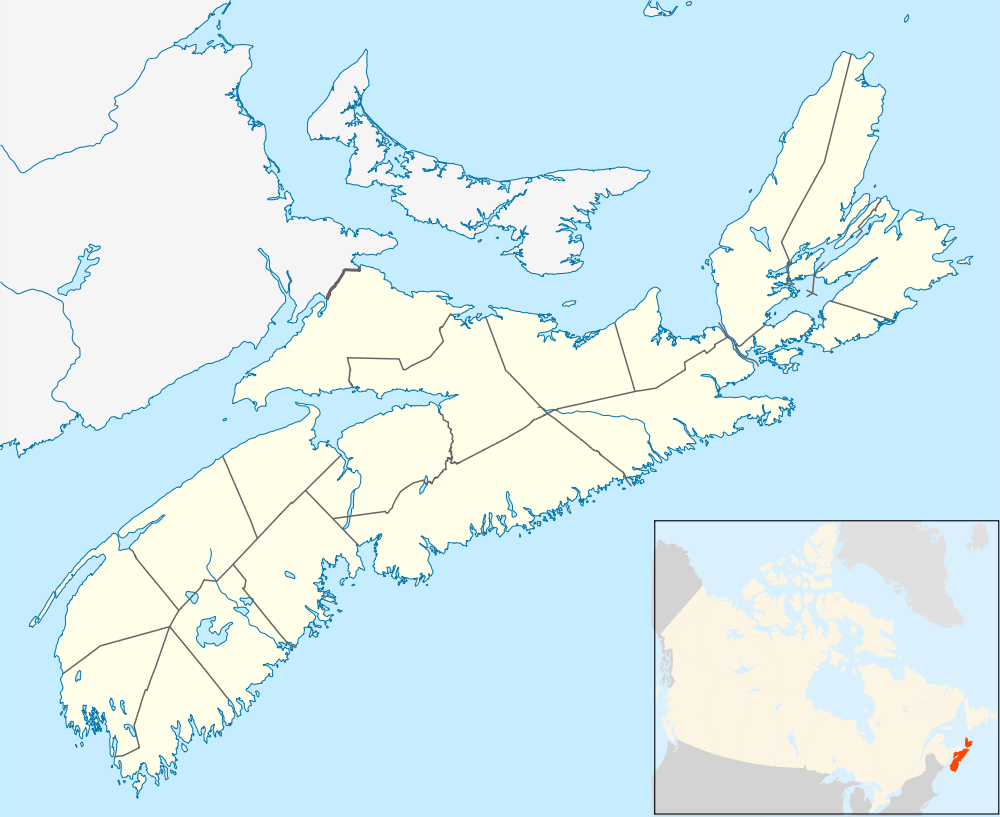

Located along the northeast coast of Cape Breton Island, Ingonish is situated on the Cabot Trail approximately 60 kilometres from the shire town of Baddeck. Ingonish consists of five communities:
- Ingonish Ferry
- Ingonish Harbour
- Ingonish Beach
- Ingonish Centre
- North Ingonish
Ingonish lies at the eastern entrance to Cape Breton Highlands National Park. The regional economy is tied to the seasonal tourism and fishing industries. The community is in the federal electoral district of Sydney—Victoria. Ingonish was one of the first areas settled on Cape Breton Island, and is home to the Keltic Lodge resort, downhill skiing at Cape Smokey, and a public golf course, the Highlands Links.
Points of interest
- Highlands Links Golf Course
- Cape Breton Highlands National Park
- Cape Smokey Provincial Park
- Keltic Lodge
- Ski Cape Smokey
Communications
- The Postal Code is B0C 1L0 (Ingonish Ferry, Ingonish Harbour, Ingonish Beach), B0C 1K0 (Ingonish Centre, Ingonish)
- The telephone exchange is 902-285
- Internet - DSL is provided by Bell Aliant
Demographics
- Total Population 1925
- Total Dwellings 652
- Total Land Area 256.185 km²
Climate
Ingonish has a humid continental climate. Winters are long, cold and snowy. In the months of December and January, snow can fall nearly every day due to sea effect snow showers which blow in from the unfrozen Gulf of St. Lawrence. Ingonish is also prone to intense Nor-Easters. As the winter progresses, the surrounding waters become covered in ice which delays the onset of spring. Summer arrives quickly though, usually in mid to late June. The cold spring gives way to a beautiful summer, with lots of warm, sunny days. In summer, the weather pattern shifts to a warm southwest flow, and lasts into the fall. These warm southwest winds blow down-slope from the Cape Breton Highlands, drying out and warming as it descends. Although the surrounding water freezes during winter, it warms very quickly through the summer, with sea surface temperatures peaking around 21°C (70°F) in August. The highest temperature ever recorded was 37.7 °C (99.9 °F) on 10 August 2001.[1] The lowest temperature was −28.0 °C (−18.4 °F) on 18 January 1982.[2] Weather data has been recorded at Parks Canada in Ingonish Beach since 1950. In 2000, Environment Canada upgraded the climate station to an automated weather station.
| Climate data for Ingonish Beach, 1981–2010 normals, extremes 1950–present | |||||||||||||
|---|---|---|---|---|---|---|---|---|---|---|---|---|---|
| Month | Jan | Feb | Mar | Apr | May | Jun | Jul | Aug | Sep | Oct | Nov | Dec | Year |
| Record high °C (°F) | 17.5 (63.5) |
19.0 (66.2) |
21.3 (70.3) |
24.0 (75.2) |
31.1 (88) |
34.4 (93.9) |
36.0 (96.8) |
37.7 (99.9) |
34.9 (94.8) |
28.5 (83.3) |
25.5 (77.9) |
18.0 (64.4) |
37.7 (99.9) |
| Average high °C (°F) | −0.8 (30.6) |
−1.0 (30.2) |
2.0 (35.6) |
6.5 (43.7) |
13.0 (55.4) |
18.7 (65.7) |
23.3 (73.9) |
23.2 (73.8) |
19.0 (66.2) |
12.7 (54.9) |
7.1 (44.8) |
2.1 (35.8) |
10.5 (50.9) |
| Daily mean °C (°F) | −5 (23) |
−5.4 (22.3) |
−2.0 (28.4) |
2.7 (36.9) |
8.1 (46.6) |
13.6 (56.5) |
18.3 (64.9) |
18.5 (65.3) |
14.5 (58.1) |
8.8 (47.8) |
3.8 (38.8) |
−1.2 (29.8) |
6.2 (43.2) |
| Average low °C (°F) | −9.2 (15.4) |
−9.7 (14.5) |
−6.0 (21.2) |
−1.0 (30.2) |
3.2 (37.8) |
8.4 (47.1) |
13.3 (55.9) |
13.6 (56.5) |
9.9 (49.8) |
4.8 (40.6) |
0.5 (32.9) |
−4.6 (23.7) |
1.9 (35.4) |
| Record low °C (°F) | −28.0 (−18.4) |
−27.5 (−17.5) |
−24.9 (−12.8) |
−15.0 (5) |
−7.0 (19.4) |
−1.7 (28.9) |
3.9 (39) |
1.0 (33.8) |
−6.7 (19.9) |
−6.5 (20.3) |
−12.5 (9.5) |
−20.0 (−4) |
−28.0 (−18.4) |
| Average precipitation mm (inches) | 186.3 (7.335) |
139.7 (5.5) |
153.9 (6.059) |
168.6 (6.638) |
108.9 (4.287) |
90.6 (3.567) |
93.1 (3.665) |
114.2 (4.496) |
143.7 (5.657) |
175.6 (6.913) |
189.7 (7.469) |
188.3 (7.413) |
1,752.7 (69.004) |
| Average rainfall mm (inches) | 79.4 (3.126) |
62.0 (2.441) |
82.3 (3.24) |
132.4 (5.213) |
105.2 (4.142) |
90.6 (3.567) |
93.1 (3.665) |
114.2 (4.496) |
143.7 (5.657) |
175.4 (6.906) |
167.9 (6.61) |
112.4 (4.425) |
1,358.5 (53.484) |
| Average snowfall cm (inches) | 105.6 (41.57) |
77.8 (30.63) |
71.8 (28.27) |
36.1 (14.21) |
3.8 (1.5) |
0.0 (0) |
0.0 (0) |
0.0 (0) |
0.0 (0) |
0.2 (0.08) |
21.8 (8.58) |
76.0 (29.92) |
393.1 (154.76) |
| Average precipitation days (≥ 0.2 mm) | 21.9 | 16.0 | 16.4 | 16.5 | 16.3 | 13.2 | 13.1 | 14.3 | 16.4 | 19.9 | 21.9 | 21.4 | 207.1 |
| Average rainy days (≥ 0.2 mm) | 7.2 | 5.0 | 8.0 | 13.5 | 16.2 | 13.2 | 13.1 | 14.3 | 16.4 | 19.9 | 18.2 | 10.0 | 154.7 |
| Average snowy days (≥ 0.2 cm) | 18.2 | 13.0 | 10.8 | 5.0 | 0.45 | 0.0 | 0.0 | 0.0 | 0.0 | 0.16 | 6.1 | 14.2 | 67.7 |
| Mean monthly sunshine hours | 77.5 | 108.1 | 128.5 | 144.8 | 199.6 | 227.1 | 237.6 | 215.7 | 157.9 | 117.6 | 69.0 | 43.3 | 1,726.6 |
| Percent possible sunshine | 27.7 | 37.1 | 34.9 | 35.6 | 42.9 | 48.0 | 49.7 | 49.1 | 41.8 | 34.7 | 24.4 | 16.2 | 36.8 |
| Source: Environment Canada[2][3][4] | |||||||||||||
References
- ↑ "Daily Data Report for August 2001". Canadian Climate Data. Environment Canada. Retrieved 8 April 2016.
- 1 2 "Ingonish Beach, Nova Scotia". Canadian Climate Normals 1981–2010. Environment Canada. Retrieved 9 May 2015.
- ↑ "Ingonish Beach RCS". Canadian Climate Data. Environment Canada. Retrieved 8 April 2016.
- ↑ "Hourly Data Report for September 10, 2001". Canadian Climate Data. Environment Canada. Retrieved 8 April 2016.
External links
- Hike the Highlands Festival
- Northeast Highlands Chamber of Commerce
- Cape Breton Highlands
- Visit Victoria County
- Municipality of Victoria County
- Ingonish Information
Coordinates: 46°38′21″N 60°24′29″W / 46.63917°N 60.40806°W
| Counties | |
|---|---|
| Economic Regions | |
| Regional municipalities | |
| Municipal districts | |
| Towns | |
| Incorporated villages | |
| Lists | |
| |