Cape Breton Highlands National Park
| Cape Breton Highlands National Park | |
|---|---|
|
IUCN category II (national park) | |
|
Autumn colours in the park | |
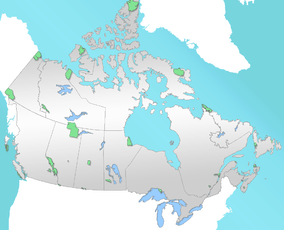 Location of Cape Breton Highlands in Canada | |
| Location | Ingonish, Nova Scotia, Canada |
| Coordinates | 46°43′0″N 60°39′35″W / 46.71667°N 60.65972°WCoordinates: 46°43′0″N 60°39′35″W / 46.71667°N 60.65972°W |
| Area | 949 km2 |
| Established | 1936 |
| Visitors | 246,312[1] (in 2015-16) |
| Governing body | Parks Canada |


Cape Breton Highlands National Park (French: parc national des Hautes-Terres-du-Cap-Breton) is located on northern Cape Breton Island in the province of Nova Scotia. One-third of the Cabot Trail passes through the park featuring spectacular ocean and mountain views. The park is well known for its "steep cliffs and deep river canyons that carve into a forested plateau bordering the Atlantic Ocean".[2] The park was the first National Park in the Atlantic provinces of Canada[3] and covers an area of 948 km2.[4] It is one of 42 in Canada's system of national parks.
At the western entrance of the park is the Acadian village of Chéticamp[5] on the Gulf of Saint Lawrence and a park information centre. On the eastern side of the park are the beaches at Ingonish on the Atlantic Ocean. In between are mountains, valleys, forests, waterfalls, rocky coastlines and a tundra-like plateau known as the Cape Breton Highlands.
Also on the east side of the park located in Ingonish at the Keltic Lodge resort is Highlands Links, an 18-hole golf course designed by Stanley Thompson. Golf Magazine ranked it as one of the top 100 courses in the world and the best public course in Canada. George Knudson suggested leaving your clubs behind and just walking the course. The course has been certified by the Audubon Cooperative Sanctuary Program, a program aimed at conserving wildlife habitat in spaces used for other purposes.
The park's forested areas include:
- Acadian forest of mixed deciduous trees and conifers, mainly found at lower elevations
- Boreal forest found on the plateau and uplands
Park wildlife features mammals and raptors including two species of owl, bald eagle, marten, lynx, snowshoe hare, beaver, mink, kestrel, bobcat, three species of hawk, river otter, ermine, red fox, raccoon, moose, black bear, skunk, and coyote. Whales (humpback, fin, minke, sei and pilot), white-sided dolphins, seals (harbour, harp, and grey) and northern gannets can often be seen from the park's coastal hiking trails, e.g. the Skyline Trail. The park's forests provide habitat for the uncommon Bicknell's thrush. The Gaspé shrew, the local name for a smallish variety of the long-tailed shrew, Sorex dispar, can be found on rocky slopes in the park. The first nest records of boreal owl for Nova Scotia were found in the south west corner of this park.[6][7] On October 27, 2009 in this park, country folk singer Taylor Mitchell became the only recorded North American adult to be a victim of a fatal coyote attack.[8][9]
North Atlantic right whales, one of the rarest whales, were once considered to be sporadic visitors into St. Lawrence regions until 1994, but after the annual concentrations were discovered off Percé in 1995, gradual increases have been recorded elsewhere since in 1998,[10] and whales suddenly increased in numbers around Cape Breton in 2014 (35 to 40 whales were found around Cape Breton to Prince Edward Island in 2015).[11]
There are many activities to do when visiting the Cape Breton Highlands National Park. Some of these activities include camping, hiking, sightseeing, swimming, fishing, geocaching, cycling, golfing, picnicking, weddings, kayaking and surfing.[2] There are endless swimming options available for all ages in the park. There are five main salt water ocean beaches in the park and two freshwater lakes. The ocean beaches include Ingonish Beach, North Bay Beach, Broad Cove Beach, Black Brook Beach and La Block Beach. The two freshwater beaches include Freshwater Lake and Warren Lake. Freshwater Lake and Ingonish Beach are both supervised with a lifeguard during the summer months. There are very strong currents at Black Brook and Ingonish Beach which must be considered when bringing small children to these two beaches.[2]
Rivers in the park include the Chéticamp River and the North Aspy River.
This park was the subject of a short film in 2011's National Parks Project, directed by Keith Behrman and scored by Tony Dekker, Old Man Luedecke and Daniela Gesundheit.
In 2014, Parks Canada started a four-year project with the Unama'ki Institute of Natural Resources and other partners to begin to restore boreal forest regions within the park.
Geology


Most of the park resides within what is called the Ganderia Terrane, sometimes referred to in the literature as the Bras d'Or or Aspy Terrane. This terrane was originally part of Gondwana, referred to as peri-Gondwanan Terrane, and through seafloor spreading separated from Gondawana, and collided with Laurentia during the Salinic Orogeny. The evidence of this collision, the closing of the Iapetus Ocean and the formation of the Iapetus Suture, is seen in the northwest part of the park where the Ganderia Terrane is connected with the Blair River Inlier, itself a remnant of the Laurentia continental margin, referred to as peri-Laurentian Terrane. Other terrane collisions followed, including the Avalonia Terrane during the Acadian orogeny, and the Meguma Terrane during the Neoacadian Orogeny. Then, between 340 and 300 Ma, Gondwana collided with Laurentia, forming Pangea. Rifting started about 200 Ma eventually forming the Atlantic Ocean.[12]
Along the Cabot Trail between the park headquarters at Ingonish Beach and Ingonish, a 402 Ma old Early Devonian granodiorite is exposed, the Cameron Brook Pluton, while the Keltic Lodge, on Middle Head, sits on a 493 Ma old Early Ordovician granite and a 550 Ma old Neoproterozoic diorite.[13] The beach in front of Freshwater Lake is a classic shingle beach, a barrier beach with boulders well rounded and polished from wave action. Glacial debris is evident along the trail at the north end of the lake. A similar bar cuts across Ingonish Harbor.[12]:90[14][15]
A Middle to 375 Ma Late Devonian granite is seen along the Cabot Trail between Ingonish and where it leaves the park near South Harbor, while a 403 Ma Early Devonian orthogneiss is exposed at Neils Harbour northward. From Cape North, the Cabot Trail follows the Aspy Fault southwards, where the Early Carboniferous Windsor Group and Horton Group outcrops, until it reenters the park at Big Intervale. These groups of rocks consist of limestone, mudstone, anhydrite, gypsum, halite, siltstone, fluvial sandstone, shale, and conglomerate. The Windsor Group is also exposed at Ingonish and Ingonish Beach.[13]
The Cabot Trail then doglegs to the north, crossing the Wilkie Brook Fault Zone, and entering the southern most extent of the Blair River Inlier. The inlier is bounded by the Wilkie Brook Fault Zone on the east and the Red River Fault Zone on the southwest near Lone Shieling. The fault zones are marked by a zone of sheared rocks characterized by mylonite. Between these zones are outcrops of Silurian Fox Back Ridge diorite and granodiorite, as well as the Red River Anorthosite Suite of Middle Proterozoic age.[13][16]
The Cabot Trail then follows the Grande Anse River westwards, with exposed Horton Group until it reaches the coast at Pleasant Bay. This is the location of the 364 Ma Late Devonian granite of the Pleasant Bay Pluton. Moving south along the trail, the 433 Ma Ordovician-Silurian Belle Cote Road orthogneiss is encountered, followed by another granite (Proterozoic-Devonian in age).[13]
As the trail loops west to follow the coastline, rocks of the 439 Ma Ordovician-Silurian Jumping Brook Metamorphic Suite are exposed. This suite consists of metamorphosed siltstone, wacke, conglomerate, arkose, and minor rhyolite. In the midst of this suite may be found the 379 Ma Devonian granite of the Gillanders Mountain Pluton. The trail encounters a 439 Ma Cambrian granite before it exists the park at La Rigoueche.[13]
Gallery
-

The Cabot Trail viewed from the Skyline Hiking Trail
-

A moose resting in the park
-

Part of the Skyline Hiking Trail
-
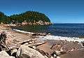
Black Brook Beach
-

Long-finned pilot whales spyhopping off Cape Breton
See also
| Wikimedia Commons has media related to Cape Breton Highlands National Park. |
References
- ↑ Parks Canada Visitation Records Accessed November 17, 2016
- 1 2 3 "Cape Breton Highlands National Park". Parks Canada. 24 March 2015. Retrieved 30 March 2014.
- ↑ "Cape Breton Highlands National Park, Cabot Trail". Retrieved 2011-03-29.
- ↑ Finkelstein, Maxwell W. (9 February 2010). "Cape Breton Highlands National Park". The Canadian Encyclopedia. Historica Canada. Retrieved 29 March 2011.
- ↑ "Cheticamp - Cape Breton Island - Nova Scotia". Retrieved 29 March 2011.
- ↑ Lauff, R.F. (2010). "First nest record of the Boreal Owl Aegolius funereus in Nova Scotia". Ardea. 97 (4): 497–502. (registration required (help)).
- ↑ Lauff, Randolph F. (Oct–Nov 2007). Johnson, D.H.; Van Nieuwenhuyse, D.; Duncan, J.R., eds. First nest records of the Boreal Owl Aegolius funereus in Nova Scotia, Canada (PDF). Proc. Fourth World Owl Conf. Project Owl Net. 97 (4). Groningen, The Netherlands: Ardea. pp. 497–502. Retrieved 26 May 2015.
- ↑ "Woman airlifted after attack by coyotes in Cape Breton". CTV News. Sydney, Nova Scotia. Canadian Press. 27 October 2009. Retrieved 26 May 2015.
- ↑ "Cape Breton coyote attack kills touring folk singer". CTV News. 28 October 2009. Retrieved 19 September 2014.
- ↑ http://baleinesendirect.org/une-baleine-noire-en-vue-merci-dappeler-urgences-mammiferes-marins/
- ↑ http://thechronicleherald.ca/novascotia/1312707-right-whales-off-cape-breton-going-the-wrong-way-for-shipping-fishing
- 1 2 Hild, Martha; Barr, Sandra (2015). Geology of Nova Scotia. Portugal Cove: Boulder Publications. p. 18-21. ISBN 9781927099438.
- 1 2 3 4 5 Keppie, J.D. (compiler) (2000). Geological Map of the Province of Nova Scotia, Map ME 2000-1, scale 1:500 000. Nova Scotia Department of Natural Resources, Minerals and Energy Branch.
- ↑ Baird, David (1971). Cape Breton Highlands National Park, where the mountains meet the sea, Misc. Report 5. Ottawa: The Geological Survey of Canada, Dept. of Mines and Technical Surveys. p. 28-32.
- ↑ Dawson, William (1891). The Geology of Nova Scotia, New Brunswick, and Prince Edward Island, or Acadian Geology. London: MacMillan and Co. pp. 71,83.
- ↑ Miller, Brent (1997). Geology, Geochronology, and Tectonic Significance of the Blair River Inlier, Northern Cape Breton Island, Nova Scotia. Halifax: Dalhousie University.
External links
| National Parks |
|
|---|---|
| National Park Reserves | |
| Marine Conservation Areas | |
| National Marine Conservation Area Reserves | |
| National Landmarks | |
| National Urban Parks |
|
| |