Indialantic, Florida
Coordinates: 28°05′16″N 80°34′08″W / 28.087861°N 80.568857°W
| Indialantic, Florida | ||
|---|---|---|
| Town | ||
| Town of Indialantic | ||
 | ||
| ||
 Location in Brevard County and the state of Florida | ||
| Coordinates: 28°5′16″N 80°34′8″W / 28.08778°N 80.56889°W | ||
| Country |
| |
| State |
| |
| County |
| |
| Government | ||
| • Mayor | Dave Berkman | |
| Area | ||
| • Total | 1.3 sq mi (3.4 km2) | |
| • Land | 1.0 sq mi (2.5 km2) | |
| • Water | 0.3 sq mi (0.9 km2) | |
| Elevation | 13 ft (4 m) | |
| Population (2010) | ||
| • Total | 2,720 | |
| • Density | 2,100/sq mi (800/km2) | |
| Time zone | Eastern (EST) (UTC-5) | |
| • Summer (DST) | EDT (UTC-4) | |
| ZIP code | 32903 | |
| Area code(s) | 321 | |
| FIPS code | 12-33375[1] | |
| GNIS feature ID | 0284480[2] | |
| Website |
www | |

Indialantic (officially incorporated as Indialantic-By-The-Sea,[3] though the official name is seldom used in casual parlance) is a town in Brevard County, Florida. The town's population was 2,720 at the 2010 United States Census.[4] It is part of the Palm Bay–Melbourne–Titusville Metropolitan Statistical Area.
The town's name is a portmanteau derived from the town's location between the Indian River Lagoon and the Atlantic Ocean.
Geography
Indialantic is situated on the barrier island that separates the Indian River Lagoon from the Atlantic Ocean. This island, approximately 25 miles (40 km) in length, stretches south from Cape Canaveral to the Sebastian Inlet. The Melbourne Causeway connects Indialantic to the city of Melbourne across the Indian River Lagoon. Indialantic is bordered on the south by the town of Melbourne Beach and on the north by unincorporated Brevard County.
According to the United States Census Bureau, the town has a total area of 1.3 square miles (3.4 km2). 0.97 square miles (2.5 km2) of it is land, and 0.35 square miles (0.9 km2) of it (25.80%) is water.[5]
Greater Indialantic
Greater Indialantic, outside the town boundaries, represents a parallel development of suburban beach homes, which for lack of a stronger identity, has assumed that of the nearest town. The Town of Indialantic is a 1 by 1 mile (1.6 by 1.6 km) community. The areas mentioned below are not in town but share a zip code with Indialantic.
This area starts with the town of Indialantic on the south and lies between the Atlantic Ocean and the Indian River, extending north just short of the Eau Gallie Causeway (SR 518). It includes mostly unincorporated parts of Brevard County but also includes a development that is part of the city of Melbourne, otherwise a mainland community. This might also be a great tourist attraction
Included are these developments:
|
|
History
- 1919-21 - Ernest Kouven-Hoven, who bought the land that ultimately became Indialantic, settled in the area, and built a wooden bridge connecting Indialantic with Melbourne[6] (Bridge #1)
- 1920s - The Indialantic Hotel was built. Its name was later changed to the Tradewinds Hotel.[7] The hotel was on what is now South Shannon Avenue, the current location of Tradewinds Terrace.
- By 1924 The Indialantic Casino was built. Its name was later changed to the Bahama Beach Club.[7][8] This is the location of Nance Park today.
- 1941-47 - Wooden bridge is replaced with drawbridge, delayed by the war years. (Bridge #2)
- 1952 - Indialantic is incorporated with the name "Indialantic-by-the-sea."
- 1985 - Modern causeway is built with elevated span to avoid boats (Bridge #3)
Demographics
| Historical population | |||
|---|---|---|---|
| Census | Pop. | %± | |
| 1960 | 1,653 | — | |
| 1970 | 2,685 | 62.4% | |
| 1980 | 2,883 | 7.4% | |
| 1990 | 2,844 | −1.4% | |
| 2000 | 2,944 | 3.5% | |
| 2010 | 2,720 | −7.6% | |
| Est. 2015 | 2,837 | [9] | 4.3% |
As of the census[1] of 2000, there were 2,944 people, 1,330 households, and 848 families residing in the town. The population density was 2,840.6 inhabitants per square mile (1,093.0/km²). There were 1,467 housing units at an average density of 1,415.5 per square mile (544.6/km²). The racial makeup of the town was 97.32% White, 0.27% African American, 0.14% Native American, 0.71% Asian, 0.58% from other races, and 0.99% from two or more races. Hispanic or Latino of any race were 2.34% of the population.
There are 1,330 households, out of which 21.6% have children under the age of 18 living with them, 54.2% were married couples living together, 7.0% had a female householder with no husband present, and 36.2% were non-families. 27.3% of all households were made up of individuals and 12.4% had someone living alone who was 65 years of age or older. The average household size was 2.21 and the average family size was 2.72.
In the town, the population was spread out with 17.6% under the age of 18, 4.7% from 18 to 24, 26.4% from 25 to 44, 27.3% from 45 to 64, and 24.0% who were 65 years of age or older. The median age was 46 years. For every 100 females there were 97.5 males. For every 100 females age 18 and over, there were 97.4 males.
The median income for a household in the town was $62,181, and the median income for a family was $76,109. Males had a median income of $51,830 versus $30,047 for females. The per capita income for the town was $41,126. About 1.1% of families and 2.3% of the population were below the poverty line, including none of those under age 18 and 1.9% of those age 65 or over.
The per capita income of $41,126 places the town of Indialantic first in Brevard County and 58 in the state (out of 887 places).
Greater Indialantic
Here are the figures as of the 2000 census for the area with the Zip code 32903:[11]
Total population = 12,792
Gender and age
- Male = 6,339 (49.6%)
- Female = 6,453 (50.4%)
- Median Age = 45.2, above US average of 35.3
- Under 5 years = 583 (4.6%) (US ave = 6.8%)
- 18 years and over = 10,361 (81%) (US ave = 74.3%)
- 65 years and over = 2,887 (22.6%) (US ave = 12.4%)
Racial characteristics:
- White - 96.4% (US ave - 75.1%)
- Asian - 1.2% (3.6%)
- Two or more races - 1.1% (2.4%)
- Black or Afro-American - .7% (12.3%)
- Another Race - .5% (5.5%)
Households:
- Size - 2.25 (2.59)
- Family size - 2.74 (3.14)
Housing:
- Owner occupied - 78.5% (66.2%)
- Renter occupied - 21.5% (33.8%)
- Vacant housing units - 11.3% (9.0%)
Social Characteristics:
- High school graduate or higher - 95.2% (80.4%)
- Bachelor's degree or higher - 47.5% (24.4%)
- Veterans - 21.5% (12.7%)
- Disability status (5 years and over) - 15% (19.3%)
- Foreign born - 7.4% (11.1%)
- Male, now married, except separated, (15 years and over) - 61.5% (56.7%)
- Female, now married, except separated, (15 years and over) - 61.1% (52.1%)
- Speak a language other than English at home (5 years and over) - 8.1% (17.9%)
Government
The town publishes a quarterly report to all residents.[12]
Officers are as follows:
- Mayor - David Berkman (term ends 2016, longest serving Mayor in Town's history)
- Deputy Mayor - Stu Glass (term ends 2016)
- Councilman - Randall Greer (term ends 2017)
- Councilman - Dick Dunn (term ends 2017)
- Councilman - Jill Hoffman (term ends 2016)
The following are all appointed or hired:
- Town Manager - Christopher Chinault (appointed)
- Police Chief - Troy Morris
- Public Works Director - Joe Gervais
- Town Attorney - Paul Gougelman
- Town Clerk - Joan Clark
- Fire Chief - Tom Flamm[13]
- Building Official - Clifford Stokes
In 2008, the town had a taxable real estate base of $367.69 million.[14] The budget for fiscal year 2012 was $4,060,999.[15]
Public safety
There are six paid firefighters plus fifteen active volunteers.[16] Since 1985, residents have lit luminaria before Christmas when firemen have distributed candy to children from a firetruck, on every street.[17]
Indialantic maintains a police force with 12 sworn police officers, including the chief of police. On average, officers respond to 4,000 calls for service a year with an approximate response time of under two minutes.[18]
Emergency services are dispatched from the town's communications center, staffed by four full-time and five part-time dispatchers.[18]
Past mayors
| Mayors of Indialantic, Florida |
|---|
|
Economy
Personal income
Economic characteristics, with the expanded town limits (CDP) in parentheses:
- In labor force, 16 and over - 57.7% (63.9%)
- Travel time to work, minutes - 19.7 (25.5)
- Median household income in 1999 dollars - $59,773 ($41,994)
- Median family income - $74,188 ($50,046)
- Per capita income - $36,095. The town has the highest per capita income in the county. ($21,587)
- Families below poverty level - 4.1% (9.2%)
- Individuals below poverty level - 4.7% (12.4%)
Tourism
The following events occur annually:
- July craft show, Nance Park[20]
- Witch Way 5-k event in October[20]
- Halloween Party, October[20]
- Indialantic Boardwalk Sprint Distance Triathlon, June[20]
Education
There are two local schools under the jurisdiction of the Brevard County School Board: Indialantic Elementary and Hoover Middle School. The state evaluated Hoover "Grade A" from 2000-2008.[21]
In 2005, Hoover contained grades 7 and 8. There were 512 students and 32 teachers, for a ratio of 16:1. 11.3% qualified for free or reduced lunch. Indialantic Elementary contained grades Pre-kindergarten though sixth. There were 812 students and 54 teachers for a ratio of 15:1. 13.3% qualified for free or reduced lunch.[22]
Media
- Florida Today published a free bi-weekly paper, The Indialantic Wave, which served Indialantic until about 2009. Then it substituted The Breeze, which contained all South Beaches communities.[23]
- The Hometown News is a free weekly paper distributed to each home.
Infrastructure
Roads
Travelocity.com named route A1A, which runs along the Brevard shore, as the "Best Driving Route" in Florida. This runs close to the ocean. A secondary major route, paralleling it, is Riverside, which is close to the Indian River.
The Florida Department of Transportation maintains A1A and 192. Brevard County maintains North Riverside Drive. The town maintains 95,568 feet (29.129 km) of roadway. Most blocks are 650 feet (200 m) long.[24]
See State Roads in Florida for explanation of numbering system.
-
 U.S. Route 192 - "Fifth Avenue"
 -
 SR A1A - Miramar Avenue[25]
 - Riverside Drive - 10,000 vehicles used this road daily in 2010.[26] It runs throughout the length of Indialantic including "greater Indialantic" in the county.
Notable people
- Brian Bollinger, NFL player[27]
- Ernest Kouwen-Hoven, businessman
- Robert F. Marx, pioneer scuba diver and author
- Pat Neshek, MLB pitcher for the Oakland Athletics
- Stefanie Scott, actress
References
- 1 2 "American FactFinder". United States Census Bureau. Archived from the original on September 11, 2013. Retrieved 2008-01-31.
- ↑ "US Board on Geographic Names". United States Geological Survey. 2007-10-25. Retrieved 2008-01-31.
- ↑ Home Page
- ↑ "Profile of General Population and Housing Characteristics: 2010 Demographic Profile Data (DP-1): Indialantic town, Florida". U.S. Census Bureau, American Factfinder. Archived from the original on September 11, 2013. Retrieved January 31, 2012.
- ↑ "Geographic Identifiers: 2010 Demographic Profile Data (G001): Indialantic town, Florida". U.S. Census Bureau, American Factfinder. Archived from the original on September 11, 2013. Retrieved January 31, 2012.
- ↑ Indialantic, a brief history, The Beaches Hometown News, March 30, 2007, page 1
- 1 2 Indialantic History
- ↑ Cleveland, Weona (December 26, 2007). Developers of Indialantic not bothered by middens. South Beaches (Florida Today).
- ↑ "Annual Estimates of the Resident Population for Incorporated Places: April 1, 2010 to July 1, 2015". Retrieved July 2, 2016.
- ↑ "Census of Population and Housing". Census.gov. Archived from the original on May 11, 2015. Retrieved June 4, 2015.
- ↑ Zip Code Tabulation Area 32903
- ↑ "Indialantic Record". Indialantic, Florida: Town of Indialantic. April 2010. pp. 4 (last).
- ↑ http://www.indialantic.com/departments/fire-rescue/
- ↑ Palm Bay is hit hardest. Florida Today. 6 June 2009. pp. 6A.
- ↑ "Council Adopts FY-12 Budget". Indialantic, Florida: Indialantic RECORD. October 2011. p. 1.
- ↑ http://www.indialantic.com/departments/
- ↑ retrieved April 1, 2009 Archived June 18, 2009, at the Wayback Machine.
- 1 2 http://www.indialantic.com/departments/police-department/police-department-overview/
- ↑ General timeframe for Hayward mayorality
- 1 2 3 4 "Recent Council Action". Indialantic Record. Indialantic, Florida: Town of Indialantic. April 2010. p. 2.
- ↑
- ↑
- ↑
- ↑ "Street resurfacing continues". Indialantic Record: 2. January 2016.
- ↑ Miramar means "View of the Sea" in Spanish
- ↑ Cervenka, Susanne (26 February 2011). "County commissioner wants speed study along Riverside". Florida Today. Melbourne, Florida. pp. 1B.
- ↑ "Brian Bollinger". pro-football-reference.com. Sports Reference LLC. Retrieved 1 August 2014.
External links
| Wikimedia Commons has media related to Indialantic, Florida. |
Municipalities and communities of Brevard County, Florida, United States | ||
|---|---|---|
| Cities | 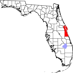 | |
| Towns | ||
| CDPs | ||
| Unincorporated communities | ||