Satellite Beach, Florida
| Satellite Beach, Florida | |
|---|---|
| City | |
| City of Satellite Beach | |
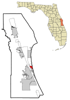 Location in Brevard County and the state of Florida | |
| Coordinates: 28°10′24″N 80°35′48″W / 28.17333°N 80.59667°WCoordinates: 28°10′24″N 80°35′48″W / 28.17333°N 80.59667°W | |
| Country |
|
| State |
|
| County |
|
| Area | |
| • Total | 4.3 sq mi (11.1 km2) |
| • Land | 2.9 sq mi (7.6 km2) |
| • Water | 1.4 sq mi (3.5 km2) |
| Elevation | 13 ft (4 m) |
| Population (2010) | |
| • Total | 10,109 |
| • Density | 2,400/sq mi (910/km2) |
| Time zone | Eastern (EST) (UTC-5) |
| • Summer (DST) | EDT (UTC-4) |
| ZIP code | 32937 |
| Area code(s) | 321 |
| FIPS code | 12-64400[1] |
| GNIS feature ID | 0290694[2] |
| Website |
www |
Satellite Beach is a coastal city situated in Brevard County, Florida. The population was 10,109 at the 2010 United States Census,[3] and it is located with the Atlantic Ocean to the east and the Indian River to the west.
Satellite Beach is part of the Palm Bay–Melbourne–Titusville Metropolitan Statistical Area.
Geography
Satellite Beach is located at 28°10′24″N 80°35′48″W / 28.17333°N 80.59667°W (28.173441, -80.596674).[4] According to the United States Census Bureau, the city has a total area of 4.3 square miles (11.1 km2). 2.9 square miles (7.6 km2) of it is land and 1.4 square miles (3.5 km2) of it (31.94%) is water.[5]
The Atlantic Ocean forms its eastern border; the Indian River the western border. It is located on the local barrier island. It is part of the South Beaches.
With both ocean and river frontage, the city is the largest beachside community in South Brevard County.[6] There are 7.7 miles (12.4 km) of shoreline in the City, including 2.8 miles (4.5 km) of Atlantic Ocean beach, 1.3 miles (2.1 km) of Banana River shoreline, and 3.6 miles (5.8 km) of shoreline fronting navigable canals connected to the Banana River.[7]
Climate
Satellite Beach is located in the region where tropical and temperate climatic zones overlap. A study commissioned by NASA[8] lends credence to the perception that Satellite Beach is located in a portion of the North American Atlantic shoreline with a reduced incidence of catastrophic hurricanes.[9] Extremes range from 24 °F (−4 °C) on December 24, 1989[10] to 99 °F (37 °C) on July 15, 1981.[11]
| Climate data for Satellite Beach (Patrick Air Force Base, 1945-2015) | |||||||||||||
|---|---|---|---|---|---|---|---|---|---|---|---|---|---|
| Month | Jan | Feb | Mar | Apr | May | Jun | Jul | Aug | Sep | Oct | Nov | Dec | Year |
| Record high °F (°C) | 86 (30) |
88 (31) |
93 (34) |
96 (36) |
96 (36) |
98 (37) |
99 (37) |
98 (37) |
95 (35) |
93 (34) |
90 (32) |
86 (30) |
99 (37) |
| Average high °F (°C) | 69 (21) |
70 (21) |
74 (23) |
78 (26) |
82 (28) |
86 (30) |
87 (31) |
87 (31) |
86 (30) |
82 (28) |
76 (24) |
71 (22) |
79 (26.3) |
| Average low °F (°C) | 56 (13) |
57 (14) |
62 (17) |
67 (19) |
72 (22) |
75 (24) |
77 (25) |
77 (25) |
77 (25) |
73 (23) |
65 (18) |
59 (15) |
68.1 (20) |
| Record low °F (°C) | 25 (−4) |
32 (0) |
29 (−2) |
46 (8) |
53 (12) |
66 (19) |
67 (19) |
68 (20) |
57 (14) |
49 (9) |
33 (1) |
24 (−4) |
24 (−4) |
| Average precipitation inches (mm) | 1.29 (32.8) |
1.62 (41.1) |
1.53 (38.9) |
1.60 (40.6) |
2.34 (59.4) |
4.87 (123.7) |
4.46 (113.3) |
3.89 (98.8) |
5.16 (131.1) |
2.89 (73.4) |
1.90 (48.3) |
1.61 (40.9) |
33.16 (842.3) |
| Source: Weather Underground[12] | |||||||||||||
Fauna


Threatened Atlantic loggerhead sea turtles nest on the city's ocean beaches at densities of approximately one nest per 10 feet (3.0 m) of shoreline per year. Endangered green sea turtles deposit an average of tens of nests along the city's ocean beach each year.
Endangered North Atlantic right whales calve off the city's shoreline. Endangered West Indian manatees frequent the city's canals and the Banana River. Bald eagles forage over Samsons Island.
The 12 acres (4.9 ha) of wetland created as mitigation by a local developer on Samsons Island provide nutrient-rich, sheltered aquatic habitat serving as finfish nursery and feeding ground for a diverse assemblage of birds and mammals. The city established Samsons Island Nature Park, the only gopher tortoise relocation recipient site on the barrier island. It is occupied by 42 relocated tortoises and three which had been living on the island when development began. The city has erected five osprey nesting platforms on Samsons Island Nature Park, from which young have been fledged. Efforts are now under way to create habitat for use by gopher tortoises and scrub jays. The city is working with faculty of the Florida Institute of Technology to promote graduate student research and class projects on Samsons Island Nature Park and to assist in devising and implementing maintenance programs to preserve and enhance desirable wildlife habitats.[13]
Flora

Due to the moderating influence of surrounding water bodies, the climate on the barrier island supports tropical species of plants normally found far to the south. Brevard County's barrier island to, approximately, Cape Canaveral, constitutes the northernmost limit of the range of many of these plant species. At the same time, the infrequency and mildness of freezes in the Central Florida region serves to define the southern limit of many plants found in temperate zones. Thus, the barrier island in the vicinity of Satellite Beach represents a unique climatological region which sustains unique habitats characterized by mixed tropical and temperate plant species, in addition to a significant number of endemic species only found in the local region.[13]
There are plant species which now grow naturally, or were present prior to development, within the boundaries of Satellite Beach.[14] Vegetated sand dunes are found along most of the beach's length and provide the major defense against storm events. Native plant species found on the dunes include sea oats, Sabal palmetto, sea grape, railroad vine, dollar weed, coral bean, Spanish bayonet, wax myrtle, yaupon holly, and several grass species. More salt-tolerant and wind-tolerant species, such as sea oats and railroad vine, are found predominantly on the ocean side of the dune, while other dune vegetation species do not generally show such zonation. These plants assist in building the dune by trapping windblown sand and in stabilizing the dune with extensive lateral root systems.[13]
Geology
There are approximately 10 acres (4.0 ha) of coquina rock outcrops frequently exposed along the low-tide line of the city's ocean beach. The National Marine Fisheries Service has classified the rock as an Essential Fish Habitat-Habitat Area of Particular Concern. It is important to aquatic life and found only in a few locations along the Eastern seaboard.
On the city's ocean beach can be found fossil Atlantic ghost crabs, the remnants of a unique set of geological circumstances which preserved these creatures when they died in their burrows perhaps about 110,000 years ago.
There are significant deposits of sand, marl, coquina and possibly phosphate within the city limits. There are no mining operations, as municipal zoning regulations prohibit mineral extraction. State licensing of mineral extraction activities on the coastal barrier island provides additional control of such activity. Finally, the cost of land within the city makes commercial extraction of minerals uneconomical.[13]
Surrounding areas
 |
South Patrick Shores | | ||
| Banana River; Merritt Island; Tropic | |
Atlantic Ocean | ||
| ||||
| | ||||
| Indian Harbour Beach |
History
In 1994, Satellite Beach was awarded the first annual Florida Excellence in Coastal Management Award. The city continued to develop its oceanfront.
Volunteers have provided more than 10,000 hours each year to youth and public service programs.[15]
Xeric scrub around the local county library, until the late 1990s, hosted a family of threatened Florida scrub jays.
In 2010, the city began planning for a rise in sea level resulting from global warming.[16]
In 2011, the city became one of a few areas in the United States participating in an initiative to install solar panels on municipal buildings.[17]
The city and FDOT (Florida Department of Transportation) have entered into a Joint Participation Agreement to fund landscaping along the South Patrick Drive corridor in the city. Under the terms of the agreement, FDOT will reimburse the city for landscaping improvements.[18]
In July 2013, State Representative John Tobia received permission to build a beach house on Shell Street in Satellite Beach. This has led to an increase in real estate value in neighboring areas.[19]
In 2013, the city announced that it will undertake $36 million worth of work to restore beach areas and dunes along the coast, to areas battered by hurricanes in 2004. There were some concerns about reef fragility. The project is financially supported by Brevard County and the Florida Department of Environmental Protection.[20][21]
On December 4, 2013, there was a parade in celebration of the Jewish holiday of Hanukkah.[22] There were one hundred Menorah-topped vehicles, a Menorah lighting, free food (including traditional Latkes), and live entertainment.[23][24][25]
The annual Ocean, Reef and Beach Festival is organized by the Surfrider Foundation, Pure Ocean TV Productions and Anglers for Conservation.[26][27]
The Banana River Sail and Power Squadron will sponsor the 2013 Holiday Boat Parade. Boats will assemble at sunset at the north end of Satellite Beach’s Grand Canal and travel south, circle Lake Shepherd, and continue to Mathers Bridge.[28][29]
On December 20, 2013, the city announced plans to build a beachside trail that would allow people to walk, jog and cycle along the coast. The proposed trail would run along the dunes south from Fischer Park. The beachside trail would hook up to the proposed 40 miles (64 km) “A1A Urban Trail.”[30][31]
The City's Public Works Department announced plans to make segment repairs to an array of walkways in early 2014. The Public Works Department plans to continue to improve beach access and infrastructure. The project includes plans to install decorative paved brick crosswalks, sidewalks, new showers, bike racks, palm trees, updated signage, and a new park.[32]
Demographics
| Historical population | |||
|---|---|---|---|
| Census | Pop. | %± | |
| 1960 | 825 | — | |
| 1970 | 6,558 | 694.9% | |
| 1980 | 9,163 | 39.7% | |
| 1990 | 9,889 | 7.9% | |
| 2000 | 9,577 | −3.2% | |
| 2010 | 10,109 | 5.6% | |
| Est. 2015 | 10,633 | [33] | 5.2% |
As of the census[1] of 2000, there were 9,577 people, 3,952 households, and 2,877 families residing in the city. The population density was 4,030.6 inhabitants per square mile (1,553.7/km2). There were 4,257 housing units at an average density of 1,791.6 per square mile (690.6/km2). The racial makeup of the city was 94.99% White, 1.02% African American, 0.18% Native American, 1.55% Asian, 0.03% Pacific Islander, 0.67% from other races, and 1.57% from two or more races. Hispanic or Latino of any race were 2.95% of the population. Of the city’s 7,444 residents who are 25 or older, approximately one in five hold a graduate or professional degree.[7]
The only traditional Jewish synagogue along the Brevard County coastline is in the city.[35]
There were 3,952 households out of which 26.8% had children under 18 living with them, 60.3% were married couples living together, 9.2% had a female householder with no husband present, and 27.2% were non-families. 22.5% of all households were made up of individuals and 10.7% had someone living alone who was 65 years of age or older. The average household size was 2.42 and the average family size was 2.83.
In the city the population was distributed by age groups as follows: 21.8% under the age of 18, 5.3% from 18 to 24, 23.0% from 25 to 44, 28.3% from 45 to 64, and 21.5% who were 65 years of age or older. The median age was 45 years. For every 100 females there were 95.0 males. For every 100 females age 18 and over, there were 92.3 males.
Government
In 2007, the city had a taxable real estate base of $877.12 million.[36]
The city maintains an active list of about 80 volunteers ("Neighbor Helping Neighbor" program) who helps out where requested, often senior citizens, whose mobility is impaired.[37]
Education
The city has the following schools
- Public schools:
- DeLaura Middle School[38]
- Satellite High School
- Holland Elementary
- Surfside Elementary
- Seapark Elementary
- Private schools:
- Chabad Hebrew School
- Torah Academy Preschool.[39]
Recreation
The city has several parks, recreational facilities and natural landscapes.
In 2013, Hightower Beach Park was renovated by a community partnership with Montecito Community Development District and state funds from the Florida Preservation 2000 and Florida Land and Water grant programs. The 15 acres (6.1 ha) park contains the natural dune system and has a boardwalk along the coastline. Surfers use the beach.
RC's Beach and Buccaneer Beach are named for a former Royal Castle hamburger kiosk and the Buccaneer Condos, respectively. They are used for surfing.[40]
Coconut Point Park is a 36.9-acre (14.9 ha) community beachside park and sea turtle nesting site. The park is listed in the state of Florida Great Florida Birding Trail. Shorebirds include black-bellied plovers, red knots (winter), gannets, seabirds (offshore), and red-throated loons (winter).[41]
The David R. Schechter Community Center is a recreational community center. It hosts gatherings, community special events, classes, programs, and other activities.
Pelican Beach Park was renovated in 2007. During the summer months, the Sea Turtle Preservation Society conducts weekly sea turtle tours. The north dune crossover is called “Pelican” by the local surfers.
DeSoto Park features eight tennis courts as well as two enclosed racquetball courts.
Samsons Island is a 52-acre (21 ha) park. It was renovated from an island overrun with exotic plants. Volunteers have worked since 1991 to develop it. It is only accessible by boat. There are butterflies, gopher tortoises, armadillos, squirrels and snakes — black racers and coachwhips. There are 30 species of birds. The island contains trails, bird watching, camping areas, wildlife, and picnic areas.[42] Samsons Island has trails for biking and hiking.
The Satellite Beach Sports and Recreation Park contains 35 acres (14 ha). It has a walking trail, skate park, dog park, frisbee fields, soccer fields and volleyball courts.
Gemini Beach Park is a 2 acres (0.81 ha) park nestled between Ellwood and Park Avenue and contains dunes, sea turtles, and birdlife.[43]
Economy
Personal income
In 2011, the median income for a household in the city was $60,870, and median family income was $75,159. 25% of households and 32% of families made more than $100,000. Males had a median income of $42,079 versus $28,259 for females. The per capita income for the city was $27,181. About 2.7% of families and 4.5% of the population were below the poverty line, including 4.2% of those under age 18 and 4.8% of those age 65 or over.
Industry
Satellite Beach Technology Company designs and develops biometric security systems. This industry generates approximately $1.5 billion revenue each year.[44]
A company Lighting Sciences Group manufactures LED light bulbs locally.[45] It employs 400 people.[46] The company was recently featured in Deloitte’s Technology Fast 500, a ranking of the 500 fastest growing technology, media, telecommunications, life sciences and clean technology companies in North America.[47]
Notable people
- Buzz Aldrin[48]
- John Antoon II, United States District Court judge
- LtGen Alexander R. Bolling, commander of the 84th Infantry Division in World War II and later commander of the Third Army
- David Max Eichhorn, Jewish philosopher, contributing author to Encyclopædia Britannica, Chaplain in the US Army whose company liberated Dachau concentration camp. Resided in Satellite Beach.[49][50]
- Larry Guarino, spent 8 years as a POW in the Hanoi Hilton during the Vietnam War
- C. J. Hobgood, 2001 ASP World Champion Surfer [51]
- Damien Hobgood, professional surfer
- Kelly Kretschman, USA Woman's Softball Team gold medalist [52]
- Nicholas Lindheim, professional golfer
- Ryan Ludwick, left fielder for Cincinnati Reds baseball team; born here on July 13, 1978
- Jefferson W. Speck, Arkansas politician and World War II prisoner of war, resided in Satellite Beach in the early 1970s
- Leonard Weaver, fullback for Philadelphia Eagles; played football at Satellite High School
References
- 1 2 "American FactFinder". United States Census Bureau. Archived from the original on 2013-09-11. Retrieved 2008-01-31.
- ↑ "US Board on Geographic Names". United States Geological Survey. 2007-10-25. Retrieved 2008-01-31.
- ↑ "Profile of General Population and Housing Characteristics: 2010 Demographic Profile Data (DP-1): Satellite Beach city, Florida". U.S. Census Bureau, American Factfinder. Archived from the original on September 11, 2013. Retrieved January 30, 2012.
- ↑ "US Gazetteer files: 2010, 2000, and 1990". United States Census Bureau. 2011-02-12. Retrieved 2011-04-23.
- ↑ "Geographic Identifiers: 2010 Demographic Profile Data (G001): Satellite Beach city, Florida". U.S. Census Bureau, American Factfinder. Archived from the original on September 11, 2013. Retrieved January 30, 2012.
- ↑ "Nautical notes". Florida Today. 29 December 2006.
- 1 2
- ↑ published in June 2000 (Wind and Flood Hazard Assessment of Critical NASA Assets at the Kennedy Space Center)
- ↑ Archived August 30, 2006, at the Wayback Machine.
- ↑ "December Weather for Cocoa Beach, FL | Weather Underground". www.wunderground.com. Retrieved 2015-12-15.
- ↑ "July Weather for Cocoa Beach, FL | Weather Underground". www.wunderground.com. Retrieved 2015-12-15.
- ↑ http://www.wunderground.com/weather-forecast/zmw:32925.1.99999
- 1 2 3 4 http://www.satellitebeach.org/boards/cpab/CompPlan/D&A%205%20Coastal%20Management-Conservation%20Element.doc. Retrieved August 3, 2015. Missing or empty
|title=(help) - ↑ Archived August 30, 2006, at the Wayback Machine.
- ↑ Archived September 27, 2011, at the Wayback Machine.
- ↑ "Florida Today". FLORIDA TODAY. Retrieved 17 November 2014.
- ↑ "Local News - FLORIDA TODAY - floridatoday.com". FLORIDA TODAY. Retrieved 17 November 2014.
- ↑
- ↑ "Local News - FLORIDA TODAY - floridatoday.com". FLORIDA TODAY. Retrieved 17 November 2014.
- ↑ "Beach debate rolls on over Brevard's Mid-Reach project | News - Home". Clickorlando.com. 2012-05-06. Retrieved 2014-02-20.
- ↑ "New month ushers in shoreline projects". Retrieved 17 November 2014.
- ↑ Times, Brevard (2013-11-22). "Brevard Times: 2013 Grand Menorah Parade Hanukkah Celebration December 4". News.brevardtimes.com. Retrieved 2013-12-12.
- ↑ "Local News - FLORIDA TODAY - floridatoday.com". FLORIDA TODAY. Retrieved 17 November 2014.
- ↑ "Chanukah Menorah Car Parade | Brevard Happening". Brevard.happeningmag.com. 2012-12-10. Retrieved 2013-12-12.
- ↑ "Chanukah Menorah Car Parade". www.wftv.com. 2011-12-22. Retrieved 2013-12-12.
- ↑ "Outdoors/Rec Sports - FLORIDA TODAY - floridatoday.com". FLORIDA TODAY. Retrieved 17 November 2014.
- ↑ "2013 Ocean Reef Beach Festival". Pure Ocean TV. Retrieved 2013-12-12.
- ↑
- ↑ "Banana River Sail & Power Squadron - Home Port". Bananariversps.org. Retrieved 2013-12-12.
- ↑
- ↑
- ↑
- ↑ "Annual Estimates of the Resident Population for Incorporated Places: April 1, 2010 to July 1, 2015". Retrieved July 2, 2016.
- ↑ "Census of Population and Housing". Census.gov. Archived from the original on May 11, 2015. Retrieved June 4, 2015.
- ↑ Welcome to JewishBrevard.com | Chabad of the Space & Treasure Coasts. Jewishbrevard.com. Retrieved on 2013-09-18.
- ↑ Dean, James (April 26, 2008). More taxes or fewer services. Florida Today.
- ↑
- ↑ "DeLaura Middle School". Edline. Retrieved 17 November 2014.
- ↑ Hebrew School - Chabad of the Space & Treasure Coasts. Jewishbrevard.com. Retrieved on 2013-09-18.
- ↑ "Central Florida Surfing". TheSurfingSite.com. 2008. Retrieved 10 June 2014.
- ↑ "Coconut Point Park". Brevard County. Brevard County Government. Retrieved 18 January 2016.
- ↑ "Local News - FLORIDA TODAY - floridatoday.com". FLORIDA TODAY. Retrieved 17 November 2014.
- ↑ "Beach Parks". Satellitebeachrecreation.org. Retrieved 2013-12-12.
- ↑ "Business - FLORIDA TODAY - floridatoday.com". FLORIDA TODAY. Retrieved 17 November 2014.
- ↑ Peterson, Patrick (14 December 2010). "Satellite Beach firm to sell 6-watt LED". Melbourne, Florida: Florida Today. pp. 6C.
- ↑ Peterson, Patrick (4 January 2010). "Lighting firm exec dies while cycling". Melbourne, Florida: Florida Today. pp. 6C.
- ↑ "Business - FLORIDA TODAY - floridatoday.com". FLORIDA TODAY. Retrieved 17 November 2014.
- ↑ "'Ailing' Buzz Aldrin recuperating". Florida Today. Melbourne, Florida. December 2, 2016. pp. 1A. Retrieved December 2, 2016.
|first1=missing|last1=in Authors list (help) - ↑ "Rabbi David Eichhorn". NYTimes.com. 1986-07-23. Retrieved 2014-02-20.
- ↑ Cain, Son of the Serpent - David Max Eichhorn - Google Boeken. Books.google.com. 1985-03-25. Retrieved 2014-02-20.
- ↑ http://surf.transworld.net/1000001374/features/cj-hobgood-is-the-2001-asp-world-champion/
- ↑ http://www.teamusa.org/USA-Softball/Team-USA/History/Women
External links
| Wikimedia Commons has media related to Satellite Beach, Florida. |
Municipalities and communities of Brevard County, Florida, United States | ||
|---|---|---|
| Cities |  | |
| Towns | ||
| CDPs | ||
| Unincorporated communities | ||