IB-18 highway (Serbia)
| ||||
|---|---|---|---|---|
|
Државни пут IБ реда 18 Državni put IB reda 18 | ||||
 | ||||
| Route information | ||||
|
Part of | ||||
| Maintained by JP "Putevi Srbije" | ||||
| Length: | 134.422 km (83.526 mi) | |||
| Major junctions | ||||
| From: |
Zrenjanin | |||
| To: |
Serbia-Romania border at Kaluđerovo | |||
| Location | ||||
| Districts: | Central Banat, South Banat | |||
| Highway system | ||||
| ||||

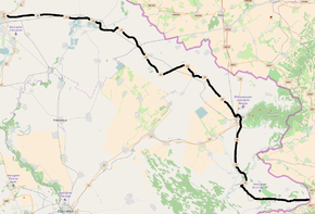
National/State Road 18, is an IB-class road in northern Serbia, connecting Zrenjanin with Romania at Kaluđerovo. It is located in Vojvodina.[1]
Before the new road categorization regulation given in 2013, the route wore the following names: M 7.1, M 1.9 and P 126 (before 2012) / 20, A3, 114 and 112 (after 2012).[2][3]
The existing route is a main road with two traffic lanes. By the valid Space Plan of Republic of Serbia the road is not planned for upgrading to motorway, and is expected to be conditioned in its current state.[4]
Section from Vršac (Plandište) to Vršac (Straža) is a part of European route E70.
Sections
| Section number | Length | Distance | Section name |
|---|---|---|---|
| 01801 | 22.248 km (13.824 mi) | 22.248 km (13.824 mi) | Zrenjanin (Sečanj) - Sutjeska (Sečanj) |
| 01802 | 6.297 km (3.913 mi) | 28.545 km (17.737 mi) | Sutjeska (Sečanj) - Sečanj (Jaša Tomić) |
| 01803 | 1.374 km (0.854 mi) | 29.919 km (18.591 mi) | Sečanj (Jaša Tomić) - Sečanj (Neuzina) |
| 01804 | 37.727 km (23.442 mi) | 67.646 km (42.033 mi) | Sečanj (Neuzina) - Plandište |
| 01014 | 19.043 km (11.833 mi) | 86.689 km (53.866 mi) | Plandište - Vršac (Plandište) |
| 01805 | 0.741 km (0.460 mi) | 87.430 km (54.326 mi) | Vršac (Plandište) - Vršac (Straža) (overlap with |
| 01806 | 18.422 km (11.447 mi)/2.122 km (1.319 mi) | 105.852 km (65.773 mi) | Vršac (Straža) - Straža |
| 01807 | 17.118 km (10.637 mi) | 122.970 km (76.410 mi) | Straža - Bela Crkva |
| 01808 | 11.452 km (7.116 mi) | 134.422 km (83.526 mi) | Bela Crkva - Serbia-Romania border (Kaluđerovo) |
See also
References
- ↑ "Republic of Serbia - national road network" (PDF). Putevi Srbije (in Serbian).
- ↑ "National road categorization regulation - Official Gazette of Republic of Serbia no. 105/2013 and 119/2013" (PDF). Serbian Spatial Planners Association (in Serbian).
- ↑ "Link between actual and previous section and road markings" (PDF). Putevi Srbije (in Serbian).
- ↑ Space plan of Republic of Serbia from 2010 to 2021
External links
- Official website - Roads of Serbia (Putevi Srbije)
- Official website - Corridors of Serbia (Koridori Srbije) (Serbian)
This article is issued from Wikipedia - version of the 11/10/2016. The text is available under the Creative Commons Attribution/Share Alike but additional terms may apply for the media files.