IB-10 highway (Serbia)
Аутопут Београд-Ватин Autoput Beograd-Vatin | ||||
|---|---|---|---|---|
|
Државни пут IБ реда 10 Državni put IB reda 10 | ||||
 | ||||
| Route information | ||||
|
Part of | ||||
| Maintained by JP "Putevi Srbije" | ||||
| Length: | 91.463 km (56.832 mi) | |||
| Major junctions | ||||
| From: |
Belgrade | |||
| To: |
Serbia-Romania border at Vatin, | |||
| Location | ||||
| Districts: | City of Belgrade, South Banat | |||
| Highway system | ||||
| ||||

Аутопут Београд-Ватин Autoput Beograd-Vatin | ||||
|---|---|---|---|---|
|
Брзи пут 10 Brzi put 10 | ||||
 | ||||
| Route information | ||||
|
Part of | ||||
| Maintained by JP "Putevi Srbije" | ||||
| Length: | 8.078 km (5.019 mi) | |||
| Major junctions | ||||
| From: |
Belgrade | |||
| To: |
Vojvodina border (Pančevo) | |||
| Location | ||||
| Districts: | City of Belgrade, South Banat | |||
| Highway system | ||||
| ||||

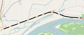
National/State Road 10, or referred to as Belgrade-Vatin Highway (Serbian: Аутопут Београд-Ватин / Autoput Beograd-Vatin), is an IB-class/expressway road in northeastern Serbia, which connects Belgrade and northern part of the country with Romania. It is located in Vojvodina and City of Belgrade regions.[1]
Before the new road categorization regulation given in 2013, the route wore the names М 1.9 (before 2012) / A3 (after 2012).[2][3]
The existing route is a main road with two traffic lanes, except for Belgrade (printing company) - Pančevo (Kovačica) section, which is built in dual-carriageway 2+1 configuration, similar to expressway. By the valid Space Plan of Republic of Serbia the motorway construction is planned, side-by-side with the existing route, and is expected to be completed by 2020.[4]
The road is a part of European route E70.
Sections
| Section number | Length (km) | Distance (km) | Section name |
|---|---|---|---|
| 01001/01002 | 5.216 | 5.216 | Belgrade (printing company) - Pančevo interchange |
| 01003/01004 | 2.862 | 8.078 | Pančevo interchange - Vojvodina border (Pančevo) |
| 01005/01006 | 5.038 | 13.116 | Vojvodina border (Pančevo) - Pančevo (Kovin) |
| 01007/01008 | 1.257 | 14.373 | Pančevo (Kovin) - Pančevo (Kovačica) |
| 01009 | 31.823/0.106 | 46.196 | Pančevo (Kovačica) - Alibunar (Plandište) |
| 01010 | 5.196 | 51.392 | Alibunar (Plandište) - Banatski Karlovac (Alibunar) |
| 01011 | 0.308 | 51.700 | Banatski Karlovac (Alibunar) - Banatski Karlovac (Devojački Bunar) |
| 01012 | 11.593 | 63.293 | Banatski Karlovac (Devojački Bunar) - Uljma |
| 01013 | 14.920/0.584 | 78.213 | Uljma - Vršac (Plandište) |
| 01014 | 0.741 | 78.954 | Vršac (Plandište) - Vršac (Straža) |
| 01015 | 12.509 | 91.463 | Vršac (Straža) - Serbia-Romania border (Vatin) |
Planned motorway
By the valid Space Plan of Republic of Serbia the motorway construction is planned side-by-side with the existing National Road IB-10. The given section would start at Belgrade bypass (which would include Pančevo from the "Pančevo-north" interchange), and end at the border with Romania. The planned highway would go south of existing route until Alibunar, and then north until Vatin, where it would be connected with Romanian road network. By that, the existing section would be shortened.
See also
References
- ↑ "Republic of Serbia - national road network" (PDF). Putevi Srbije (in Serbian).
- ↑ "National road categorization regulation - Official Gazette of Republic of Serbia no. 105/2013 and 119/2013" (PDF). Serbian Spatial Planners Association (in Serbian).
- ↑ "Link between actual and previous section and road markings" (PDF). Putevi Srbije (in Serbian).
- ↑ Space plan of Republic of Serbia from 2010 to 2021
External links
- Official website - Roads of Serbia (Putevi Srbije)
- Official website - Corridors of Serbia (Koridori Srbije) (Serbian)