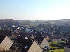
Houx
| Houx | ||
|---|---|---|
 | ||
| ||
 Houx | ||
|
Location within Centre-Val de Loire region  Houx | ||
| Coordinates: 48°33′58″N 1°37′12″E / 48.5661°N 1.62°ECoordinates: 48°33′58″N 1°37′12″E / 48.5661°N 1.62°E | ||
| Country | France | |
| Region | Centre-Val de Loire | |
| Department | Eure-et-Loir | |
| Arrondissement | Chartres | |
| Canton | Maintenon | |
| Intercommunality | Terrasses et Vallées de Maintenon | |
| Government | ||
| • Mayor (2008–2014) | Jean-François Pichery | |
| Area1 | 6.24 km2 (2.41 sq mi) | |
| Population (2008)2 | 797 | |
| • Density | 130/km2 (330/sq mi) | |
| Time zone | CET (UTC+1) | |
| • Summer (DST) | CEST (UTC+2) | |
| INSEE/Postal code | 28195 / 28130 | |
| Elevation | 102–142 m (335–466 ft) | |
| Website | http://www.houx.fr/ | |
|
1 French Land Register data, which excludes lakes, ponds, glaciers > 1 km² (0.386 sq mi or 247 acres) and river estuaries. 2 Population without double counting: residents of multiple communes (e.g., students and military personnel) only counted once. | ||
.svg.png)
Houx is a commune in the Eure-et-Loir department in northern France, located 79 km from Paris and 20 km from Chartres.
Population
| Historical population | ||
|---|---|---|
| Year | Pop. | ±% |
| 1962 | 213 | — |
| 1968 | 240 | +12.7% |
| 1975 | 260 | +8.3% |
| 1982 | 303 | +16.5% |
| 1990 | 428 | +41.3% |
| 1999 | 653 | +52.6% |
| 2008 | 797 | +22.1% |
See also
References
| Wikimedia Commons has media related to Houx (Eure-et-Loir). |
This article is issued from Wikipedia - version of the 2/12/2016. The text is available under the Creative Commons Attribution/Share Alike but additional terms may apply for the media files.