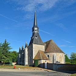
Alluyes
| Alluyes | |
|---|---|
 | |
 Alluyes | |
|
Location within Centre-Val de Loire region  Alluyes | |
| Coordinates: 48°13′47″N 1°21′42″E / 48.2297°N 1.3617°ECoordinates: 48°13′47″N 1°21′42″E / 48.2297°N 1.3617°E | |
| Country | France |
| Region | Centre-Val de Loire |
| Department | Eure-et-Loir |
| Arrondissement | Châteaudun |
| Canton | Bonneval |
| Intercommunality | Bonnevalais |
| Government | |
| • Mayor (2008–2014) | Bernard Mercuzot |
| Area1 | 19.58 km2 (7.56 sq mi) |
| Population (2008)2 | 702 |
| • Density | 36/km2 (93/sq mi) |
| Time zone | CET (UTC+1) |
| • Summer (DST) | CEST (UTC+2) |
| INSEE/Postal code | 28005 / 28800 |
| Elevation |
121–154 m (397–505 ft) (avg. 129 m or 423 ft) |
|
1 French Land Register data, which excludes lakes, ponds, glaciers > 1 km² (0.386 sq mi or 247 acres) and river estuaries. 2 Population without double counting: residents of multiple communes (e.g., students and military personnel) only counted once. | |
Alluyes is a commune in the Eure-et-Loir department in northern France.
Population
| Historical population | ||
|---|---|---|
| Year | Pop. | ±% |
| 1962 | 703 | — |
| 1968 | 720 | +2.4% |
| 1975 | 692 | −3.9% |
| 1982 | 548 | −20.8% |
| 1990 | 577 | +5.3% |
| 1999 | 619 | +7.3% |
| 2008 | 702 | +13.4% |
See also
References
| Wikimedia Commons has media related to Alluyes. |
This article is issued from Wikipedia - version of the 3/15/2016. The text is available under the Creative Commons Attribution/Share Alike but additional terms may apply for the media files.