Châtillon-en-Dunois
| Châtillon-en-Dunois | |
|---|---|
|
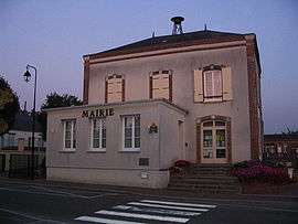
Town hall | |
 Châtillon-en-Dunois | |
|
Location within Centre-Val de Loire region  Châtillon-en-Dunois | |
| Coordinates: 48°07′00″N 1°11′15″E / 48.1167°N 1.1875°ECoordinates: 48°07′00″N 1°11′15″E / 48.1167°N 1.1875°E | |
| Country | France |
| Region | Centre-Val de Loire |
| Department | Eure-et-Loir |
| Arrondissement | Châteaudun |
| Canton | Cloyes-sur-le-Loir |
| Intercommunality | Trois Rivières |
| Government | |
| • Mayor (2008–2014) | Claude Térouinard |
| Area1 | 37.19 km2 (14.36 sq mi) |
| Population (2008)2 | 753 |
| • Density | 20/km2 (52/sq mi) |
| Time zone | CET (UTC+1) |
| • Summer (DST) | CEST (UTC+2) |
| INSEE/Postal code | 28093 / 28290 |
| Elevation |
144–182 m (472–597 ft) (avg. 172 m or 564 ft) |
|
1 French Land Register data, which excludes lakes, ponds, glaciers > 1 km² (0.386 sq mi or 247 acres) and river estuaries. 2 Population without double counting: residents of multiple communes (e.g., students and military personnel) only counted once. | |
Châtillon-en-Dunois is a commune in the Eure-et-Loir department in northern France.
Population
| Historical population | ||
|---|---|---|
| Year | Pop. | ±% |
| 1962 | 1,028 | — |
| 1968 | 967 | −5.9% |
| 1975 | 813 | −15.9% |
| 1982 | 752 | −7.5% |
| 1990 | 739 | −1.7% |
| 1999 | 716 | −3.1% |
| 2008 | 753 | +5.2% |
See also
References
| Wikimedia Commons has media related to Châtillon-en-Dunois. |
This article is issued from Wikipedia - version of the 11/15/2013. The text is available under the Creative Commons Attribution/Share Alike but additional terms may apply for the media files.