Hokes Bluff, Alabama
| Hokes Bluff, Alabama | |
|---|---|
| City | |
 Location in Etowah County and the state of Alabama | |
| Coordinates: 34°00′N 85°52′W / 34.000°N 85.867°W | |
| Country | United States |
| State | Alabama |
| County | Etowah |
| Area | |
| • Total | 12.1 sq mi (31.4 km2) |
| • Land | 11.9 sq mi (30.9 km2) |
| • Water | 0.2 sq mi (0.4 km2) |
| Elevation | 587 ft (179 m) |
| Population (2010) | |
| • Total | 4,286 |
| • Density | 359/sq mi (138.6/km2) |
| Time zone | Central (CST) (UTC-6) |
| • Summer (DST) | CDT (UTC-5) |
| ZIP code | 35903 |
| Area code(s) | 256 |
| FIPS code | 01-35392 |
| GNIS feature ID | 0155100 |
| Website |
www |
Hokes Bluff is a city in Etowah County, Alabama, United States. It is part of the Gadsden Metropolitan Statistical Area. At the 2010 census the population was 4,286.[1]
History
Hokes Bluff was established on a high bluff overlooking the Coosa River. The town was called "The Bluff", and was used as a lookout station for Native American tribes, as they could see a great distance across, up and down the Coosa River. Hokes Bluff was one the staging areas where the Cherokee were collected, and sent to Gunter's Landing (Guntersville), and west to Oklahoma on the Trail of Tears.
Settlers came into the area in the 1840s. Daniel Hoke Jr. was among the settlers, who came in 1850 and built a trading post and a blacksmith shop near the site of the bluff. The town was renamed "Hoke's Bluff" after him in 1853 by W.B. Wynne, a friend of Hoke. The town was raided and pillaged during the Civil War by raiding parties of both sides of the Union and the Confederacy. John Henry Wisdom, who became the "Paul Revere of the Confederacy" after making his famous ride from Gadsden to Rome during the Civil War, was a resident of Hokes Bluff.
A new mail route was established from Gadsden to Hokes Bluff in 1890. Before it was established, Hokes Bluff had poor mail service, receiving most mail by steamboat. The post office was established in 1877 and discontinued in 1931.
One legend associated with the town is about Tawannah Springs, the town's water supply. It is said that the springs are named for a Native American princess (Tawannah) who grieved herself to death after her cousin, Princess Noccalula, jumped herself to death at Noccalula Falls in Gadsden.
Hokes Bluff was incorporated in 1946 with a population of 1,200. W.B. Ford was the first mayor. In 1949, a water system was installed with a 75,000 gallon reservoir and 54 hydrants. In 1953, gas was installed in the town, and in 1956, the streets were paved.
Geography
Hokes Bluff is located in eastern Etowah County at 34°00′N 85°52′W / 34.000°N 85.867°W.[2] It is bordered to the west by the cities of Gadsden (the county seat) and Glencoe, and to the northwest by the Coosa River. U.S. Route 278 passes through the city, leading west 9 miles (14 km) to the center of Gadsden, and east 15 miles (24 km) to Piedmont.
According to the U.S. Census Bureau, the city of Hokes Bluff has a total area of 12.1 square miles (31.4 km2), of which 11.9 square miles (30.9 km2) is land and 0.2 square miles (0.4 km2), or 1.35%, is water.[1]
Demographics
| Historical population | |||
|---|---|---|---|
| Census | Pop. | %± | |
| 1950 | 1,158 | — | |
| 1960 | 1,619 | 39.8% | |
| 1970 | 2,133 | 31.7% | |
| 1980 | 3,216 | 50.8% | |
| 1990 | 3,739 | 16.3% | |
| 2000 | 4,149 | 11.0% | |
| 2010 | 4,286 | 3.3% | |
| Est. 2015 | 4,301 | [3] | 0.3% |
| U.S. Decennial Census[4] | |||
As of the census[5] of 2000, there were 4,149 people, 1,638 households, and 1,272 families residing in the city. The population density was 357.0 people per square mile (137.9/km²). There were 1,721 housing units at an average density of 148.1 per square mile (57.2/km²). The racial makeup of the city was 98.99% White, 0.10% Black or African American, 0.22% Native American, 0.07% Asian, 0.24% from other races, and 0.39% from two or more races. 0.46% of the population were Hispanic or Latino of any race.
There were 1,638 households out of which 32.1% had children under the age of 18 living with them, 67.6% were married couples living together, 7.3% had a female householder with no husband present, and 22.3% were non-families. 20.9% of all households were made up of individuals and 11.1% had someone living alone who was 65 years of age or older. The average household size was 2.53 and the average family size was 2.93.
In the city the population was spread out with 22.9% under the age of 18, 7.1% from 18 to 24, 28.0% from 25 to 44, 26.7% from 45 to 64, and 15.3% who were 65 years of age or older. The median age was 40 years. For every 100 females there were 93.7 males. For every 100 females age 18 and over, there were 89.2 males.
The median income for a household in the city was $37,923, and the median income for a family was $42,534. Males had a median income of $32,444 versus $26,513 for females. The per capita income for the city was $17,476. About 3.8% of families and 4.3% of the population were below the poverty line, including 6.0% of those under age 18 and 1.7% of those age 65 or over.
2010 census
As of the census[6] of 2010, there were 4,286 people, 1,747 households, and 1,287 families residing in the city. The population density was 351.6 people per square mile (135.6/km²). There were 1,846 housing units at an average density of 156.4 per square mile (60.3/km²). The racial makeup of the city was 98.5% White, 0.3% Black or African American, 0.1% Native American, 0.4% Asian, 0.1% from other races, and 0.5% from two or more races. 0.2% of the population were Hispanic or Latino of any race.
There were 1,747 households out of which 28.4% had children under the age of 18 living with them, 60.2% were married couples living together, 9.9% had a female householder with no husband present, and 26.3% were non-families. 23.8% of all households were made up of individuals and 11.7% had someone living alone who was 65 years of age or older. The average household size was 2.45 and the average family size was 2.88.
In the city the population was spread out with 21.7% under the age of 18, 6.6% from 18 to 24, 26.0% from 25 to 44, 28.3% from 45 to 64, and 17.4% who were 65 years of age or older. The median age was 42.3 years. For every 100 females there were 94.9 males. For every 100 females age 18 and over, there were 97.7 males.
The median income for a household in the city was $54,668, and the median income for a family was $67,857. Males had a median income of $47,424 versus $34,288 for females. The per capita income for the city was $26,375. About 1.6% of families and 4.1% of the population were below the poverty line, including 10.3% of those under age 18 and 1.9% of those age 65 or over.
Notable person
- Drake White, country music singer
Issac Haas, basketball player, Purdue Boilermakers, Junior as of 2016-2017 season
References
- 1 2 "Geographic Identifiers: 2010 Demographic Profile Data (G001): Hokes Bluff city, Alabama". American Factfinder. U.S. Census Bureau. Retrieved January 22, 2016.
- ↑ "US Gazetteer files: 2010, 2000, and 1990". United States Census Bureau. 2011-02-12. Retrieved 2011-04-23.
- ↑ "Annual Estimates of the Resident Population for Incorporated Places: April 1, 2010 to July 1, 2015". Retrieved July 2, 2016.
- ↑ "U.S. Decennial Census". Census.gov. Retrieved June 6, 2013.
- ↑ "American FactFinder". United States Census Bureau. Retrieved 2008-01-31.
- ↑ "American FactFinder". United States Census Bureau. Retrieved 2015-07-23.
External links
Coordinates: 33°59′36″N 85°51′54″W / 33.993449°N 85.865118°W
Municipalities and communities of Etowah County, Alabama, United States | ||
|---|---|---|
| Cities | 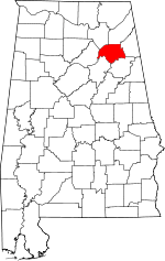 | |
| Towns | ||
| CDPs | ||
| Unincorporated communities | ||
| Footnotes | ‡This populated place also has portions in an adjacent county or counties | |