Rainbow City, Alabama
| Rainbow City, Alabama | |
|---|---|
| City | |
 Location in Etowah County and the state of Alabama | |
| Coordinates: 33°56′38″N 86°3′42″W / 33.94389°N 86.06167°W | |
| Country | United States |
| State | Alabama |
| County | Etowah |
| Area | |
| • Total | 25.6 sq mi (66.3 km2) |
| • Land | 25.4 sq mi (65.9 km2) |
| • Water | 0.2 sq mi (0.4 km2) |
| Elevation | 568 ft (173 m) |
| Population (2010) | |
| • Total | 9,602 |
| • Density | 377/sq mi (145.6/km2) |
| Time zone | Central (CST) (UTC-6) |
| • Summer (DST) | CDT (UTC-5) |
| ZIP codes | 35901, 35906 |
| Area code(s) | 256 |
| FIPS code | 01-63288 |
| GNIS feature ID | 0153101 |
| Website |
www |
Rainbow City is a city in Etowah County, Alabama, United States. It incorporated in 1950.[1] The population was 9,602 at the 2010 census.[2] It is part of the Gadsden Metropolitan Statistical Area.
History
This city was named after U.S. Highway 411, called Rainbow Drive, which runs through the middle of the city.[3] Some of the older citizens say it was named after the US 42nd Infantry Division, known as the "Rainbow Division".
As early as 1818, families from the Carolinas and Georgia began to migrate to the area and homestead land near the Coosa River. Hernando de Soto's troops were the first visitors to the area in 1540, and today a bridge stands where the Pensacola Trading Path crossed the Coosa River. A paved highway now traces the trail that was cut from Nashville to Horseshoe Bend by Andrew Jackson on his way to fight the Creek Native Americans in what is now known as the Battle of Horseshoe Bend.
Originally called "Coosa Bend", the area was later called "Morgan's Cross Road". It was located at the intersection of the Gadsden-Ashville Road and Gilbert's Ferry Road. The land was passed from Edmond Jones to his son Clayton, who never married. When he died, the land passed to his sister, Luvica Morgan, who was also the wife of William Morgan.
Knowing the importance of education, John Sheffield Jones, the grandson of Edmond Jones, an original settler, donated $1,000 and the land for the construction of the first John S. Jones Elementary School. Later, John S. Jones burned to the ground and a new elementary school was built and serves the Rainbow City area today. Rainbow Middle School and the Westbrook Christian School, also serve the Rainbow City students today.
On Saturday, April 2, 1831, a church was organized at the Harmony Meeting House. Thomas Morgan served as the first pastor. A few years later, the first Baptist association was organized by Rev. John Gilliland. Harmony was one of the first five members in the association. The adjoining cemetery, Old Harmony Cemetery, has been declared a historic landmark. This cemetery has black and white slaves buried in it, Native Americans, single and double interment, and most of the tombstones have poems and writings on them. They say one man is buried crosswise because he lived crosswise with the world.
Geography
Rainbow City is located in southern Etowah County at 33°56′38″N 86°3′42″W / 33.94389°N 86.06167°W (33.943964, -86.061546).[4] It is bordered to the northeast by Gadsden, the county seat, to the southeast by the Coosa River, across which is the city of Southside, and to the southwest, across Little Canoe Creek, by the town of Steele in St. Clair County.
U.S. Route 411 (Rainbow Drive) is the main road through the city, leading northeast 6 miles (10 km) to the center of Gadsden and southwest 15 miles (24 km) to Ashville. Alabama State Route 77 (Grand Avenue) crosses US 411 in the center of Rainbow City, leading northwest 4 miles (6 km) to Interstate 59 at Exit 181 and south 26 miles (42 km) to Lincoln.
According to the U.S. Census Bureau, Rainbow City has a total area of 25.6 square miles (66.3 km2), of which 25.4 square miles (65.9 km2) is land and 0.15 square miles (0.4 km2), or 0.58%, is water.[2]
Demographics
| Historical population | |||
|---|---|---|---|
| Census | Pop. | %± | |
| 1960 | 1,629 | — | |
| 1970 | 3,107 | 90.7% | |
| 1980 | 6,299 | 102.7% | |
| 1990 | 7,673 | 21.8% | |
| 2000 | 8,428 | 9.8% | |
| 2010 | 9,602 | 13.9% | |
| Est. 2015 | 9,580 | [5] | −0.2% |
| U.S. Decennial Census[6] | |||
As of the census[7] of 2000, there were 8,428 people, 3,586 households, and 2,517 families residing in the city. The population density was 335.3 people per square mile (129.5/km²). There were 3,824 housing units at an average density of 152.1 per square mile (58.8/km²). The racial makeup of the city was 93.09% White, 3.51% Black or African American, 0.34% Native American, 1.45% Asian, 0.51% from other races, and 1.09% from two or more races. 1.45% of the population were Hispanic or Latino of any race.
There were 3,586 households out of which 30.6% had children under the age of 18 living with them, 56.9% were married couples living together, 11.0% had a female householder with no husband present, and 29.8% were non-families. 27.0% of all households were made up of individuals and 10.6% had someone living alone who was 65 years of age or older. The average household size was 2.35 and the average family size was 2.84.
In the city the population was spread out with 23.0% under the age of 18, 8.0% from 18 to 24, 28.8% from 25 to 44, 25.7% from 45 to 64, and 14.6% who were 65 years of age or older. The median age was 39 years. For every 100 females there were 89.9 males. For every 100 females age 18 and over, there were 87.2 males.
The median income for a household in the city was $40,216, and the median income for a family was $50,844. Males had a median income of $38,278 versus $26,483 for females. The per capita income for the city was $20,860. About 6.9% of families and 8.4% of the population were below the poverty line, including 9.7% of those under age 18 and 7.5% of those age 65 or over.
2010 census
As of the census[8] of 2010, there were 9,602 people, 4,113 households, and 2,721 families residing in the city. The population density was 333.1 people per square mile (128.5/km²). There were 4,534 housing units at an average density of 179.2 per square mile (69.1/km²). The racial makeup of the city was 87.4% White, 7.2% Black or African American, 0.4% Native American, 2.6% Asian, 1.0% from other races, and 1.4% from two or more races. 2.4% of the population were Hispanic or Latino of any race.
There were 4,113 households out of which 27.9% had children under the age of 18 living with them, 49.1% were married couples living together, 13.3% had a female householder with no husband present, and 33.8% were non-families. 29.9% of all households were made up of individuals and 12.3% had someone living alone who was 65 years of age or older. The average household size was 2.33 and the average family size was 2.88.
In the city the population was spread out with 22.9% under the age of 18, 8.5% from 18 to 24, 24.8% from 25 to 44, 27.0% from 45 to 64, and 16.8% who were 65 years of age or older. The median age was 40.5 years. For every 100 females there were 90.3 males. For every 100 females age 18 and over, there were 90.0 males.
The median income for a household in the city was $40,236, and the median income for a family was $60,000. Males had a median income of $45,593 versus $32,421 for females. The per capita income for the city was $23,422. About 10.5% of families and 12.6% of the population were below the poverty line, including 21.1% of those under age 18 and 7.8% of those age 65 or over.
Notable people
- Brodie Croyle, former Alabama quarterback and retired NFL player
- Patrick Nix, former Auburn quarterback and current high school football coach in Scottsboro
References
- ↑ http://www.encyclopediaofalabama.org/article/h-3220
- 1 2 "Geographic Identifiers: 2010 Demographic Profile Data (G001): Rainbow City city, Alabama". American Factfinder. U.S. Census Bureau. Retrieved January 22, 2016.
- ↑ Smith, Katie (Jun 17, 1984). "Names often lend special air to places". Gadsden Times. pp. B1. Retrieved 20 May 2015.
- ↑ "US Gazetteer files: 2010, 2000, and 1990". United States Census Bureau. 2011-02-12. Retrieved 2011-04-23.
- ↑ "Annual Estimates of the Resident Population for Incorporated Places: April 1, 2010 to July 1, 2015". Retrieved July 2, 2016.
- ↑ "U.S. Decennial Census". Census.gov. Retrieved June 6, 2013.
- ↑ "American FactFinder". United States Census Bureau. Retrieved 2008-01-31.
- ↑ "American FactFinder". United States Census Bureau. Retrieved 2015-07-23.
External links
Coordinates: 33°56′38″N 86°03′42″W / 33.943964°N 86.061546°W
Municipalities and communities of Etowah County, Alabama, United States | ||
|---|---|---|
| Cities | 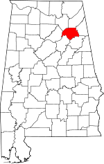 | |
| Towns | ||
| CDPs | ||
| Unincorporated communities | ||
| Footnotes | ‡This populated place also has portions in an adjacent county or counties | |