Háj ve Slezsku
| Háj ve Slezsku | |||
| Village | |||
 Saint Valentine Church | |||
|
|||
| Country | Czech Republic | ||
|---|---|---|---|
| Region | Moravian-Silesian | ||
| District | Opava | ||
| Commune | Opava | ||
| Elevation | 233 m (764 ft) | ||
| Coordinates | CZ 49°54′8″N 18°5′34″E / 49.90222°N 18.09278°ECoordinates: CZ 49°54′8″N 18°5′34″E / 49.90222°N 18.09278°E | ||
| Area | 13.79 km2 (5.32 sq mi) | ||
| Population | 3,324 (2006-07-03) | ||
| Density | 241/km2 (624/sq mi) | ||
| First mentioned | 1366 | ||
| Mayor | Karel Palovský | ||
| Timezone | CET (UTC+1) | ||
| - summer (DST) | CEST (UTC+2) | ||
| Postal code | 747 92 | ||
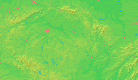
  Location in the Czech Republic | |||
  Location in the Moravian-Silesian Region | |||
| Wikimedia Commons: Háj ve Slezsku | |||
| Statistics: statnisprava.cz | |||
| Website: www.hajveslezsku.cz/ | |||
Háj ve Slezsku (Czech pronunciation: [ˈɦaːj ˈvɛslɛsku]), meaning grove in the Silesia, is a village between Opava and Ostrava – the two larger cities in the Moravian-Silesian Region, Czech Republic. It has 3,317 citizens: 1,704 women; 1,613 men. The town has only 972 households.
History
The village was built in about 1880 in the Chabičov-town land register, and it was considered its administrative part until 1922. By the unification Chabičov and another town called Smolkov, Háj ve Slezsku officially became an independent town, and the four towns became administrative parts. Jilešovice and Lhota u Opavy were connected in 1976 and 1979, respectively.
Trivia
- The birthplace of Vladislav Vančura – a famous Czech writer.
- For several years the town has celebrated its citizens and people from surrounding areas in an annual festival called Rozmarné léto, after Vančura’s best known novel.
| Wikimedia Commons has media related to Háj ve Slezsku. |
This article is issued from Wikipedia - version of the 4/7/2016. The text is available under the Creative Commons Attribution/Share Alike but additional terms may apply for the media files.

