Sudice (Opava District)
| Sudice | |||
| German: Zauditz | |||
| Town | |||
| Centre of town with Saint John the Baptist Catholic Church in the background | |||
|
|||
| Official name: Sudice (former official name: Zauditz) | |||
| Country | Czech Republic | ||
|---|---|---|---|
| Region | Moravian-Silesian Region | ||
| District | Opava | ||
| Commune | Kravaře | ||
| Elevation | 244 m (801 ft) | ||
| Coordinates | CZ 50°01′53″N 18°04′07″E / 50.03139°N 18.06861°ECoordinates: CZ 50°01′53″N 18°04′07″E / 50.03139°N 18.06861°E | ||
| Area | 9.43 km2 (3.64 sq mi) | ||
| Population | 671 (2012) | ||
| Density | 71/km2 (184/sq mi) | ||
| First mentioned | 1327 | ||
| Mayor | Petr Halfar | ||
| Timezone | CET (UTC+1) | ||
| - summer (DST) | CEST (UTC+2) | ||
| Postal code | 747 25 | ||
| Area code | +420 553 | ||
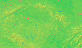
  Location in the Czech Republic | |||
  Location in the Moravian-Silesian Region | |||
| Wikimedia Commons: Sudice (Opava District) | |||
| Website: www.obecsudice.cz | |||
_Aerial_View.jpg)
Sudice formerly Zauditz also Czauditz[1][2] (German: Zauditz, Latin: Zaudicium[3]) located within the historical and geographical region of Upper Silesia, is now a border town in the district of Opava (German: Troppau) present day Czech Republic, that since medieval times held a municipal charter and enjoyed Town privileges (German town law).
Within present day Czech Republic it belongs to the administrative Moravian-Silesian Region and is located in the northern tip of the micro Hlučín Region, close to the border with Poland. Its Polish town neighbour Pietraszyn is about a kilometer away.
History
The settlement of Zauditz, first mentioned in 14th century written records, was part of the Duchy of Troppau (Opava) then in the possession of Prince Nicholas II Duke of Troppau (Opava), who in year 1327 sold Zauditz to the Dominican Order of friars from a monastery seated in neighbouring Racibórz (German: Ratibor).[4][5] As a consequence of this acquisition and conveyance to the Dominican Order, Zauditz being formerly part of a fief, had now become a "free village" (German: freies Dorf) enjoying local autonomy and jurisdiction within the Holy Roman Empire, similar to a free imperial city. Soon after, Zauditz elevated to and was granted town charter status (Stadtrechte in German) enjoying the autonomy of town privileges (German town law).[5]
Notes and references
- ↑ Martin Helwig Map of Silesia 1561 - first woodcut map of Silesia made on the basis of surveys and data collected from local inhabitants, Published 1561.
- ↑ Map of Upper Silesia (Silesia Ducatus) by Willem Janszoon and Joan Blaeu - Theatrum orbis terrarum, sive, Atlas novus - Published 1635
- ↑ Bavarian State Library - Pedigree of Maria Eleonora of Brandenburg, Queen consort of Sweden - Published 1633, in Latin. (Latin: Stemma Mariae Eleonorae, Suecorum Augustae), p.24
- ↑ Extracted and translated from the official Sudice Mayor's Office website at www.obecsudice.cz
- 1 2 Kateřina Kolibová, Master's Thesis - The German dialects in the Bohemian countries, with emphasis on Zauditz (Sudice), 2008, in German. Masaryk University Faculty of Arts, Department of German, Scandinavian and Dutch Studies.
External links
| Wikimedia Commons has media related to Sudice (Opava District). |

_CoA_CZ.jpg)