Guanay Municipality
| Guanay Municipality | |
|---|---|
| Municipality | |
|
The Cordillera Real as seen from Lake Titicaca with Chachakumani and Ch'iyar Juqhu of the Guanay Municipality in the center | |
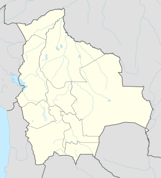 Guanay Municipality Location of the Viacha Municipality within Bolivia | |
| Coordinates: 15°29′41″S 67°54′00″W / 15.4947°S 67.900°WCoordinates: 15°29′41″S 67°54′00″W / 15.4947°S 67.900°W | |
| Country |
|
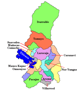
| Department | La Paz Department |
| Province | Larecaja Province |
| Seat | Guanay |
| Government | |
| • Mayor | Eddy Loayza Guzmán (2007) |
| • President | Lady Saavedra de Chávez (2007) |
| Area | |
| • Total | 1,510 sq mi (3,911 km2) |
| Elevation | 1,600 ft (500 m) |
| Population (2001) | |
| • Total | 11,528 |

Guanay Municipality is the second municipal section of the Larecaja Province in the La Paz Department, Bolivia. Its seat is Guanay.
Geography
The Cordillera Real traverses the Guanay Municipality. Some of the highest peaks of the range, Chachakumani and Ch'iyar Juqhu, lie within the borders of the municipality. More mountains are listed below:[1]
Languages
The languages spoken in the Guanay Municipality are mainly Spanish, Aymara and Quechua.
| Language | Inhabitants |
|---|---|
| Quechua | 1.653 |
| Aymara | 3.405 |
| Guaraní | 5 |
| Another native | 94 |
| Spanish | 10.064 |
| Foreign | 86 |
| Only native | 737 |
| Native and Spanish | 4.123 |
| Only Spanish | 5.942 |
Ref.: obd.descentralizacion.gov.bo
See also
References
- ↑ Bolivian IGM map 1:50,000 Comunidad Amaguaya 5946-III and Zongo 5945-I
This article is issued from Wikipedia - version of the 2/22/2016. The text is available under the Creative Commons Attribution/Share Alike but additional terms may apply for the media files.