Qalsata
For the mountain in the Sud Yungas Province, La Paz Department, Bolivia, see Qalsata (Sud Yungas).
| Qalsata | |
|---|---|
 | |
| Highest point | |
| Elevation | 5,874 m (19,272 ft) [1] |
| Coordinates | 15°55′57″S 68°26′16″W / 15.93250°S 68.43778°WCoordinates: 15°55′57″S 68°26′16″W / 15.93250°S 68.43778°W [2] |
| Geography | |
 Qalsata Bolivia | |
| Location |
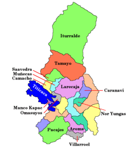
Bolivia La Paz Department, Larecaja Province, Sorata Municipality |
| Parent range | Andes, Cordillera Real |
| Climbing | |
| First ascent | 1-1962 via N.W. face,[1] |
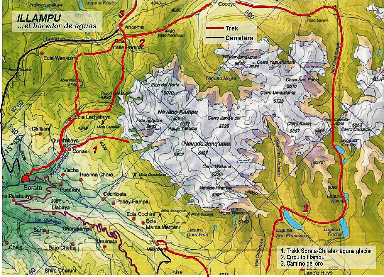
Qalsata (Aymara qalsa stones,[3]-ta a suffix, the hispanicized spelling is the misleading word Calzada)[4] is a mountain in the Andes, about 5,874 m (19,272 ft) high, located in the Cordillera Real of Bolivia. It lies in the La Paz Department, Larecaja Province, on the border of the Sorata Municipality and the Guanay Municipality. It is situated south-east of Janq'u Uma, between the mountain Q'asiri in the north-west and Ch'iyar Juqhu in the south-east, and east of San Francisco Lake.[5]
See also
External links
- Sorata Municipality: population data and map showing San Francisco Lake. Qalsata is situated east of it.
References
- 1 2 "Jill Neate, Mountaineering in the Andes" (PDF). rgs.org.
- ↑ wikimapia.org "Nevado Calzada "
- ↑ Thomas A. Sebeok, Materials for an Aymara Dictionary, Journal de la Société des Américanistes, 1951, p. 133
- ↑ babylon.com Calzada (Spanish) - roadway; road; pavement; wearing shoes; equipped with shoes
- ↑ huayna-potosi.com Map of the Illampu massif and surroundings (north is upper left) showing Qalsata ("Cerro Calzada") on the right
This article is issued from Wikipedia - version of the 9/14/2016. The text is available under the Creative Commons Attribution/Share Alike but additional terms may apply for the media files.