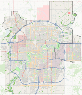
Groat Road

Start/End points of Groat Road
Groat Road
Maintained by the City of Edmonton
Length 5.9 km (3.7 mi)
Location Edmonton
South end 87 Avenue / Saskatchewan Drive
Major
junctions
Saskatchewan Drive, Emily Murphy Park Road, Victoria Park Road, 107 Avenue, 111 Avenue, 118 Avenue
North end 118 Avenue / St. Albert Trail
Groat Road, looking south from 102 Avenue.

Groat Road is a freeway in Edmonton, Alberta, Canada.

At a roundabout west of the University of Alberta, Edmonton's river valley road Saskatchewan Drive branches Groat Road to the north and heads down into the river valley. Here Groat Road crosses the North Saskatchewan River on Groat Bridge. It then winds through a gorge, formerly occupied by the now culverted Groat Creek, before reaching the flat plains at the top of the valley.[1] The route ends, and becomes St. Albert Trail, at 118 Avenue (at a traffic circle with traffic lights).

Because of their short lengths, Wayne Gretzky Drive and Groat Road will be the only freeways in Edmonton not to have a highway designation, until the completion of Terwillegar Drive.

Neighbourhoods

List of neighbourhoods Groat Road runs through, in order from south to north.[2]

Interchanges and intersections

Groat Road currently has six interchanges (bold), giving it freeway status for the 4.1 kilometres (2.5 mi) from 87 Avenue to 109 Avenue.[2]

Direction Intersecting road Current intersection type Coordinates
South-North 87 Avenue / Saskatchewan Drive Roundabout 53°31′22″N 113°32′26″W / 53.52278°N 113.54056°W / 53.52278; -113.54056 (Groat x Saskatchewan)
Emily Murphy Park Road (to William Hawrelak Park and Saskatchewan Drive) Diamond T interchange 53°31′56″N 113°32′17″W / 53.53222°N 113.53806°W / 53.53222; -113.53806 (Groat x Murphy)
River Valley Road Partial cloverleaf interchange 53°32′18″N 113°32′16″W / 53.53833°N 113.53778°W / 53.53833; -113.53778 (Groat x Valley)
Victoria Park Road (100 Avenue) Directional T interchange 53°32′24″N 113°32′17″W / 53.54000°N 113.53806°W / 53.54000; -113.53806 (Groat x Victoria)
102 Avenue Overpass 53°32′35″N 113°32′25″W / 53.54306°N 113.54028°W / 53.54306; -113.54028 (Groat x 102)
Stony Plain Road Overpass 53°32′52″N 113°32′45″W / 53.54778°N 113.54583°W / 53.54778; -113.54583 (Groat x Stony)
107 Avenue Diamond interchange 53°33′4″N 113°32′59″W / 53.55111°N 113.54972°W / 53.55111; -113.54972 (Groat x 107)
111 Avenue At-grade (traffic lights) 53°33′32″N 113°33′5″W / 53.55889°N 113.55139°W / 53.55889; -113.55139 (Groat x 111)
114 Avenue At-grade (traffic lights) 53°33′48″N 113°33′5″W / 53.56333°N 113.55139°W / 53.56333; -113.55139 (Groat x 114)
118 Avenue Traffic light controlled traffic circle 53°34′13″N 113°32′58″W / 53.57028°N 113.54944°W / 53.57028; -113.54944 (Groat x 118)

References

  1. Martell, Kathryn; Dammeyer, Henry (2001). "Lost Creeks and Wetlands". Environmental Research and Studies Center. University of Alberta. Retrieved 2016-08-18.
  2. 1 2 City of Edmonton map utility


This article is issued from Wikipedia - version of the 8/19/2016. The text is available under the Creative Commons Attribution/Share Alike but additional terms may apply for the media files.