Grenora, North Dakota
| Grenora, North Dakota | |
|---|---|
| City | |
 | |
 Location of Grenora, North Dakota | |
| Coordinates: 48°37′5″N 103°56′12″W / 48.61806°N 103.93667°WCoordinates: 48°37′5″N 103°56′12″W / 48.61806°N 103.93667°W | |
| Country | United States |
| State | North Dakota |
| County | Williams |
| Area[1] | |
| • Total | 0.61 sq mi (1.58 km2) |
| • Land | 0.61 sq mi (1.58 km2) |
| • Water | 0 sq mi (0 km2) |
| Elevation | 2,123 ft (647 m) |
| Population (2010)[2] | |
| • Total | 244 |
| • Estimate (2014)[3] | 257 |
| • Density | 400.0/sq mi (154.4/km2) |
| Time zone | Central (CST) (UTC-6) |
| • Summer (DST) | CDT (UTC-5) |
| ZIP code | 58845 |
| Area code(s) | 701 |
| FIPS code | 38-33500 |
| GNIS feature ID | 1029242[4] |
Grenora is a city in Williams County, North Dakota in the United States. The population was 244 at the 2010 census.[5]
Grenora was founded in 1916 at the end of a Great Northern Railway branch line that began in Stanley. The name comes from a combination of letters in the railway's name: GREat NOrthern RAilway.[6][7] The tracks were in place until 2002, when Great Northern successor BNSF Railway filed for abandonment.[8]
The city's motto is, "Friendliness lives here — you're only a stranger once." The city is home to a senior citizen's center, credit union, gas station, grain elevator, restaurant, bar which has famous cheeseburgers statewide, apartment buildings, and community built low-income housing. There are also two churches: the St. Olaf Lutheran Church (ELCA) and St. Boniface Catholic Church.
Attractions
The surrounding area is home to small game hunting opportunities (pronghorn and deer). There is also very excellent pheasant hunting. Available in the nearby Missouri River are paddlefish, a prehistoric fish which can weigh more than 120 pounds. This is one of the few places the fish can be found on the North American continent. Grenora is located 30 miles (48 km) from the Canada–United States border and only 4 miles (6.4 km) from North Dakota's border with Montana.
Grenora is home to the Writing Rock State Historical Site. The Assiniboine, Lakota, and Plains Chippewa Indian tribes often returned to the Spirit Rock, or Hoi-waukon, located on a hilly prairie just outside Grenora. The rock served to mark a spot where Native Americans felt they could foretell the future. The two granite rocks at this site are covered with petroglyphs presumably carved by ancient Plains Indians.
Geography
Grenora is located at 48°37′5″N 103°56′12″W / 48.61806°N 103.93667°W (48.618147, -103.936657).[9]
According to the United States Census Bureau, the city has a total area of 0.61 square miles (1.58 km2), all of it land.[1]
Demographics
| Historical population | |||
|---|---|---|---|
| Census | Pop. | %± | |
| 1920 | 358 | — | |
| 1930 | 487 | 36.0% | |
| 1940 | 425 | −12.7% | |
| 1950 | 525 | 23.5% | |
| 1960 | 448 | −14.7% | |
| 1970 | 401 | −10.5% | |
| 1980 | 362 | −9.7% | |
| 1990 | 261 | −27.9% | |
| 2000 | 202 | −22.6% | |
| 2010 | 244 | 20.8% | |
| Est. 2015 | 250 | [10] | 2.5% |
| U.S. Decennial Census[11] 2014 Estimate[3] | |||
2010 census
As of the census[2] of 2010, there were 244 people, 98 households, and 65 families residing in the city. The population density was 400.0 inhabitants per square mile (154.4/km2). There were 121 housing units at an average density of 198.4 per square mile (76.6/km2). The racial makeup of the city was 97.5% White, 0.4% African American, 0.8% Native American, and 1.2% from two or more races. Hispanic or Latino of any race were 4.5% of the population.
There were 98 households of which 30.6% had children under the age of 18 living with them, 52.0% were married couples living together, 9.2% had a female householder with no husband present, 5.1% had a male householder with no wife present, and 33.7% were non-families. 29.6% of all households were made up of individuals and 13.3% had someone living alone who was 65 years of age or older. The average household size was 2.49 and the average family size was 3.09.
The median age in the city was 36.3 years. 30.3% of residents were under the age of 18; 3.7% were between the ages of 18 and 24; 26.3% were from 25 to 44; 25.8% were from 45 to 64; and 13.9% were 65 years of age or older. The gender makeup of the city was 48.0% male and 52.0% female.
2000 census
As of the census of 2000, there were 202 people, 98 households, and 58 families residing in the city. The population density was 342.7 people per square mile (132.2/km²). There were 139 housing units at an average density of 235.8 per square mile (91.0/km²). The racial makeup of the city was 98.02% White, 0.99% Native American, and 0.99% from two or more races.
There were 98 households out of which 17.3% had children under the age of 18 living with them, 55.1% were married couples living together, 3.1% had a female householder with no husband present, and 39.8% were non-families. 39.8% of all households were made up of individuals and 23.5% had someone living alone who was 65 years of age or older. The average household size was 2.06 and the average family size was 2.76.
In the city the population was spread out with 18.3% under the age of 18, 5.0% from 18 to 24, 23.3% from 25 to 44, 24.3% from 45 to 64, and 29.2% who were 65 years of age or older. The median age was 48 years. For every 100 females there were 124.4 males. For every 100 females age 18 and over, there were 126.0 males.
The median income for a household in the city was $26,250, and the median income for a family was $37,083. Males had a median income of $31,750 versus $15,625 for females. The per capita income for the city was $13,960. None of the families and 4.2% of the population were living below the poverty line, including no under eighteens and 9.6% of those over 64.
Climate
This climatic region is typified by large seasonal temperature differences, with warm to hot (and often humid) summers and cold (sometimes severely cold) winters. According to the Köppen Climate Classification system, Grenora has a humid continental climate, abbreviated "Dfb" on climate maps.[12]
References
- 1 2 "US Gazetteer files 2010". United States Census Bureau. Retrieved 2012-06-14.
- 1 2 "American FactFinder". United States Census Bureau. Retrieved 2012-06-14.
- 1 2 "Population Estimates". United States Census Bureau. Retrieved May 29, 2015.
- ↑ "US Board on Geographic Names". United States Geological Survey. 2007-10-25. Retrieved 2008-01-31.
- ↑ "2010 Census Redistricting Data (Public Law 94-171) Summary File". American FactFinder. United States Census Bureau. Retrieved 2 May 2011.
- ↑ Wick, Douglas A. "Grenora (Williams County)". North Dakota Place Names. Retrieved 8 May 2011.
- ↑ Temple, Robert D. Edge Effects: The Border-Name Places, (2nd edition, 2009), iUniverse, ISBN 978-0-595-47758-6, page 324.
- ↑ "THE BURLINGTON NORTHERN AND SANTA FE RAILWAY COMPANY--ABANDONMENT EXEMPTION--IN BURKE AND WILLIAMS COUNTIES, ND". Docket Number AB_6_394_X. Surface Transportation Board. Retrieved 8 May 2011.
- ↑ "US Gazetteer files: 2010, 2000, and 1990". United States Census Bureau. 2011-02-12. Retrieved 2011-04-23.
- ↑ "Annual Estimates of the Resident Population for Incorporated Places: April 1, 2010 to July 1, 2015". Retrieved July 2, 2016.
- ↑ "U.S. Decennial Census". Census.gov. Retrieved May 25, 2014.
- ↑ Climate Summary for Grenora, North Dakota
External links
- Grenora Elementary School
- Grenora High School
- Grenora, North Dakota, golden jubilee, 1916-1966 from the Digital Horizons website
Municipalities and communities of Williams County, North Dakota, United States | ||
|---|---|---|
| Cities | 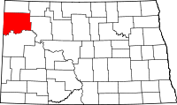 | |
| Townships |
| |
| Unorganized territories |
| |
| Unincorporated communities | ||